Welcome to the second instalment on Navigating the Geospatial Tapestry. A blog series which aims to give a view on GIS and how data can be improved to offer a more valuable and powerful outcome.
Part one of this series outlined the benefit of GIS in our industry. We gave a brief introduction to the key components of what makes GIS powerful. These components included Hardware, Software, Data and People. In part 2 we will delve deeper into Hardware being a powerful component for efficient GIS.
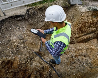
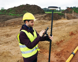
GIS hardware refers to the physical components and equipment required to support GIS operations and functions. Hardware can come in all shapes and sizes, particularly in Australia. Hardware needs to be durable and withstand the harshest of environments. With temperatures reaching the mid 40’s one day, then monsoon rains the next, Australia really is a continent where GIS equipment is tested to its fullest. Let us investigate a few Hardware options that would be very beneficial in the GIS space.
1. Leica FLX100 Plus
Leica Geosystems is a renowned company that produces a wide range of surveying, mapping, and geospatial equipment. It’s also a part of Hexagon AB, a global technology group headquartered in Sweden.
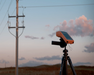
The Leica FLX100 plus smart Antenna is the latest smart antenna developed by Leica which is compatible with IOS, Android and Windows. Flexibility is key to GIS hardware, and this device literally has flexibility in its name. The device is designed to be paired with your smartphone or tablet via Bluetooth. Any data captured with your smartphone or tablet can achieve 20mm-30mm accuracy when paired with a correction service. The Leica FLX100 Plus achieves sub 1 Meter accuracy without any correction service which may be desirable for a lot of GIS applications, including arboriculture or Geology. The Leica FLX100 plus can be Setup using the Universal Handheld Tray, traditional survey pole or simply belt pouch. Tested in Australia’s harshest environments and living up to expectation is a real strength of the Leica FLX100 plus. The Leica FLX100 plus is compatible with most GIS software packages out there and is highly endorsed by Esri.
2. Leica GG04 Plus
Similar to the Leica FLX100 Plus, the GG04 plus is compatible with IOS, Android and Windows. The GG04 is usually used in more remote parts of Australia for GIS mapping applications. Why you ask? The GG04 can achieve sub 100mm accuracy in areas with no phone coverage, using Smartlink positioning. This gives the GG04 plus the “High accuracy Everywhere” tag.
The receiver is compatible with multiple satellite constellations, including GPS (Global Positioning System), GLONASS, Galileo, and BeiDou, providing reliable positioning even in challenging environments. Overall, the Leica GG04 Plus GNSS receiver is a versatile and reliable solution for professionals who require high-precision positioning and accurate location data for their projects. It is commonly used in surveying, mapping, construction, agriculture, and other geospatial applications.
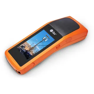
3. IKE4
ikeGPS Limited, or IKE, is an American-based New Zealand company which provides services for measuring, modelling and managing power and telecommunications assets. The IKE 4 is a rugged hardware device, with an in build RTK GPS and Laser rangefinder. This tool is typically used in the utility industry but more specifically with power poles. The IKE 4 device records GPS coordinates for power poles, while also storing measurable photos.
The GIS component of the IKE 4 comes with its ability to create customisable forms for each power pole. These forms include vital information such as midspan height, anchor lead lengths, pole number, pole condition and more. This information is compiled, along with measurable photos, and geospatial information. All this data is then synced into IKE office Pro. The data can then be analysed within IKE office.

To wrap things up, GIS hardware is chosen based on its reliability, functionality and effectiveness. From powerful computers and storage devices, to specialized input and output peripherals, GIS hardware enables the collection, processing, storage, analysis, and visualization of spatial data.
As GIS continues to evolve and expand its applications across diverse industries such as urban planning, environmental management, disaster response, transportation, and natural resource management, the importance of robust and efficient hardware solutions cannot be overstated. By investing in reliable GIS hardware, organizations and professionals can harness the full potential of spatial technology to make informed decisions, solve complex problems, and address critical challenges.
Read Part 1 Here