


Centralised Reality Capture Data Management with Hexagon GeoCloud
Across surveying, construction, engineering, and asset management workflows, the volume of reality capture data continues to grow. High-resolution laser scans, mobile mapping datasets, and photogrammetry outputs create detailed digital records, but also introduce challenges in storage, access, and long-term usability.
Traditional approaches to managing this data, such as local storage, external drives, or ad hoc file sharing, can lead to version control issues, limited accessibility, and increasing infrastructure costs over time.
Reality capture delivers value over time when data can be reliably accessed, shared, and reused as a persistent digital reference.
Cloud-based platforms such as Hexagon GeoCloud provide an alternative approach by centralising data storage, enabling controlled access, and supporting collaboration workflows across geographically distributed teams.
Challenge: Managing Growing Reality Capture Datasets
As organisations increase their use of reality capture technologies, they often encounter practical challenges:
- Large datasets that require significant local storage capacity
- Difficulty sharing data with external stakeholders
- Version control issues across multiple project contributors
- Reliance on physical media such as USB drives or external hard drives
These constraints can introduce inefficiencies and increase the risk of teams working with outdated or incomplete information.
Hexagon GeoCloud: Cloud-Based Data Access and Archiving
Hexagon GeoCloud supports the upload, storage, and access of reality capture datasets in a centralised cloud environment.
One of its key capabilities is the ability to archive datasets cost-effectively. Once data is uploaded, it remains accessible without ongoing reprocessing or duplication. Organisations can retain historical data and adjust their subscription plans to account primarily for new datasets, helping manage long-term storage costs.
This approach enables:
- On-demand access to previously captured datasets
- Reduced reliance on local storage infrastructure
- Long-term preservation of digital site records
- Scalable storage aligned with project activity
Fit-for-Fabrication: Reliable Data for Design and Engineering
Maintaining a consistent and accessible dataset supports downstream workflows such as design validation, prefabrication, and asset verification. When reality capture data is centrally stored and version-controlled, teams can reference the same dataset across different stages of a project lifecycle.
This consistency helps reduce rework and enables better alignment between field conditions and digital models.
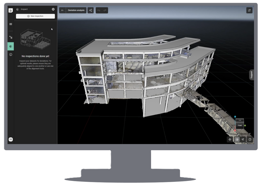
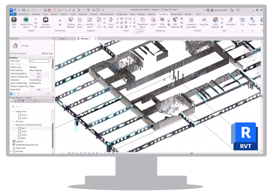
Case Study: Collaborative Access via CloudWorx
A typical workflow involves a project team capturing scan data and uploading it to Hexagon GeoCloud. From there, stakeholders across disciplines can access the dataset using the CloudWorx plugin within their CAD environments.
In practice, this means:
- Designers, engineers, and contractors can connect directly to the same dataset
- All users reference a single source of truth rather than distributed files
- There is no need to transfer large datasets via USB drives or external storage
- Version control is inherently managed within the cloud environment
This workflow supports a more consistent decision-making process, as all stakeholders are working with the latest available data without manual file handling.
Safety and Risk Reduction
Centralised access to accurate reality capture data can also support safer project execution. By enabling remote review and validation of site conditions, teams may reduce the need for repeat site visits.
Additionally, improved data consistency can help reduce the risk of design decisions being based on outdated or incomplete information.
Workflow: From Scan to Decision
A typical scan-to-decision workflow using Hexagon GeoCloud includes:
- Capture site data using laser scanning or mobile mapping systems
- Upload datasets to the GeoCloud platform
- Store and organise data within a centralised cloud environment
- Provide controlled access to stakeholders
- Connect to datasets directly within CAD using CloudWorx
- Review, validate, and make decisions based on current data
This workflow supports continuity between data capture, design, and project delivery stages.
Conclusion
As reality capture adoption continues to expand, the ability to manage and access data efficiently becomes increasingly important. Platforms such as Hexagon GeoCloud support a structured approach to data archiving and collaboration, helping organisations maintain access to historical datasets while enabling current project workflows.
By reducing dependency on physical storage and improving accessibility, these systems support more reliable and consistent use of reality capture data across project teams.
Learn More
For further information on Hexagon GeoCloud and how it can support your workflows, visit the link below:
