Embarking on the journey into the dynamic realm of Geographic Information Systems (GIS) is like unlocking a treasure trove of spatial intelligence.
Imagine a technology that not only captures and stores geographic data but transforms it into a multifaceted tool, seamlessly merging hardware, software, and the expertise of individuals. GIS is not merely an acronym; it is a gateway to a world where every geographical nuance can be harnessed for meaningful insights.
In this series of blogs, we will unravel what GIS is, and what benefits GIS can bring to business and organisations alike. From the intricacies of hardware like the Leica Zeno FLX100 plus to the user-friendly expanse of software like Leica Zeno Mobile One, GIS epitomizes the fusion of innovation and expertise. As we delve into the layers of GIS, from data integration to applications across various fields, the profound impact on decision-making becomes abundantly clear.
GIS stands for Geographic Information System. It is a system designed to capture, store, manipulate, analyse, manage, and present spatial or geographic data. GIS combines hardware, software, and data to provide a powerful tool for mapping and analysing spatial relationships. The key components of GIS include:
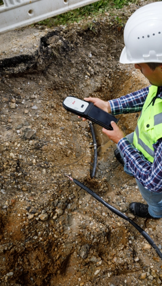
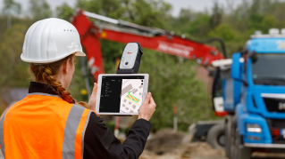
- Hardware: This refers to the physical devices used to collect data, store, and process geographic information. It includes computers, GPS devices, and other data capture tools. The Leica Zeno FLX100 plus or the Leica GG04 Plus Smart Antenna paired with any Android or IOS device is a perfect hardware solution.
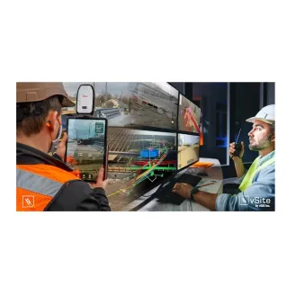
- Software: GIS software allows users to collect, manipulate, analyse, and visualise spatial data. There are various GIS software packages available for both data collection and data analysis on a laptop. There is a variety of data collection software options that include Leica Zeno Mobile One, Geolantis Collector, Esri ArcGis Collector. This data can then be brough into a “desktop software” for analysis. Geolantis Manager and Esri platforms are commonly used desktop software’s in Geological, engineering, utilities, and arboriculture industries. This data can then be visualised in an Augmented Reality format, using software such as VGIS.
- Data: Geographic data is a crucial component of GIS. It can include information about the location, shape, size, and characteristics of physical features and phenomena on Earth. GIS databases often integrate data from various sources, such as satellite imagery, property boundary information, surveys, and remote sensing.
- People: GIS involves the expertise of individuals who understand geography, cartography, and the specific applications of GIS technology. These professionals use GIS tools to analyse and interpret spatial data for various purposes. GIS software has become more user friendly in recent times, and data collection has become seamless.
As we draw the curtain on our exploration of Geographic Information Systems (GIS), it is evident that GIS is not just a technology; it is a transformative force shaping the future of decision-making. As GIS continues to be an indispensable tool in Utility mapping, urban planning, environmental management, Agriculture management, natural resource exploration, epidemiology, transportation planning and beyond, its ability to uncover hidden patterns and facilitate informed decision-making remains the hallmark of a truly exceptional GIS workflow.
So, let us embark on this journey with GIS as our compass, unlocking the endless possibilities that lie within the dynamic realm of spatial intelligence.


/geolantis-collector---next-generation-platform-to-manage-data-collection-and-management.jpg)