


Welcome to blog number three on Navigating the Geospatial Tapestry, a blog which goes into a bit more detail surrounding what GIS is and the different aspects of GIS which subsequently bring detailed information together.
Part one of this series outlined the benefit of GIS in our industry. We gave a brief introduction to the key components of what makes GIS powerful. These components included Hardware, Software, Data, and People. In this blog, we will delve deeper into software as a powerful component for efficient GIS.
GIS software is a powerful tool used for capturing, storing, analysing, managing, and presenting spatial or geographic data. GIS software typically consists of several key components, each serving a specific function to facilitate comprehensive spatial analysis and visualisation. The key functions of the GIS software that you use will fundamentally influence your choice of software for your GIS journey. I have gone into a bit more detail about what I believe the key functions of GIS software are below.

Data Capture
The way in which data is captured is crucial for the final product. Is the GIS data GPS accurate to survey grade standards? Does the data require survey grade accuracy? This would be a big factor in deciding your GIS data capture software. Some GIS software programs cannot be used in conjunction with survey grade accurate GPS antennas like the Leica FLX100 plus. So it is important that this research is done. Another important aspect of choosing the right GIS software is the software’s compatibility with local coordinate systems. Here in Australia, we are split up into zones, from Zone 49 on the west coast of WA to Zone 56 on NSW’s east coast. To add a little bit more confusion, Australia also works off GDA 94 and 2020. Can the data capture software adopt the coordinate system to your localised project? Outside the positional accuracy of the data, the detail in the data needs to be comprehensive. For instance, if collecting utility GIS data, the attribute of this data is crucial. As an example, when collecting the GIS data of a watermain, the attributes of that watermain may include diameter, material type, condition, and depth from surface level. This is all crucial information, and it’s important to know that the GIS software you choose can handle such information while collecting data.
Data Management
The way data is managed has become a massive talking point in recent months. Is the data stored locally or overseas? A lot of organisations within Australia will not allow their data to be stored overseas as a security measure. Does the data need to be stored in the cloud, or does local device storage (tablet or phone) suffice? The topic of how the data is exported is also important. Does the end user require shapefiles, vector data, GeoTIFFs, KMLs? These data exports are common, but possibly your organisation requires a specialised export file format.

Data Analysis
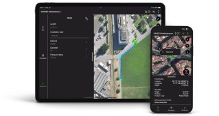
Spatial analysis involves examining the locations, attributes, and relationships of features in spatial data. It allows for the identification of patterns, trends, and relationships that are not readily apparent in raw data. Overlaying base maps is a very simple example of this. Many GIS software packages can link WMS as a base map for both free and paid sources. In the construction space, comparing the design against “as-built” data is a good example. Is it important in your GIS workflow to analyse if a new utility has been placed in the right location? A simple way to do this is by importing the design source file, maybe a shapefile or DWG. Overlaying this against your surveyed GIS data and “staking out” to find if the utility is in the correct position. Although this falls more in the survey space than the GIS space, a lot of GIS software packages have the ability to complete this function.
Data Sharing
Perhaps an afterthought when purchasing your GIS software is how to get the data to the client in a format that they require. Because, of course, not every client has the same GIS software as you. Is it a simple delivery of a shapefile or DWG that the client requires? If this is the case, a simple email may suffice. However, what if it is a massive file, months and months, possibly years of data collection? In this case, some GIS software packages have a “viewer” option. This allows the end user to view the data that has been collected without having the ability to manage or edit the data. Sometimes sharing the data via Web Mapping Service (WMS) or Web Feature Service (WFS) is an easier way to share this data. WMS and WFS can be very useful for large datasets.

GIS software is a powerful and versatile tool that transforms geographic data into actionable insights. By providing robust capabilities for data capture, management, analysis, visualisation, and sharing, GIS software enables users to make informed decisions based on spatial information. Its applications across various fields highlight its importance as a critical tool for understanding and managing the complexities of the spatial world. As technology advances, the role of GIS software will continue to grow, offering new opportunities for innovation and discovery in the realm of spatial analysis. It is crucial to understand what you require from your GIS software and what deliverables your client expects before settling on the GIS software that is right for you.
