C.R. Kennedy has placed the first order for the newly launched Leica DS4000 Ground Penetrating Radar (GPR), reaffirming its position at the forefront of geospatial technology in Australia.
This strategic move underscores the company's commitment to delivering cutting-edge solutions for underground utility detection and mapping.
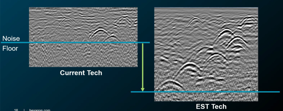
The Leica DS4000 GPR introduces advanced features, including patented Equalised Scrambling Technology (EsT), which enhances the clarity of subsurface imaging at both shallow and deeper levels. This innovation allows for the detection of challenging underground objects, such as fibre optic cables, thereby reducing risks associated with excavation projects.
C.R. Kennedy's adoption of the Leica DS4000 GPR aligns with its history of integrating state-of-the-art equipment to meet the evolving needs of Utility Locators, Geophysical engineers, surveyors, civil engineers, and utility professionals across Australia. The company's extensive experience and nationwide support infrastructure ensure that clients receive comprehensive assistance, from equipment selection to after-sales service.
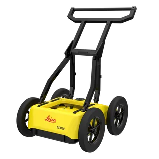
Beneath our feet lies a complex and often chaotic web of cables, pipes, and infrastructure. As cities expand and underground spaces become more crowded, the need for precise, non-intrusive utility detection has never been greater. Enter the Leica DS4000 Ground Penetrating Radar (GPR) — a groundbreaking solution designed to navigate the invisible and reduce risk before a single shovel hits the ground.
Uncovering the Invisible with Equalised Scrambling Technology (EsT)
At the heart of the DS4000 GPR is its patented Equalised Scrambling Technology (EsT), which enables clearer detection of underground utilities at both shallow and deep levels. This innovative technology allows operators to identify even hard-to-see hazards like fibre optic cables - critical for avoiding service interruptions and safety incidents.
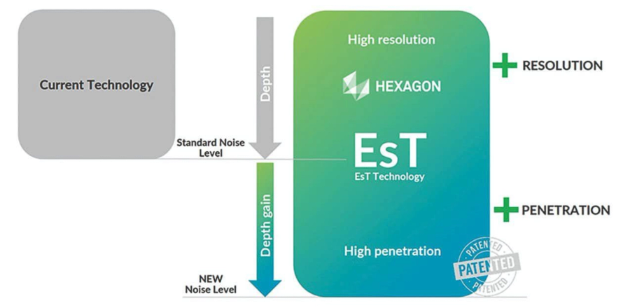
Reach 60% Deeper Than Traditional Systems
The Leica DS4000 GPR doesn’t just improve clarity — it reaches farther. Capable of identifying underground assets up to 60% deeper than conventional systems, it empowers teams to make informed decisions with confidence, speed, and safety. Whether it's gas lines, electrical cables, or communication infrastructure, the DS4000 brings more underground data to the surface.
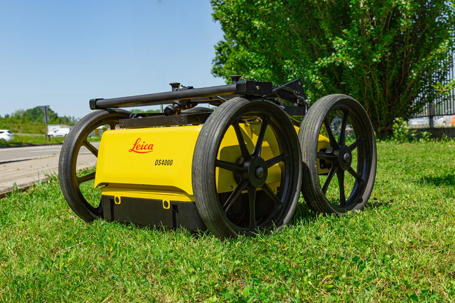
Lightweight Powerhouse
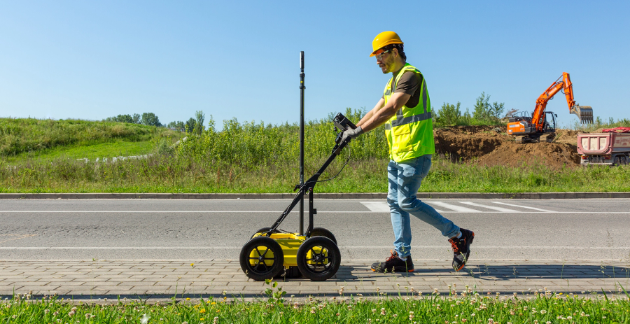
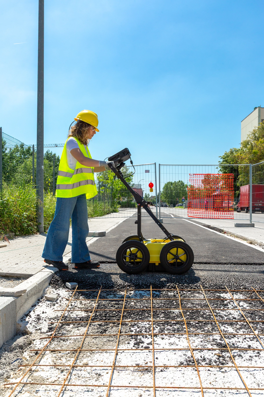
Despite its compact frame, the DS4000 packs serious technological punch. At a weight of less than 20kg the DS4000 is designed with mobility and ease-of-use in mind, it allows for single-user deployment, making it ideal for dense urban environments where space is tight and time is short.
At just a fraction of the weight of traditional utility radar systems, the DS4000 enables field teams to move quickly between sites and operate effortlessly, even in difficult terrain or high-traffic areas.
Streamlined Workflow, Smarter Deployment
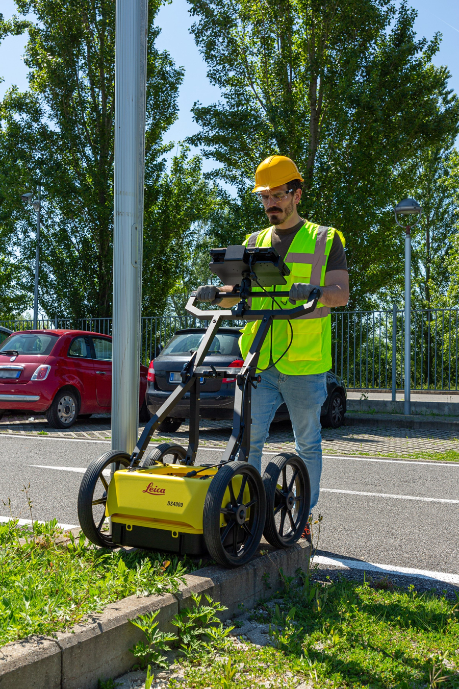
Engineered with urban versatility in mind, the DS4000 is compact, lightweight, and designed for single-user deployment. With its intuitive “Quick Scan Mode”, field operations become faster and more efficient, drastically reducing time on site and operational costs. With the option of GPS, Total Station integration for positioning, you have the option to deliver the complete workflow to the client. On the other hand the Leica DS4000 doesn’t need a GPS or Total station, and can be used for quickly marking utilities on site.
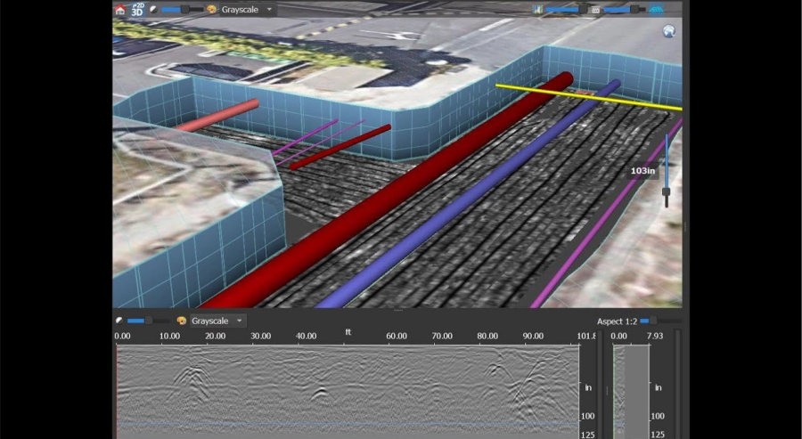
Advanced Software Integration
To complement its powerful hardware, the DS4000 integrates seamlessly with:
- uMap Field Software: For fast, intuitive data collection and straightforward utility mapping.
- IQMaps Post-Processing Software: For deeper analysis and high-quality deliverables that support decision-making and planning.
Built for Real-World Demands
A suite of accessories enhances the DS4000’s performance:
- External positioning support: For GPS/GNSS or Total Station mounting.
- Off-road wheels: Engineered for reliable tracking over rugged terrain.
- Hard shipping box: Ensures safe, secure transport between job sites.