Today, we're going to talk about a fascinating technology called LiDAR. It has become an essential tool in many industries, from archaeology to self-driving cars. So, what is LiDAR and how does it work? What is LiDAR? An Introduction to the Technology.
LiDAR stands for Light Detection and Ranging, and it's a remote sensing technology that uses laser beams to measure distances. It's similar to radar (Radio Detection and Ranging) and sonar (Sound Navigation and Ranging), which use radio waves and sound waves, respectively, to detect objects. However, LiDAR uses light waves, which are much faster and more accurate than radio or sound waves.
How Does LiDAR Work?
Understanding the Basics.
The basic idea of LiDAR is straightforward. A laser beam is emitted from a sensor and it travels through space until it hits an object. The light bounces off the object and returns to the sensor, which measures the reflection with sensors and the time it took for the light to make the round trip. Since the speed of light is constant, the distance to the object can be calculated by dividing the time by the speed of light. This process is repeated many times per second, creating a map of the surrounding environment.
How Does LiDAR Work?
This section is for those people who love to find out more regarding the inner workings of all things.
Well then, let's dive deeper into how LiDAR works. The laser beam emitted from the sensor is usually a pulse of light, rather than a continuous beam. This is because it allows for more accurate distance measurements. The pulse is very short, typically lasting only a few nanoseconds, and it has a very high intensity. When the pulse hits an object, some of the light is absorbed, some is scattered, and some is reflected towards the sensor. The amount of light that is reflected depends on the properties of the object, such as its colour, texture, and reflectivity.
The sensor detects the reflected light and measures the time it took for the pulse to travel to the object and back. This time measurement is known as the time-of-flight. To measure the time-of-flight accurately, the sensor needs to have a very precise clock that can measure time intervals on the order of picoseconds (trillionths of a second). The sensor also needs to have a high-resolution detector that can measure the intensity of the reflected light.
Once the time-of-flight is measured, the distance to the object can be calculated using the following formula: Distance = (Speed of light x time-of-flight) / 2
The division by 2 is because the light has to travel to the object and back, so the distance is half the round-trip distance. The speed of light is a constant, which is approximately 299,792,458 metres per second (or about 186,282 miles per second). Therefore, if the time-of-flight is measured to be, say, 10 nanoseconds (or 10 billionths of a second), then the distance to the object is:
Distance = (299,792,458 x 10 x 10^-9) / 2 Distance = 1.49896229 metres
So, the LiDAR sensor has measured the distance to the object to be 1.5 metres (or about 5 feet).
The LiDAR sensor emits laser pulses in different directions and measures the time it takes for the pulses to return after reflecting off objects in the environment. By combining the measurements from multiple laser pulses, the LiDAR system can create a point cloud, which is a collection of 3D points that represent the location and characteristics of objects in the environment.
The accuracy and precision of LiDAR measurements depend on several factors, such as the wavelength of the laser, the frequency of the laser pulses, the speed of light, and the sensitivity of the LiDAR sensor. Typically, LiDAR systems use lasers with wavelengths in the near-infrared spectrum, which have a range of about 800 to 1600 nanometres. The frequency of the laser pulses can range from a few kilohertz to several megahertz, depending on the application.
The Different Types of LiDAR: Which One is Right for Your Application?
Sorry that I got carried away with that last section, you might be able to determine what sort of person I am, let’s get back on track by covering the different types and applications of LiDAR.
- Airborne LiDAR: This type of LiDAR is mounted on an airplane or helicopter to capture data of large areas quickly. It is commonly used in topographic mapping, forest management, and disaster response.
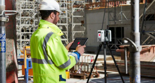
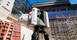
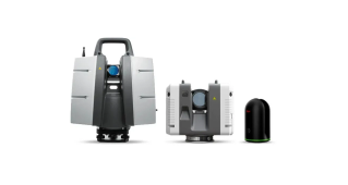
- Terrestrial LiDAR: Terrestrial LiDAR is used to capture data from the ground. It is commonly used in surveying, construction, and architecture to create detailed 3D models of buildings, landscapes, and other structures. A common laser scanner for this type of work would be the Leica P40 or Leica RTC360.
- Mobile LiDAR: Mobile LiDAR is mounted on a moving platform such as a car, truck, or boat. It is commonly used in transportation engineering, city planning, and infrastructure management to capture data on roadways, bridges, and other transportation infrastructure. An example of this scanner would be the Pegasus TRK.
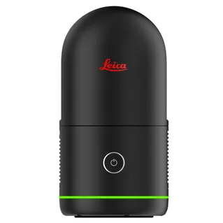
- Solid-State LiDAR: Solid-state LiDAR uses solid-state lasers instead of the traditional rotating mirrors. It is smaller, more durable, and less expensive than other types of LiDAR, making it suitable for consumer applications such as self-driving cars, robotics, and augmented reality.
- Bathymetric LiDAR: Bathymetric LiDAR is used to measure water depth and create detailed maps of the seafloor. It is commonly used in marine research, coastal zone management, and hydrographic surveys.
- Unmanned Aerial Vehicles & LiDAR: The younger smaller sibling to Airborne LiDAR, miniaturised sensors that are carried as payloads underneath UAV’s. There is cross over here with all of the above applications, except terrestrial LiDAR , as sensors are miniaturized and integrated on drones.
History of LiDAR
The history of LiDAR can be traced back to the early 1960s when laser technology was first developed.
In 1960, Theodore Maiman developed the first working laser, which used a ruby crystal to produce a focused beam of light. This breakthrough led to the development of many other laser types, including the gas laser, which emits a continuous beam of light. By the mid-1960s, researchers had begun experimenting with using lasers for remote sensing.
One of the earliest applications of LiDAR was in atmospheric studies. In 1965, researchers used LiDAR to measure the height and density of the earth's upper atmosphere. LiDAR was also used to study the distribution of ozone and other gases in the atmosphere.
The first airborne LiDAR system was developed in the early 1970s. This system used a pulsed laser to measure the distance from an aircraft to the ground. The data was then used to create 3D maps of the terrain.
In the 1980s, LiDAR technology was used for a wide range of applications, including forestry, archaeology, and topographic mapping. For example, LiDAR is regularly used to create detailed maps of forests to help manage resources and identify areas at risk of wildfires. LiDAR has also been used to map archaeological sites to help researchers better understand ancient civilizations.
Leica Geosystems Terrestrial LiDAR History
Leica Geosystems, founded in 1921, has a long history of providing cutting-edge surveying and geospatial solutions. In the 1990s, the company began exploring the potential of LiDAR technology for terrestrial applications, leading to the development of their first terrestrial LiDAR product, the Cyrax 2400 in 1999.
The Cyrax 2400 was a game-changer in the industry, offering high-speed data capture and an unprecedented level of accuracy. It quickly became popular in industries such as architecture, archaeology, and mining, where it allowed for highly detailed 3D mapping and analysis.
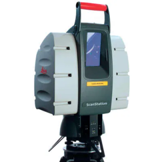
In 2007, Leica Geosystems released the ScanStation 2, which was even more advanced than the Cyrax 2400. The ScanStation 2 offered increased range, speed, and precision, as well as improved data acquisition and processing capabilities. It quickly became one of the most widely used terrestrial LiDAR systems on the market. Leica Geosystems continued to innovate in the field of terrestrial LiDAR, releasing a series of highly advanced products over the years.
In 2010, they introduced the Leica ScanStation C10, which was notable for its high-accuracy dual-axis compensator and its ability to capture data in full-colour. The C10 also offered real-time data registration, allowing users to verify data quality as it was being captured.
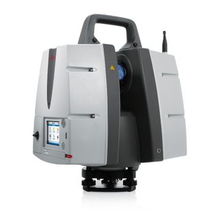
In 2013, Leica Geosystems released the Leica ScanStation P20, which was designed for high-performance scanning in challenging environments. The P20 featured an advanced laser scanner, a high-resolution camera, and a range of other features that made it ideal for use in industries such as engineering, construction, and forensics.
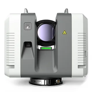
Today, one of Leica Geosystems most popular terrestrial LiDAR products is the Leica RTC360. This cutting-edge scanner offers fast and accurate 3D data capture, quickly make it a favourite among surveying and geospatial professionals. Its high accuracy, fast data capture, and intuitive software make it an essential tool for anyone looking to take their scanning and mapping capabilities to the next level.