When a breakthrough in technology allows you to work more efficiently and with greater accuracy, it’s difficult to imagine maintaining a competitive edge without it.
That’s abundantly clear to Jensen Bowers, a Queensland-based consultancy of surveyors, town planners and development advisors. Jensen Bowers understand that being across the newest technology is vital for running a profitable, relevant and efficient business – they have been in business since 1908. Jensen Bowers have created a corporate culture that looks at technology as the way to enable people to constantly adapt and learn, continually create advanced solutions for clients and drive relentless change.
Keeping up with technology is easier when you have a problem that you’d like to solve. Right now, Jensen Bowers is making the most of an innovative technology recently developed by Leica Geosystems. It relates to GNSS receivers, and it has just been incorporated into Leica’s latest GS18T tilt-compensating GNSS rovers– typically used for RTK topographical surveys and staking out. The technological breakthrough with the GS18T is that its tilt compensation is achieved by combining measurements from GNSS with those produced by inertial measurement units (IMUs).
The idea was inspired by technologies previously used in aviation and marine navigation. Specialists in these technologies found that a fusion of GNSS and IMU sensors can find true north when undergoing arbitrary motion. Since the algorithm relies on movement, the Australian R&D team faced a challenge in scaling the motion of a fighter jet to that of a pedestrian surveyor. The team overcame the challenge, and the technology has been incorporated into the GS18T. The system provides highly accurate information on pole tilt, direction of tilt and sensor heading – allowing the tilt distance to be added into the calculation of GNSS measurements. In effect, the pole tip always represents the true position, whichever way the pole is tilted.
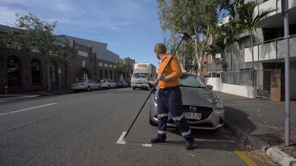
Where conventional GNSS rovers need the pole vertical and need several seconds to level the pole at each location, the GS18T can be used on angles up to and beyond 30º. And measurement is instantaneous.

According to Jensen Bowers’ Senior Surveyor James McDonnell, this feature has created a whole new dynamic to how they take measurements in the field.
“With the GS18T there’s no need to watch the level bubble while you’re trying to read the stake instructions and move the pole into position, all at the same time,” McDonnell said. “As you move, you simply watch the graphics of the pole location in a 3D viewer and move the pole tip to its bulls eye centre.”
The display shows the position and angle of the pole and the whole scene is updated as the operator turns around.
“You can forget the bubble and just measure,” McDonnell said. “That speeds things up considerably.”
Jensen Bowers is also finding tilt compensation beneficial where levelling the bubble can’t be the operator’s highest priority, for example taking measurements on a roadway, where watching out for traffic is more important. It means the operator can take more measurements faster and more safely.
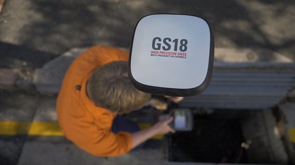
McDonnell also pointed out that there are often instances where it’s impossible to get the pole vertical – for example measuring the invert of a pipe in a pit or when you’re measuring a point that’s at the base of a wall – where you can’t get close enough, because of the bulk of the GNSS sensor.
“Measurements like these aren’t a problem with the GS18T,” McDonnell said. “Whatever you’re measuring with the GS18T, quality assurance is integrated into the process because you’re not relying on the operator to hold the pole vertical.”
Leica’s adoption of IMUs to determine pole orientation has other benefits. Most other tilt compensating sensors use a magnetometer to determine the pole’s tilt. The problem is that magnetometers need to be calibrated frequently and are vulnerable to magnetic disturbances, electromagnetic fields and ferromagnetic materials. None of these affect IMUs. They are calibration free, and to achieve a network fixed position they only require initialisation with an RTK or SmartNet CORS network. McDonnell said that knowing his team can take measurements close to metallic objects is important.
“Often you don’t know the nature of the materials you are working around or what other features might be affecting your readings. Having switched from magnetic to IMUs we are much more confident of the quality of our field data,” he said.
Internal quality control mechanisms allow an automatic start and stop of tilt compensation on the fly, allowing the system to cope with extreme pole dynamics such as hard shocks.
Leica’s use of advanced GNSS antenna technologies is part of the reason the GS18T can operate so far from vertical. The sensor in the GS18T is highly sensitive. It excels in signal tracking, even at low elevations – ensuring coordinate quality. Case studies have shown the GS18T has up to 40% fewer cycle slips than a survey-grade GNSS smart antenna and that a 3D coordinate quality of 2cm is still achievable with the GS18T when the pole is tilted.

Scott Morrison is Business Development Manager and a director of Jensen Bowers. He emphasised the fact that having the right equipment is vital to their operations.
“We always look for equipment that is reliable accurate and robust, but we also take into consideration any innovative features, potential deficiencies and supplier support. The GS18T is satisfying all those criteria and it has been easy to integrate it into all our software, other equipment and workflows,” he said.
“The speed of the GS18T and the quality of its data mean we feel more comfortable using this measurement tool than we have with many other tools in the past. With it working in combination with the national Smartnet CORS Network, the GS18T has given us confidence to mobilise anywhere in Australia,” Morrison said.
The tilt compensation functionality of the GS18 T represents the pinnacle of Swiss engineering. The Leica GS18 T GNSS RTK rover recently won an Australian Engineering Excellence Award during the Australian Engineering Conference in Sydney.
Under the category of Products and Manufacturing, the GS18 T took top honours for innovative fusion of GNSS and inertial micros unit (IMU) sensors. The event is hosted annually by the professional association Engineers Australia (EA), the largest and most diverse organisation serving around 100,000 engineers in the country.
Published with permission - Spatial Source - 4 November 2018


