Melbourne-based Nobelius Land Surveyors, a family-owned business, offers a wide variety of cadastral and topographical surveying services, from small urban re-developments of from 2 to 6 lots, to large-scale projects of more than 2,000 lots. And that work is now being made easier with the arrival of the Leica GS18 I.
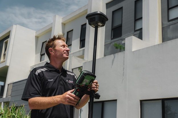
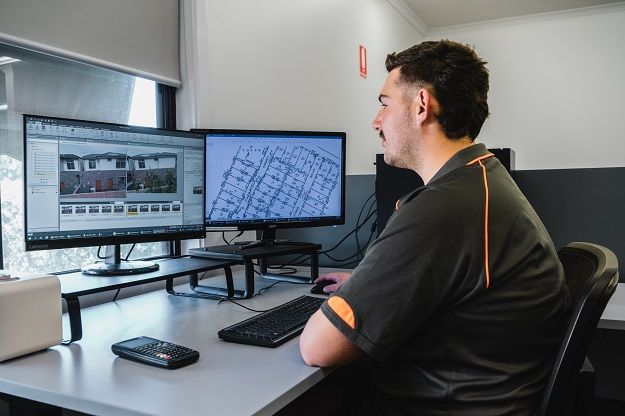
Melbourne-based Nobelius Land Surveyors is using the Leica GS18 I on a daily basis, with the company’s Survey Manager, Stuart Wilson (pictured) saying it has capabilities “unlike anything else we had seen”.
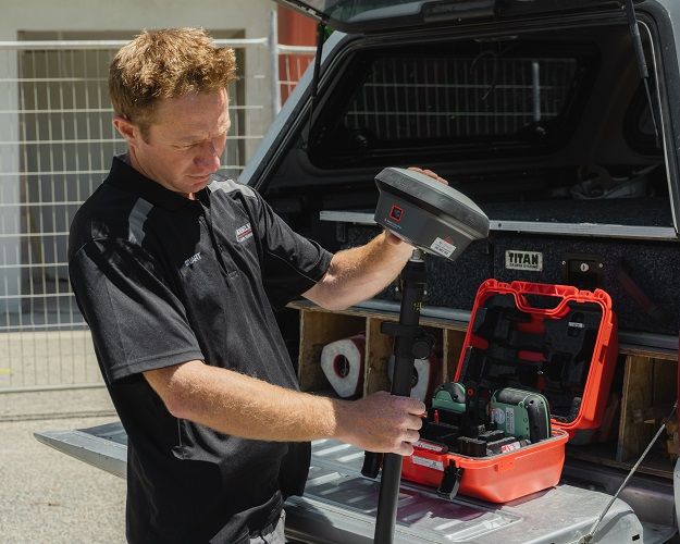
A lot of Nobelius’ work involves cadastral/feature and level surveys in and around Melbourne, with individual crews sometimes having to survey up to five sites per day across the city and eastern Victoria. With such distances between sites, the ability to quickly survey on location is crucial to the company’s success.
After performing traverse work, the crew’s party leader and assistant often engage in separate jobs. Using teams of two, they can split up, with the party leader using the Leica TS10 for the cadastral measurements and the survey assistant using GNSS to capture feature and level data.
The data is uploaded to SharePoint from the field tablets for the company’s drafts people to start drawing plans even before the crew arrives at its next site. The data is ASCII for the measurements and Leica DBX if using the GNSS with imaging.
“Our field crews constantly have trouble getting line of site for the TS10 total stations through obstructions such as trees, fences and buildings within the suburban/residential allotments,” said Nobelius’ Survey Manager, Stuart Wilson. “Obtaining measurements accurately by going over fences and around trees with the GS18 I enables us to work faster and more accurately than with our previous methods of measuring and sketching.”
Wilson has been in the surveying sector for a long time, having started 18 years ago as a survey assistant to Ken Nobelius. He worked his way up to become a party leader and was appointed Survey Manager three years ago. He says the company is an early adopter of new technology.
“In a competitive market, Nobelius is trying to always improve the speed and accuracy of our survey work,” he said. “We are mostly a young, up-and-coming survey team, so we are all eager to learn more and figure out how to use technology to improve our business and make our jobs easier.”
“This in turn enables us to deliver fast, high-quality data to our clients.”
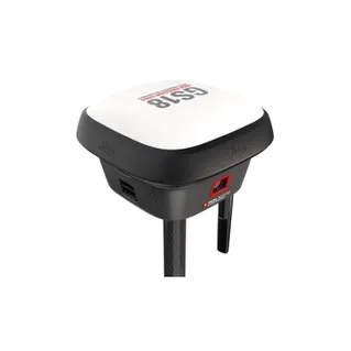
This approach is what has led the company to the new Leica GS18 I, an innovative RTK rover that features visual positioning technology based around the seamless integration of GNSS, IMU and a camera.
Wilson says that an initial webinar briefing showed him that the unit has an ability to measure that is “unlike anything we have done before”. So he needed to see more.
“C.R. Kennedy is our main supplier of survey equipment, and they were more than happy to come to us for a demonstration. Peter Barstow came out and did a demonstration in front of the entire survey team,” he said.
“The GS18 I lock was impressive under difficult conditions and the infield point extraction from images was unlike anything else we had seen.”
Thus, following the demonstration, the company loaned a unit to test it for themselves before making a purchase.
Wilson said the acid test was the ability to obtain measurements over a fence, “since this is the biggest issue we face on site — we have this problem constantly”.
“Tilt functionality, as well as the improved performance under trees, excited us and got us thinking more about different features we can measure,” he said. “The imaging feature then adds another level of usability, and tests showed the accuracies were great.”
According to Wilson, the company’s surveyors had always had difficulty accurately locating habitable and non-habitable windows nine metres around the subject site for the working drawings to be made. “The standard height of residential fences made it virtually impossible to use a total station to measure the features required,” he said. “We needed to find a way to quickly and accurately measure features for the drawings. The previous way was to use a ladder and disto to sketch these features.”
A typical survey run will see the company’s surveyors use the GS18 I (tilt measurements) for as much feature and level work as required, followed by imaging runs. The accuracy of each image group is checked as it is taken to ensure the crew is happy with the data quality. The data is then exported and the files uploaded to SharePoint for the office work to be done. That’s followed by creation of the additional points in Leica Infinity software for the features they want to extract. These are then exported and added to the TS10 data in a CAD program so that plan drawing can commence.
“Recording the images allows us to also remeasure anything we capture,” said Wilson. “If any architects or drafts people require extra information, the data is always there.”
Wilson says using the GS18 I means less time spent on site (with the unit being around 20% faster than previous methods), more accurate data is produced, and there’s no need to get the ladder from the car to look over a fence or position awkwardly over a fence.
And that’s not all — Nobelius hasn’t yet fully explored all the possibilities the GS18 I has to offer. “The ability of creating a point cloud from the images is something we might investigate later, knowing that we if we are asked to provide this for a client, we have the capabilities to do so,” he said.
Wilson says the tilt, speed of measurement and how well the GS18 I initialises has been a surprise, as has the ease at which the company’s surveyors can now collect more data than ever before compared to using the old GNSS instruments. “It is fast and accurate, has fantastic performance under trees, and opens up a new way of thinking for collecting measurements on a site,” he said.
Summarising, Wilson says the top three advantages to using the GS18 I are:
- The ability to measure over fences
- Having an accurate record of the feature and how it was calculated
- Having images to show designers and office staff
He adds that with the minimal price difference, it makes more sense to choose the imaging option over the tilt. “Over the lifespan of the equipment, it will save you more money than it costs for the upgrade,” he said. “The ability to use images to extract points in the field as well as back in the office, enables you to review images later in case of a missed measurement.”
Read the full article at Spatial Source