
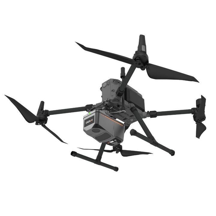
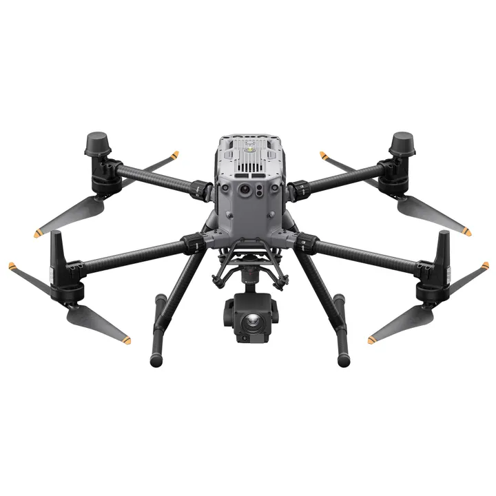
CHCNAV X500 Professional Multirotor Drone / UAV Package
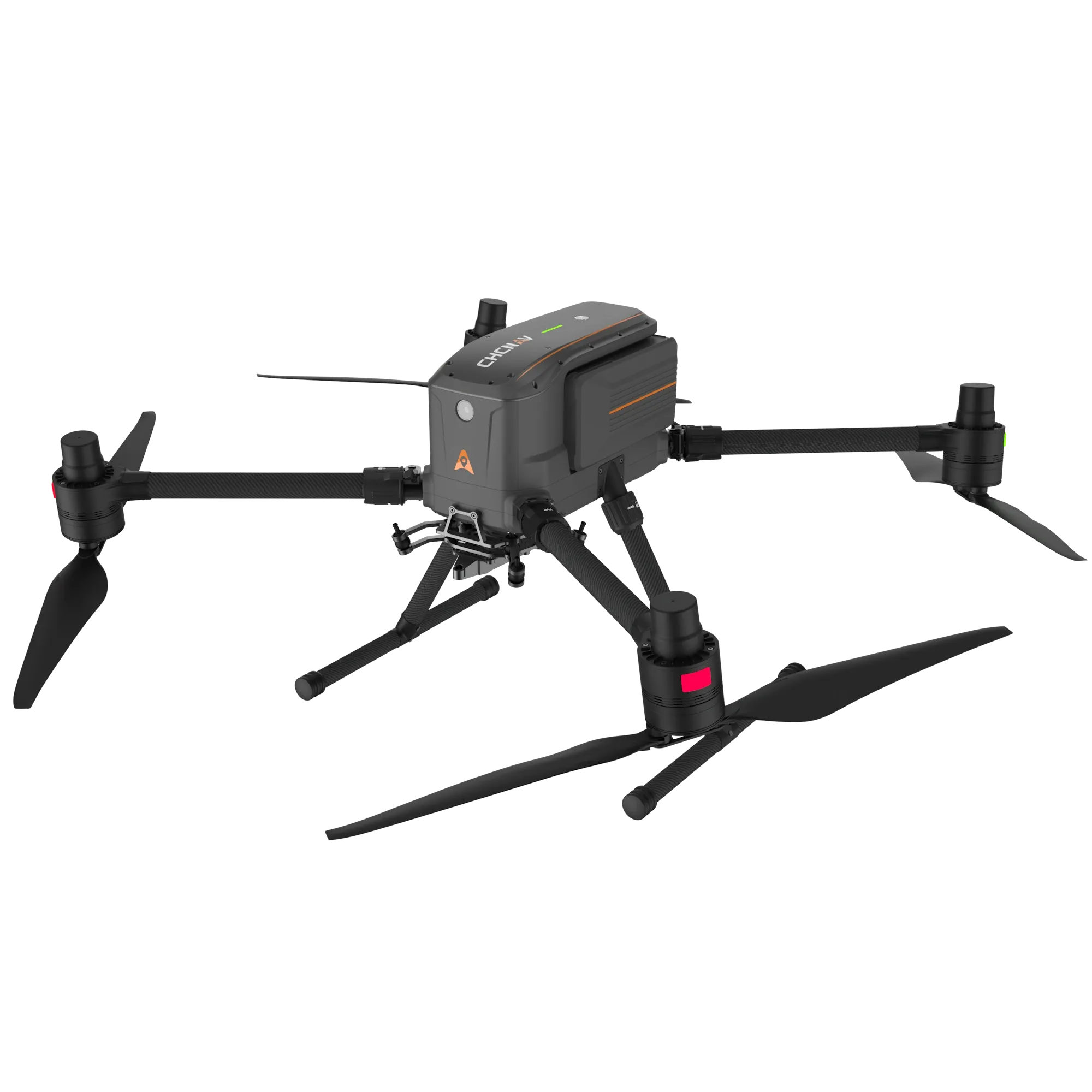
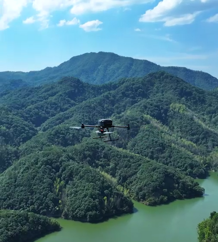
- Professional drone engineered for exceptional payload capacity and endurance.
- Equipped with advanced flight controls and high-precision positioning,
- Delivers superior maneuverability, stability, and flight performance.
- Built-in visual SLAM and obstacle detection radar ensure intelligent, safe operations.
- Compatible with aCHCNAV sensors and third-party payloads.
- Ideal for surveying, urban surveillance, emergency scouting, disaster relief, and inspection missions applications.
- Long hover time up to 58 mins (with no payload).
High Performance
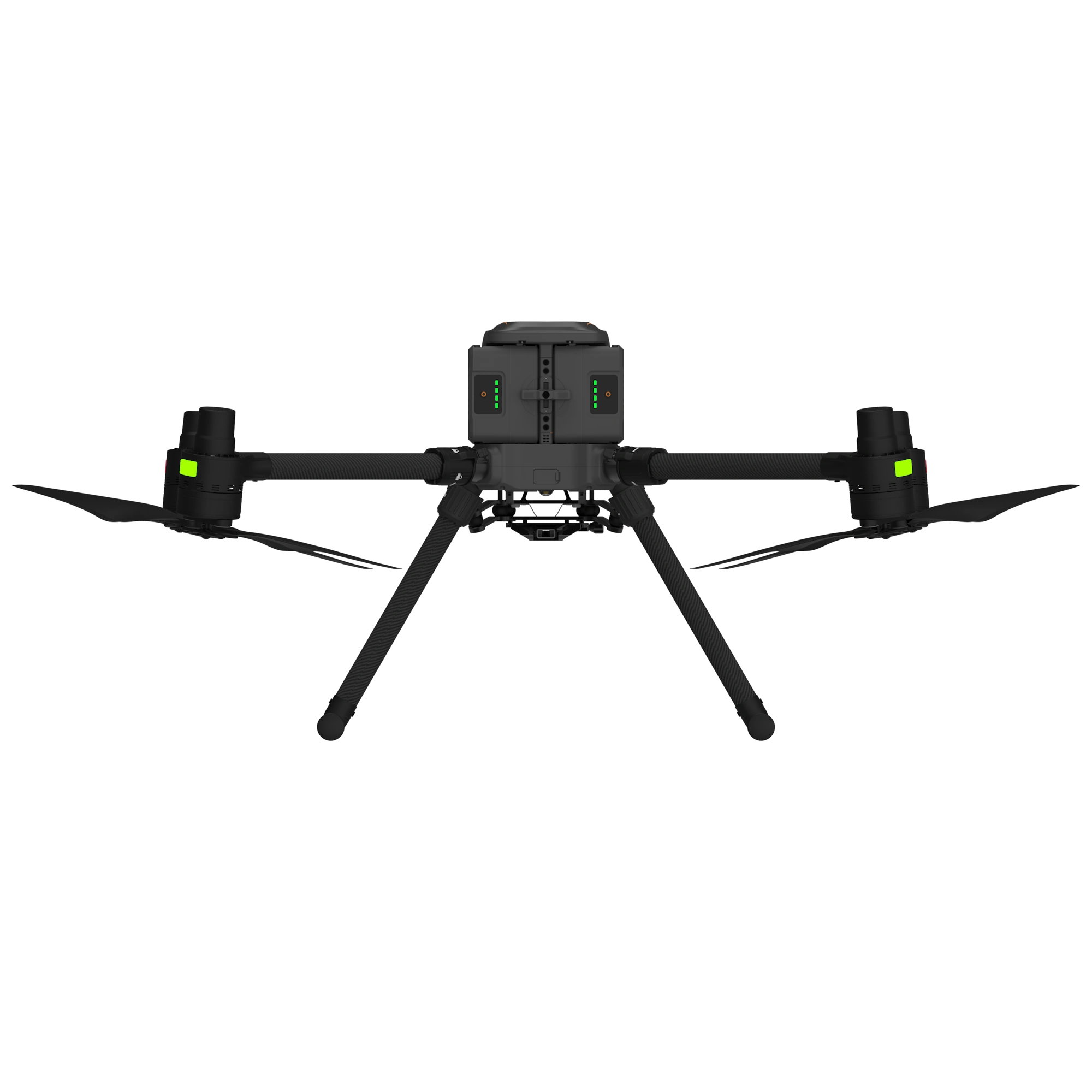
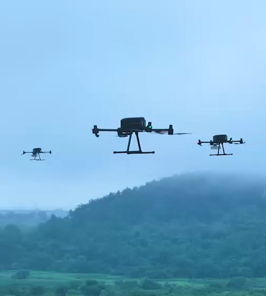
The X500 supports a 5 kg payload capacity and offers a flight endurance of 58 minutes, or up to 50 minutes when equipped with the CHCNAV AA10 LiDAR. Its IP55 rating and 12 m/s wind resistance enable reliable performance in challenging environments.
Optimal Flight Safety
The X500 features robust redundancy with dual GNSS, triple IMU backups, dual-redundant flight control, and safe return strategies. Its millimeter-wave radar ensures precise obstacle detection and avoidance, including trees, buildings, and towers. The V-SLAM visual positioning system enables landings on moving vehicles and vessels.
Efficient Energy System
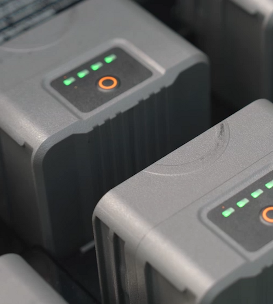
Paired with the BS10 charging station, which holds up to six batteries, it allows fast charging from 20% to 90% in just 40 minutes ensuring uninterrupted operation throughout
Versatile Payload Options
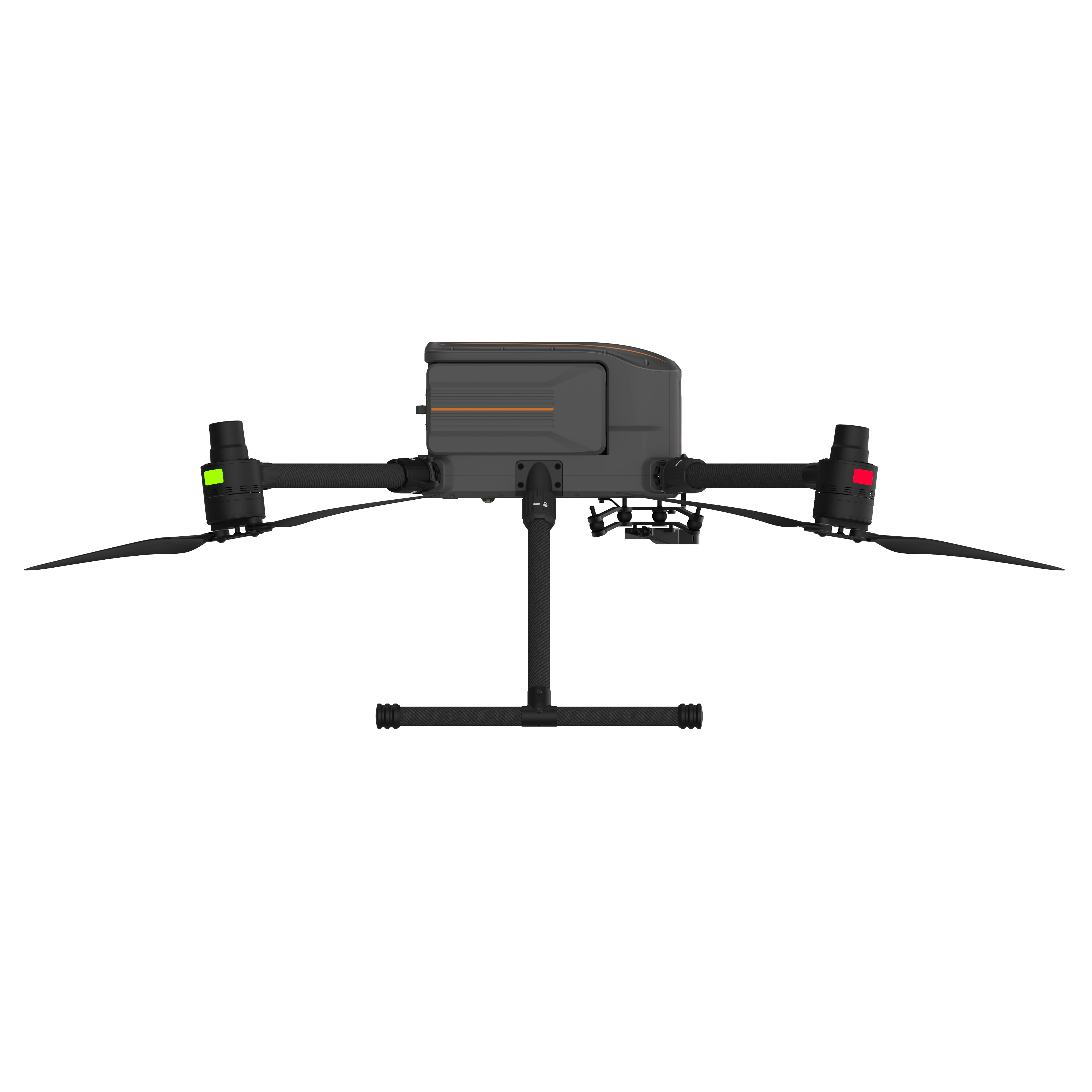
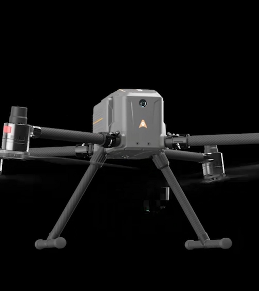
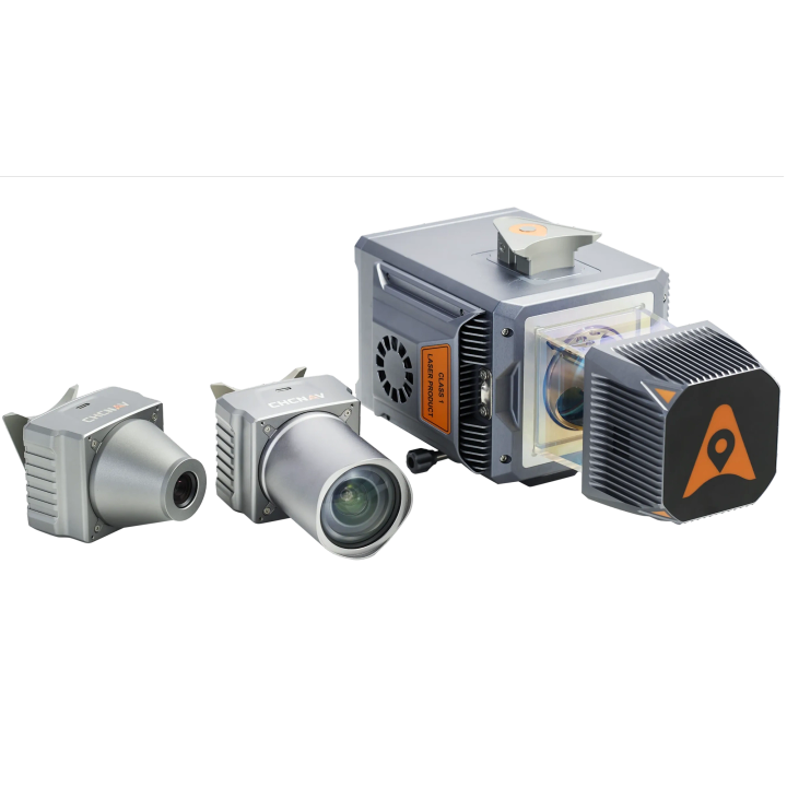
The X500 supports up to 3 concurrent payloads and is compatible with CHCNAV LiDARs and cameras. Its open SDK interface facilitates integration with third-party devices, enabling customization for specific mission requirements. Built on the universal Mavlink protocol, it ensures adaptability to multiple applications.
Long-Range Operation
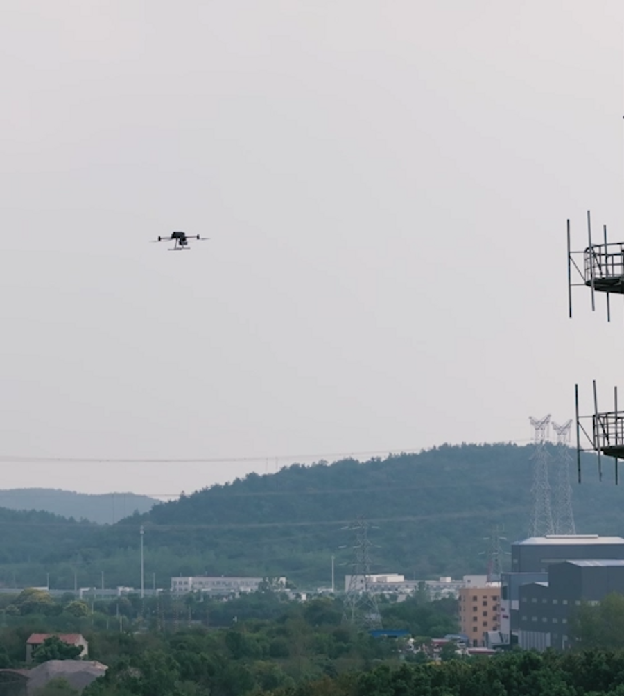
The X500 uses CHCNAV’s video transmission system with a range of up to 20 km. Advanced algorithms optimize HD video transmission by minimizing latency and enhancing reliability. Its 1080p HD FPV feed and 10.1" large-screen remote control provide intuitive operating experience.
Intelligent Flight Software
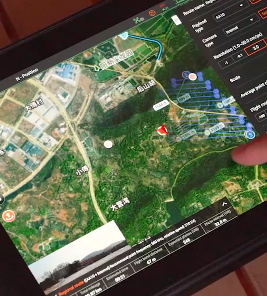
CHCNAV SmartGo ground control software supports diverse flight path options, including rectangular, strip, polygonal, and facade routes. It provides real-time updates on the drone's status, heading, and surrounding obstacles, ensuring enhanced safety for beyond-visual-line-of-sight (BVLOS) operations.
| General System Performance | |
| Type | Quadcopter with 4 propellers |
| Structure | Carbon fiber, quickly release design |
| Dimensions (unfolded) | 770 x 804 x 450 mm(L x W x H) |
| Dimensions (folded) | 485 x 410 x 450 cmm(L x W x H) |
| Diagonal wheelbase | 1,000mm |
| Weight | Approx. 4.4 kg (without batteries) Approx. 8.9 kg (with two batteries) |
| Max. payload | 5.0kg |
| Hovering accuracy | Vertical: ±0.5 m (with GNSS positioning) ±0.1 m (with RTK positioning) Horizontal: ±1.5 m (with GNSS positioning) ±0.1 m (with RTK positioning) |
| RTK accuracy (RTK FIX) | 1 cm ± 1 ppm Hz 1.5 cm ± 1 ppm V |
| GNSS | GPS + GLONASS + BeiDou + Galileo |
| Operating temperature | -20° to 50°C |
| Storage temperature | -40° to 70°C |
| Transport container dimensions | 770 x 520 x 310 mm(L x W x H) |
| Supported payload configurations | Single downward payload Single upward payload Dual downward payload Single downward payload + single upward payload |
| Supported CHCNAV payload | RGB camera: C5/C30 LiDAR: AU20/AA15/AA10/AA9 |
| Flight Performance | |
| Max. ascent speed | 8 m/s |
| Max. descent speed | 6 m/s |
| Max. speed | 23 m/s |
| Max. wind resistance | 12 m/s (level 6) |
| Max. flight time | 58 mins with no payload 52 mins with 2 kg payload 40 mins with 4 kg payload |
| IP Rating | IP55 |
| Obstacle avoidance module | Forward millimeter wave radar |
| Obstacle detection range | 80m |
| Landing deviation | ≤ 10 cm (with vision positioning) ≤ 8 cm (with RTK fixed) |
| Remote Controller | |
| Screen | 10.1" |
| Weight | 1.5kg |
| Built-in battery | Li-Ion |
| Operating time | Approx. 5 hours |
| Operating temperature | -20° to 50°C |
| Operating frequency | 2.403 GHz to 2.483 GHz |
| Max. transmission distance | 20km |
| Brochures | |
|---|---|
| X500KIT - Brochure |


Brand: CHCNAV |
Code: X500KIT
APN: 9319499316150 |
Supplier Code: 8005 010 155
Brand: CHCNAV |
Code: X500KIT
APN: 9319499316150 |
Supplier Code: 8005 010 155
At a glance
- Professional drone engineered for exceptional payload capacity and endurance.
- Equipped with advanced flight controls and high-precision positioning,
- Delivers superior maneuverability, stability, and flight performance.
- Built-in visual SLAM and obstacle detection radar ensure intelligent, safe operations.
- Compatible with aCHCNAV sensors and third-party payloads.
- Ideal for surveying, urban surveillance, emergency scouting, disaster relief, and inspection missions applications.
- Long hover time up to 58 mins (with no payload).
High PerformanceThe X500 supports a 5 kg payload capacity and offers a flight endurance of 58 minutes, or up to 50 minutes when equipped with the CHCNAV AA10 LiDAR. Its IP55 rating and 12 m/s wind resistance enable reliable performance in challenging environments. |
|
|
|
Optimal Flight SafetyThe X500 features robust redundancy with dual GNSS, triple IMU backups, dual-redundant flight control, and safe return strategies. Its millimeter-wave radar ensures precise obstacle detection and avoidance, including trees, buildings, and towers. The V-SLAM visual positioning system enables landings on moving vehicles and vessels. |
Efficient Energy SystemPaired with the BS10 charging station, which holds up to six batteries, it allows fast charging from 20% to 90% in just 40 minutes ensuring uninterrupted operation throughout |
|
|
|
Versatile Payload OptionsThe X500 supports up to 3 concurrent payloads and is compatible with CHCNAV LiDARs and cameras. Its open SDK interface facilitates integration with third-party devices, enabling customization for specific mission requirements. Built on the universal Mavlink protocol, it ensures adaptability to multiple applications. |
Long-Range OperationThe X500 uses CHCNAV’s video transmission system with a range of up to 20 km. Advanced algorithms optimize HD video transmission by minimizing latency and enhancing reliability. Its 1080p HD FPV feed and 10.1" large-screen remote control provide intuitive operating experience. |
|
|
|
Intelligent Flight SoftwareCHCNAV SmartGo ground control software supports diverse flight path options, including rectangular, strip, polygonal, and facade routes. It provides real-time updates on the drone's status, heading, and surrounding obstacles, ensuring enhanced safety for beyond-visual-line-of-sight (BVLOS) operations. |
| General System Performance | |
| Type | Quadcopter with 4 propellers |
| Structure | Carbon fiber, quickly release design |
| Dimensions (unfolded) | 770 x 804 x 450 mm(L x W x H) |
| Dimensions (folded) | 485 x 410 x 450 cmm(L x W x H) |
| Diagonal wheelbase | 1,000mm |
| Weight | Approx. 4.4 kg (without batteries) Approx. 8.9 kg (with two batteries) |
| Max. payload | 5.0kg |
| Hovering accuracy | Vertical: ±0.5 m (with GNSS positioning) ±0.1 m (with RTK positioning) Horizontal: ±1.5 m (with GNSS positioning) ±0.1 m (with RTK positioning) |
| RTK accuracy (RTK FIX) | 1 cm ± 1 ppm Hz 1.5 cm ± 1 ppm V |
| GNSS | GPS + GLONASS + BeiDou + Galileo |
| Operating temperature | -20° to 50°C |
| Storage temperature | -40° to 70°C |
| Transport container dimensions | 770 x 520 x 310 mm(L x W x H) |
| Supported payload configurations | Single downward payload Single upward payload Dual downward payload Single downward payload + single upward payload |
| Supported CHCNAV payload | RGB camera: C5/C30 LiDAR: AU20/AA15/AA10/AA9 |
| Flight Performance | |
| Max. ascent speed | 8 m/s |
| Max. descent speed | 6 m/s |
| Max. speed | 23 m/s |
| Max. wind resistance | 12 m/s (level 6) |
| Max. flight time | 58 mins with no payload 52 mins with 2 kg payload 40 mins with 4 kg payload |
| IP Rating | IP55 |
| Obstacle avoidance module | Forward millimeter wave radar |
| Obstacle detection range | 80m |
| Landing deviation | ≤ 10 cm (with vision positioning) ≤ 8 cm (with RTK fixed) |
| Remote Controller | |
| Screen | 10.1" |
| Weight | 1.5kg |
| Built-in battery | Li-Ion |
| Operating time | Approx. 5 hours |
| Operating temperature | -20° to 50°C |
| Operating frequency | 2.403 GHz to 2.483 GHz |
| Max. transmission distance | 20km |

C.R. Kennedy is your national partner for all positioning needs from surveying to machine control, building construction to reality capture and everything in-between. Wherever you are in Australia, C.R. Kennedy are with you, providing an unparalleled level of service and support from industry experts to get the job done safely and efficiently.
Shop Safely and Securely with
@ C.R.Kennedy Geospatial Solutions
© 2025 C.R. KENNEDY. All rights reserved.
ICON SITE EXCAVATOR
SPECIAL OFFER - LIMITED TIME
A simple machine control solution ideal for compact excavators — with a big payoff!
