


Pix4Dsurvey

Product options:
Product options:
- Bridge the gap between photogrammetry and CAD.
- Import data seamlessly from Pix4Dmatic.
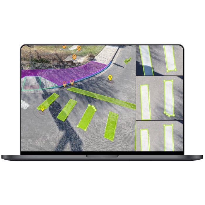
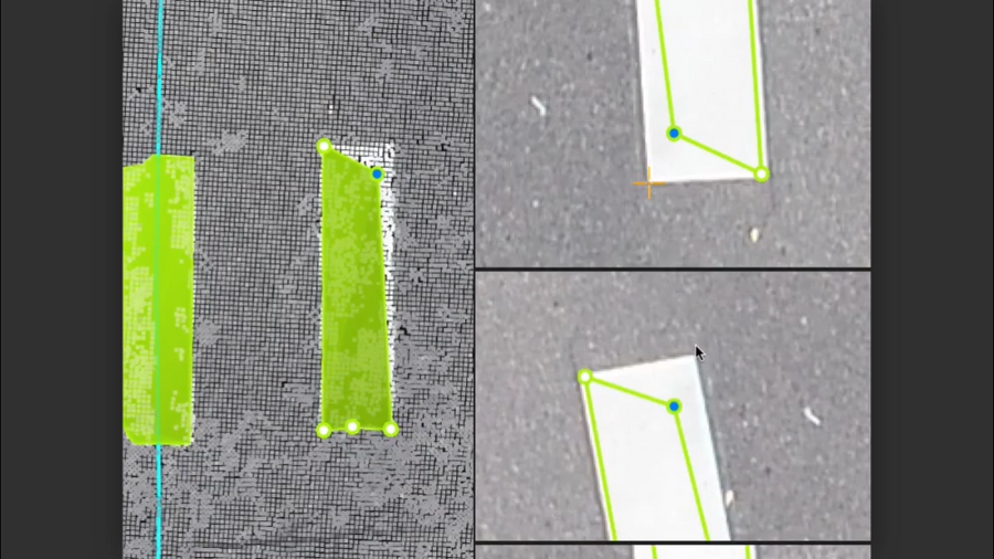
Built-in vectorization tools
Vectorize your project using points, polylines, polygons and catenary curves with just a few clicks.

Measure volumes
Measure the volume of any object or space with straightforward steps.
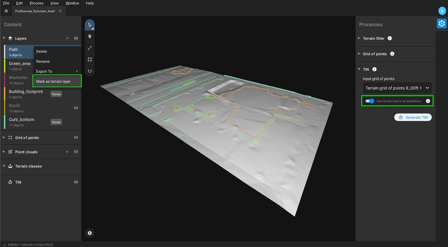
Create surfaces
Model the ground with a TIN from points and breaklines to represent the topography of your project. Automate the creation of spot elevations and allow drastic simplification of the number of point cloud points.
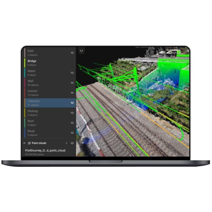
Unlock more data
Move beyond photogrammetry, yet still work with Pix4D’s rayCloud to access the original images and 3D point clouds simultaneously. Vectorize in 3D, edit in 2D. Survey complex objects only visible in images. Use color selection to pick a point and search in a defined radius for points of a similar color.
Scale up
PIX4Dsurvey can handle billions of points. Work with as many point cloud files as you like in the same projects, including .las.

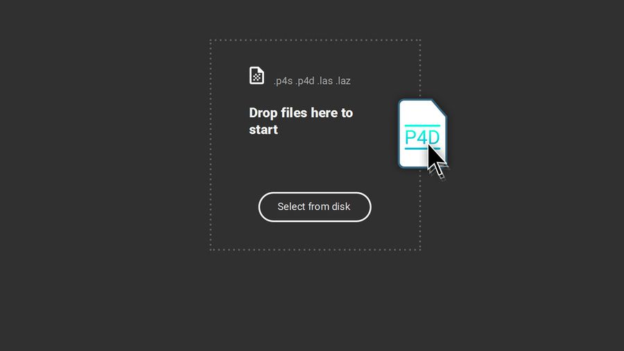
Integrated solution
PIX4Dsurvey works with your existing workflows. Import .p4d files from PIX4Dmapper, PIX4Dcloud, or .p4m files from PIX4Dmatic with the click of a button, or work with .las and .laz files from any device/source.
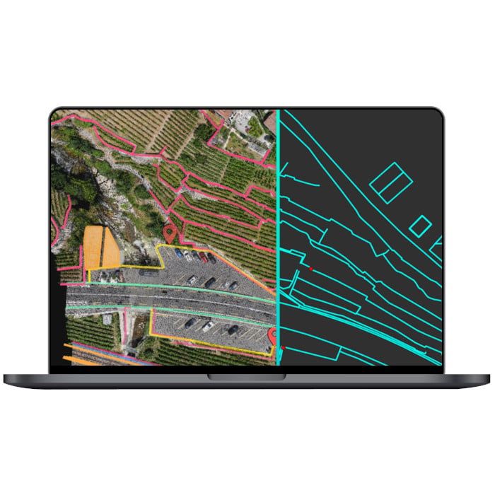
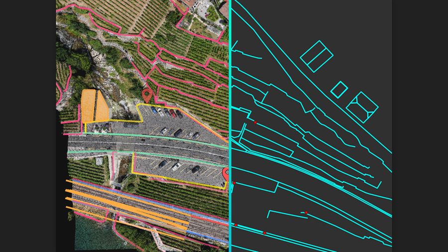
Easy export
Every surveyed object can be assigned to a layer and edited. Layers can be exported separately or together for a smooth transition to your preferred CAD or GIS software.


Brand: Pix4D |
Product options:
Brand: Pix4D |
At a glance
- Bridge the gap between photogrammetry and CAD.
- Import data seamlessly from Pix4Dmatic.
Built-in vectorization toolsVectorize your project using points, polylines, polygons and catenary curves with just a few clicks. |
|
|
|
Measure volumesMeasure the volume of any object or space with straightforward steps. |
Create surfacesModel the ground with a TIN from points and breaklines to represent the topography of your project. Automate the creation of spot elevations and allow drastic simplification of the number of point cloud points. |
|
|
|
Unlock more dataMove beyond photogrammetry, yet still work with Pix4D’s rayCloud to access the original images and 3D point clouds simultaneously. Vectorize in 3D, edit in 2D. Survey complex objects only visible in images. Use color selection to pick a point and search in a defined radius for points of a similar color. |
Scale upPIX4Dsurvey can handle billions of points. Work with as many point cloud files as you like in the same projects, including .las. |
|
|
|
Integrated solutionPIX4Dsurvey works with your existing workflows. Import .p4d files from PIX4Dmapper, PIX4Dcloud, or .p4m files from PIX4Dmatic with the click of a button, or work with .las and .laz files from any device/source. |
Easy exportEvery surveyed object can be assigned to a layer and edited. Layers can be exported separately or together for a smooth transition to your preferred CAD or GIS software. |
|
