


Pix4Dreact

Product options:
Product options:
- Get rapid and reliable situational awareness for quick decisions and collaboration in the field.
- Create 2D maps fast from drone aerial imagery, ideal for emergency response and public safety.
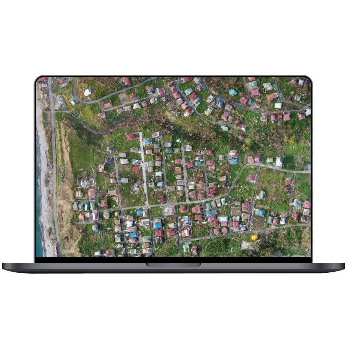
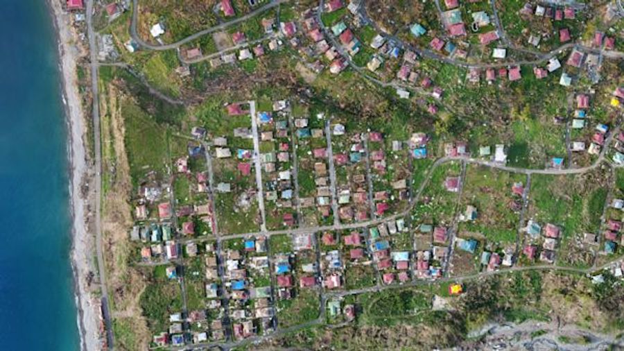
2D orthomosaic map
PIX4Dreact uses fast-stitching technology to create accurate 2D orthomosaic maps by combining a large number of nadir drone images.
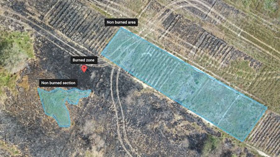
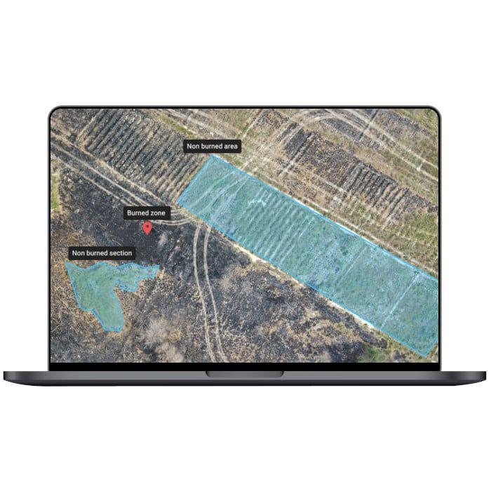
Markers and measurements
Mark areas of interest or GPS coordinates within the project and assess the situation on the ground for smoother collaboration or long-term documentation.
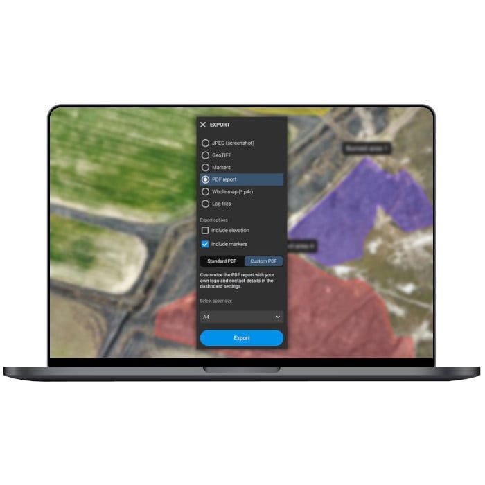
Screenshots and whole maps
Document and collaborate in seconds with options to export your maps as screenshots or a whole map that can be imported into PIX4Dreact on another computer.
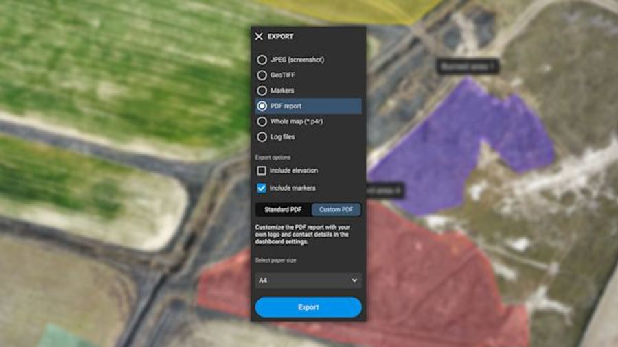
PDF Report
Easily share a 2D orthomosaic, location data and markers in one file over email. Customize the report by white labeling it with your company details and logo.


Brand: Pix4D |
Code:
PIX4DREACTMONTH
Product options:
Brand: Pix4D |
Code:
PIX4DREACTMONTH
At a glance
- Get rapid and reliable situational awareness for quick decisions and collaboration in the field.
- Create 2D maps fast from drone aerial imagery, ideal for emergency response and public safety.
2D orthomosaic mapPIX4Dreact uses fast-stitching technology to create accurate 2D orthomosaic maps by combining a large number of nadir drone images. |
|
|
|
Markers and measurementsMark areas of interest or GPS coordinates within the project and assess the situation on the ground for smoother collaboration or long-term documentation. |
Screenshots and whole mapsDocument and collaborate in seconds with options to export your maps as screenshots or a whole map that can be imported into PIX4Dreact on another computer. |
|
|
|
PDF ReportEasily share a 2D orthomosaic, location data and markers in one file over email. Customize the report by white labeling it with your company details and logo. |
