


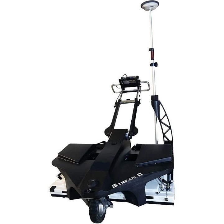
IDS Stream C Ground Penetrating Radar (GPR) - motorized

This product is now obsolete and replaced by the latest IDS GeoRadar Stream DP GPR
REPLACEMENT NOTICE:
IDS STREAM C is now replaced by its successor IDS STREAM DP GPR
CLICK HERE to check out the IDS GeoRadar Stream DP GPR
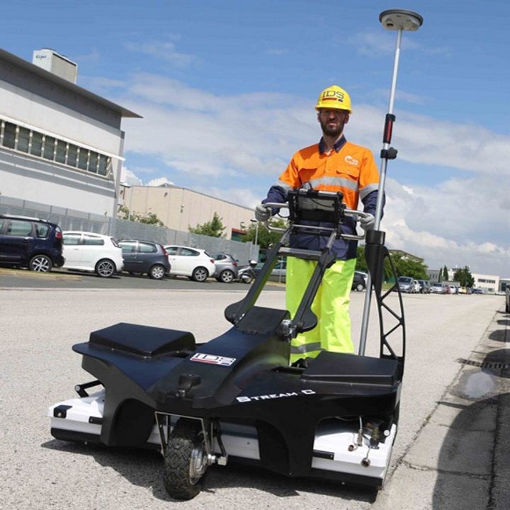
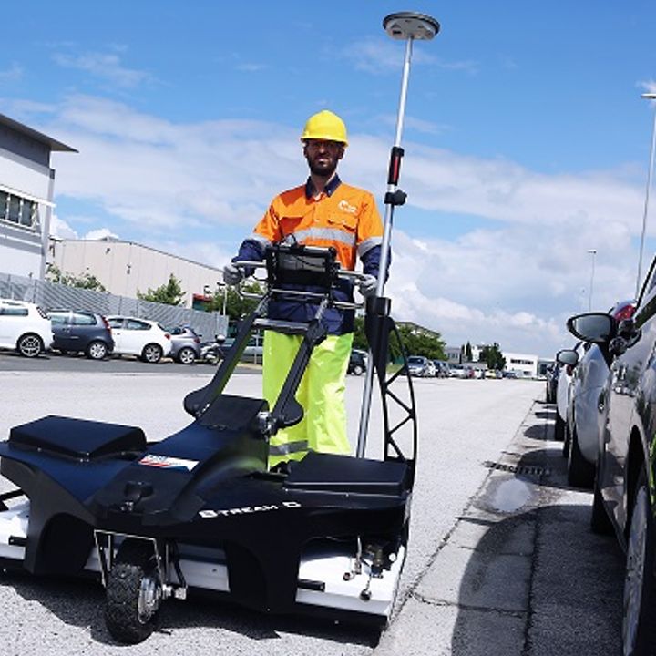
Stream C is the compact array solution for real-time 3D mapping of underground utilities and features. Thanks to the increased level of accuracy, provided by a massive antenna array, Stream C is able to detect pipes and cables automatically.
Daily use of Stream C is aided by ergonomic features including electronic ride height adjustment, options to tow manually or with a small vehicle, and a motor assisted drive wheel.
Stream C is available in both Basic and Advanced configurations.
Benefits of the Stream C include
High Productivity
Surveys only need to be performed in one direction to ensure optimal detection of both longitudinal and transversal pipes;
No advanced training needed
The system automatically detects and locates the position of pipes in real time and displays them on screen;
Reduced user fatigue
Thanks to electronic ride height adjustment and a motor assisted drive wheel;
Facilitates large surveys
The system can be towed manually or with a small vehicle, increasing the acquisition speed (up to 6 km/h).
Software
Real time software for advanced viewing
Stream C is supplied with the OneVision and GRED HD 3D CAD software suites.
OneVision
OneVision - Acquisition software for use in the field. Providing real-time target viewing, onsite object mapping and GPS navigation, OneVision is a software application for advanced GPR data collection This powerful tool can be used with an array of antennas when performing utility mapping, archeological and environmental surveys, and extensive mapping of medium to large size projects.OneVision is available for:
- Stream EM
- Stream X
- RIS MF Hi-Mod
OneVision is a powerful application for advanced surveys with integrated navigation, featuring:
- Real-time tomography on a cartographic background (e.g. Google Maps, GeoTIFF and KML)
- Multi-view screen with GPR radar maps (B-scan and T-scan), radar tomography (C scan) and cartography
- Survey planning tools
- Special function allowing tomographic merging of transversal and longitudinal swathes
- Continuous monitoring of GPR and GPS statuses
- Survey management with interactive and on-site target mapping as well as review and editing
- Automatic Pipe Detection (optional)
OneVision provides increased productivity and reduced costs. Other benefits include:
- Immediate decision-making with real-time on-site detection
- Target recognition removing the need for specialist skills
- Immediate understanding of complex environments (e.g., urban areas) with the tomographic map in real time
- Complete coverage is always provided in a single visit with integrated acquisition and navigation functions
GRED HD 3D CAD – specialised integration software
Specifically designed to offer an integrated framework for CAD and GIS, GRED HD 3D CAD combines the characteristics of industrial productivity with high levels of reliability. The software offers the fast creation and display of 2D and 3D tomograms in just a few minutes after basic filtering. Raw data, structures and objects of any generic shape are able to be directly exported to CAD or GIS maps.The software is fully compatible with any GPS or positioning data in order to obtain automatically geo-referenced data plots.
Key features include:
- Real-time display of trajectories using GPS or Total Station.
- 2D and 3D tomography for an immediate visualisation and detection of anomalies.
- Automated transfer to CAD/GIS: the identified target can be automatically transferred to CAD or GIS maps for professional SUE / utility mapping.
- Geolocated data information and visualisation
| Brochures | |
|---|---|
| IDS Stream C Ground Penetrating Radar (GPR) - motorized - Brochure | Datasheets |
| IDS Stream C Ground Penetrating Radar (GPR) - motorized - Datasheet |


Brand: Leica Geosystems |
Code: LG856241
MPN:
Supplier Code:

Brand: Leica Geosystems |
Code: LG856241
MPN:
Supplier Code:
At a glance
This product is now obsolete and replaced by the latest IDS GeoRadar Stream DP GPR
News | Sep 25, 2020
News | Jul 16, 2024
