


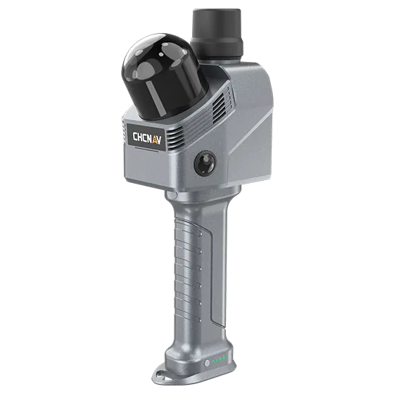
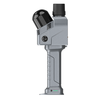
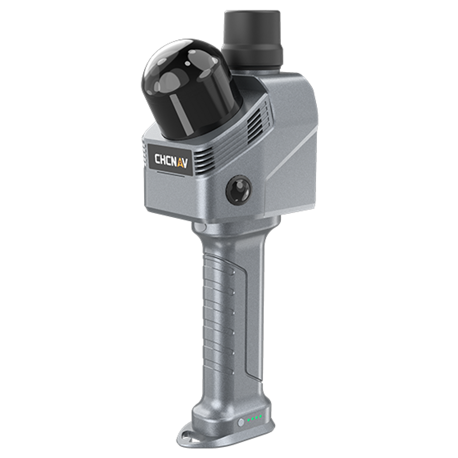
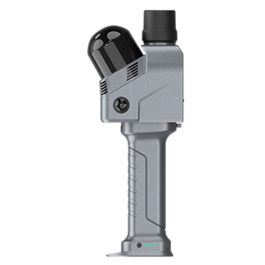
CHCNAV RS7 Slam Scanner Package

- High-performance handheld real-time SLAM scanner capturing up to 1.15 million points per second for efficient indoor surveying and BIM modelling.
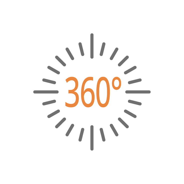
- High-precision IMU with 0.5°/h bias instability ensuring stability in feature-poor environments like tunnels and corridors, complemented by an ultra-wide 360° × 189° LiDAR FOV.
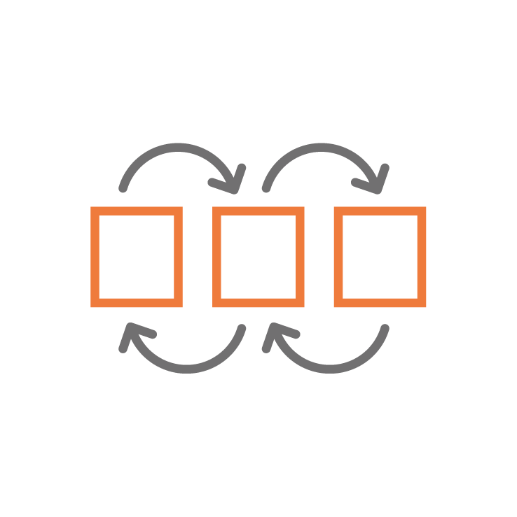
- Dual 12 MP HD cameras for low-light imaging and CoCloud integration automating point cloud processing and 3D Gaussian Splatting for optimized workflows.
CHCNAV RS7 Slam Scanner
High-Rate LiDARUp to 1.15 million pts/s |

High-precision IMUIMU bias instability |

HD Imaging SystemDual 12 MP HD cameras |
Expansion InterfacesOpen hardware interface |
Next-Generation Handheld SLAM Scanner
The CHCNAV RS7 is a high-performance handheld SLAM laser scanner designed for fast, accurate indoor and complex environment mapping. Built for BIM documentation, construction verification and digital twin capture, the RS7 delivers survey-grade point clouds without the need for GNSS or targets. Lightweight, mobile and powerful, it captures reality in real time.

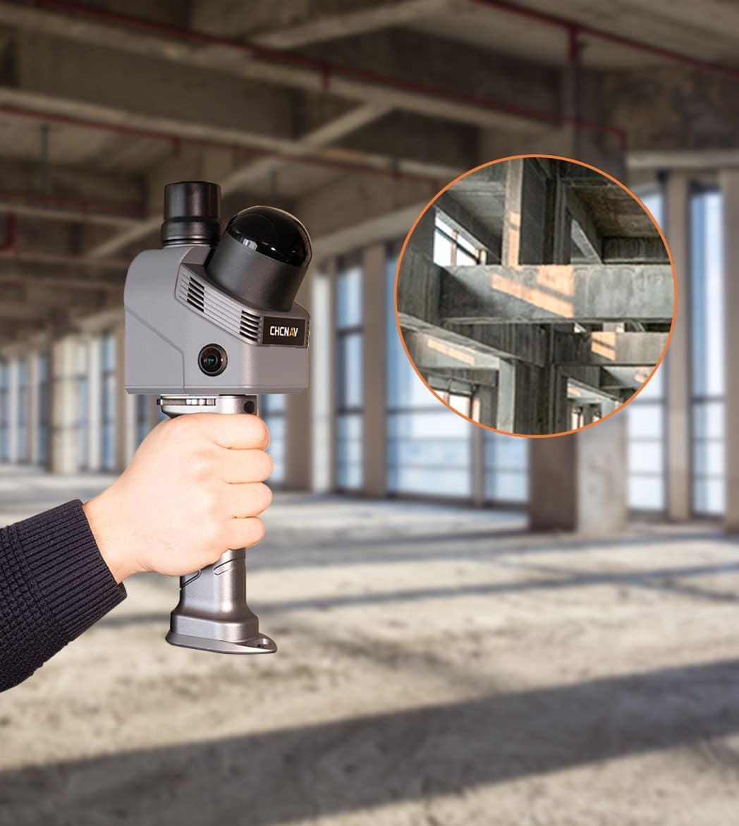
Purpose-Built for BIM & Indoor Surveying
From plant rooms and warehouses to commercial buildings and multi-level structures, the RS7 is optimised for indoor mapping and as-built documentation. Advanced SLAM algorithms ensure robust positioning in GNSS-denied environments, delivering consistent and repeatable results for architects, engineers and surveyors.
Survey-Grade Accuracy with SLAM Intelligence
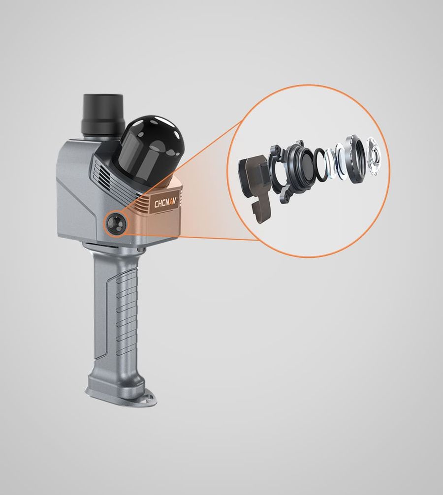
Equipped with a high-density LiDAR sensor and industrial-grade IMU, the RS7 delivers accurate, drift-controlled point clouds even across extended indoor trajectories. Real-time processing provides immediate feedback in the field, reducing rework and ensuring complete data capture before leaving site.

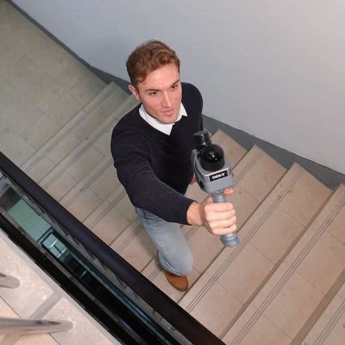
Designed for Productivity
The ergonomic handheld design allows operators to move naturally through corridors, stairwells and confined spaces. Rapid deployment, minimal setup and simplified workflows mean projects can be completed significantly faster than traditional static laser scanning methods.
RS7 System Features
- HIGH-SPEED LIDAR: Up to 1.15 million pts/s with 360° × 189° ultra-wide field of view for dense, full-coverage capture
- ADVANCED SLAM + INDUSTRIAL IMU: Drift-controlled indoor positioning without GNSS, maintaining stability across extended trajectories
- DUAL 12 MP RGB CAMERAS: Time-synchronised imaging system for accurate colourised point clouds and reliable low-light performance
- REAL-TIME VISUALISATION: Immediate in-field feedback to verify coverage and eliminate costly return visits
- LIGHTWEIGHT ERGONOMIC DESIGN: Comfortable handheld operation for efficient scanning of corridors, stairwells and confined environments
- BIM-READY OUTPUT: Export colourised point clouds and modelling data for BIM, construction verification, plant capture and digital twin workflows
GENERAL
| System type | Handheld real-time 3D LiDAR SLAM scanner with Deep INS + SLAM fusion and integrated RGB imaging |
| Workflow | Device-to-cloud processing with SmartGo acquisition software and point cloud generation |
| Data storage | 512 GB internal storage |
| Weight | Approx. 1.2 kg (with battery handle) |
| Ingress protection | IP64 (IEC 60529) |
| Operating temperature | -20°C to +50°C |
PERFORMANCE
| Absolute accuracy | < 3 cm RMS (horizontal & vertical) |
| Relative accuracy | < 1 cm |
| Repeatability | < 2 cm |
| Max effective measurement rate | Single Return: 576,000 pts/sec Dual Return: 1,152,000 pts/sec |
| Working time | Up to 150 minutes per battery |
SCANNING
| Laser classification | Class 1 Eye Safe |
| Laser wavelength | 905 nm |
| Field of view | 360° (horizontal) / 189° (vertical) |
| Range | Up to 40 m @ 10% reflectivity |
| Channels | 64 |
| Point rate | Up to 1.15 million points per second |
IMAGING
| Camera system | Dual 12 MP RGB cameras |
| Imaging technology | Sony binning technology for enhanced low-light performance |
| Field of view | 340° (H) × 360° (V) |
| Output | Colourised point clouds, 3D mesh models and 3D Gaussian Splatting (3DGS) |
POSITIONING & ORIENTATION
| Positioning system | Deep INS + SLAM fusion |
| IMU update rate | 500 Hz |
| Gyro zero bias instability | 0.5°/hr |
| GNSS support | GPS (L1, L2, L5), GLONASS (L1, L2), BeiDou (B1, B2, B3), Galileo (E1, E5a, E5b) |
| Communication | Wi-Fi 2.4/5 GHz, Bluetooth 5.3, USB-C |
| Datasheets | |
|---|---|
| CHCNAV RS7 Slam Scanner Package - Datasheet |
- RS7 Main Unit
- 1 x Battery
- Phone Holder
- Laser Head Protective Cover
- Laser Head Lens Cleaning Cloth
- Power Adapter
- Data Cable
- Quick Start Guide
- Warranty Card
- Backpack
- RS7 Item List


Brand: CHCNAV |
Code: 1100100004
APN: 9319499335434 |
Supplier Code: 11001000004
Brand: CHCNAV |
Code: 1100100004
APN: 9319499335434 |
Supplier Code: 11001000004
At a glance
- High-performance handheld real-time SLAM scanner capturing up to 1.15 million points per second for efficient indoor surveying and BIM modelling.
- High-precision IMU with 0.5°/h bias instability ensuring stability in feature-poor environments like tunnels and corridors, complemented by an ultra-wide 360° × 189° LiDAR FOV.
- Dual 12 MP HD cameras for low-light imaging and CoCloud integration automating point cloud processing and 3D Gaussian Splatting for optimized workflows.
CHCNAV RS7 Slam Scanner
|
|||||
Next-Generation Handheld SLAM ScannerThe CHCNAV RS7 is a high-performance handheld SLAM laser scanner designed for fast, accurate indoor and complex environment mapping. Built for BIM documentation, construction verification and digital twin capture, the RS7 delivers survey-grade point clouds without the need for GNSS or targets. Lightweight, mobile and powerful, it captures reality in real time. |
|
||||
|
|
Purpose-Built for BIM & Indoor SurveyingFrom plant rooms and warehouses to commercial buildings and multi-level structures, the RS7 is optimised for indoor mapping and as-built documentation. Advanced SLAM algorithms ensure robust positioning in GNSS-denied environments, delivering consistent and repeatable results for architects, engineers and surveyors. |
||||
Survey-Grade Accuracy with SLAM IntelligenceEquipped with a high-density LiDAR sensor and industrial-grade IMU, the RS7 delivers accurate, drift-controlled point clouds even across extended indoor trajectories. Real-time processing provides immediate feedback in the field, reducing rework and ensuring complete data capture before leaving site. |
|
||||
|
|
Designed for ProductivityThe ergonomic handheld design allows operators to move naturally through corridors, stairwells and confined spaces. Rapid deployment, minimal setup and simplified workflows mean projects can be completed significantly faster than traditional static laser scanning methods. |
||||
RS7 System Features
|
|
||||
