


vSite Augmented Reality
Who uses vSite Utilities?
Municipalities, public utilities and service providers such as and locator services use vSite Utilities to help their field workforce, GIS specialists, project managers, engineers, field supervisors and others gain clarity and direction for the work at hand. Organizations use vSite to find and repair infrastructure, avoid accidental line cuts during excavations and address GIS documentation gaps. Locator services use vSite to speed up line identification. Contractors rely on vSite to reduce delays and speed up work.
.jpg)
.jpg)
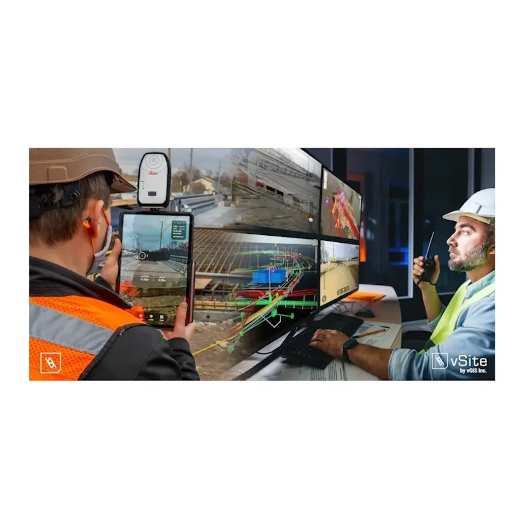
vSite Utilities transforms your traditional GIS data into augmented reality displays and holograms overlain on your view of a physical job site.
Use a device already in your pocket—Android phone or iPhone, a tablet or even the futuristic Microsoft HoloLens—to “see” your underground utility infrastructure as you tour a work area. Water pipes, sewage systems and gas and electrical lines appear in your field of view as a natural extension of the real world.
vSite creates instant awareness of your surroundings, saving you time and helping you avoid costly mistakes.
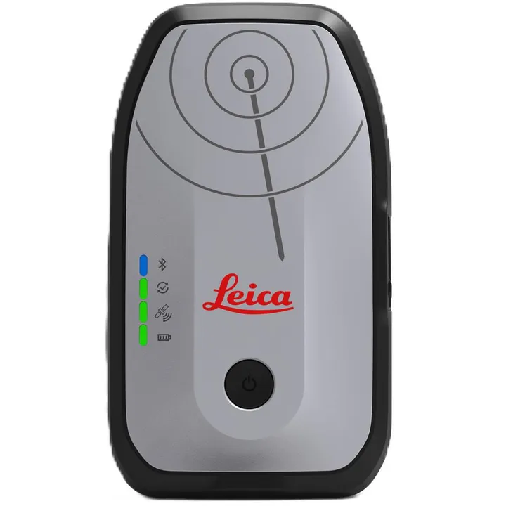
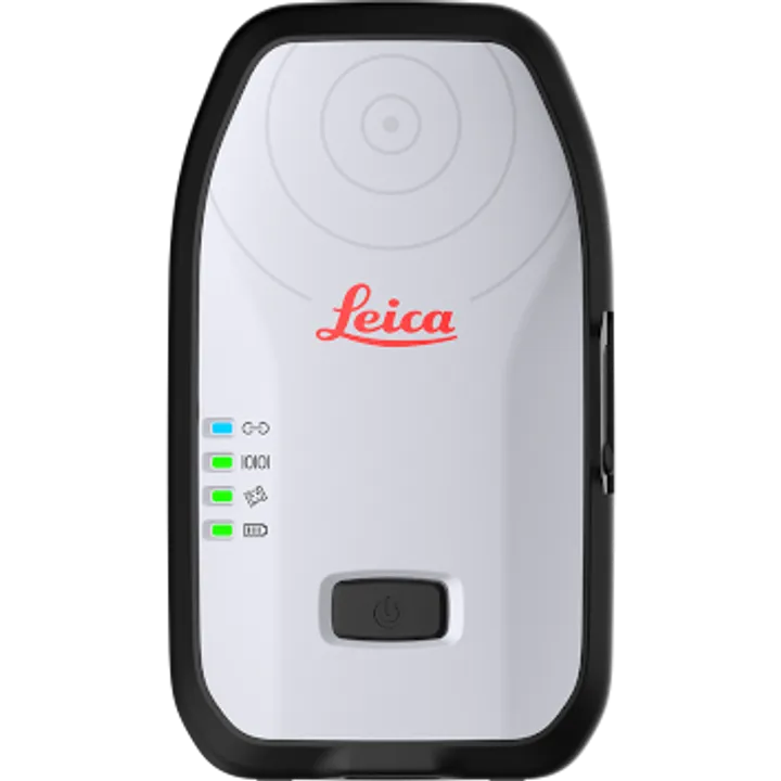
The Leica’s high-accuracy GG04 Plus GNSS assists users to identify underground utility assets with highest confidence.
Brand: vGIS |
Code: VGIS-UTL-0119-A
Supplier Code: VGIS-UTL-0119-A

Brand: vGIS |
Code: VGIS-UTL-0119-A
Supplier Code: VGIS-UTL-0119-A
At a glance
The #1 augmented reality system for GIS. Designed specifically for municipalities and public utilities, vSite Utilities uses augmented reality to display infrastructure—pipes, lines, cables and other assets—in-field and in real time.
Who uses vSite Utilities?Municipalities, public utilities and service providers such as and locator services use vSite Utilities to help their field workforce, GIS specialists, project managers, engineers, field supervisors and others gain clarity and direction for the work at hand. Organizations use vSite to find and repair infrastructure, avoid accidental line cuts during excavations and address GIS documentation gaps. Locator services use vSite to speed up line identification. Contractors rely on vSite to reduce delays and speed up work. |
|
|
|
vSite Utilities transforms your traditional GIS data into augmented reality displays and holograms overlain on your view of a physical job site. Use a device already in your pocket—Android phone or iPhone, a tablet or even the futuristic Microsoft HoloLens—to “see” your underground utility infrastructure as you tour a work area. Water pipes, sewage systems and gas and electrical lines appear in your field of view as a natural extension of the real world. vSite creates instant awareness of your surroundings, saving you time and helping you avoid costly mistakes. The Leica’s high-accuracy GG04 Plus GNSS assists users to identify underground utility assets with highest confidence. |
