

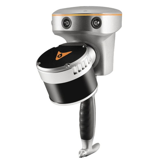
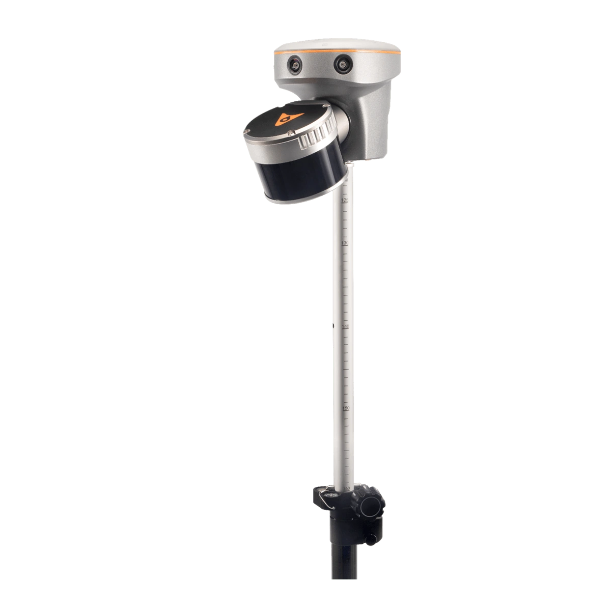
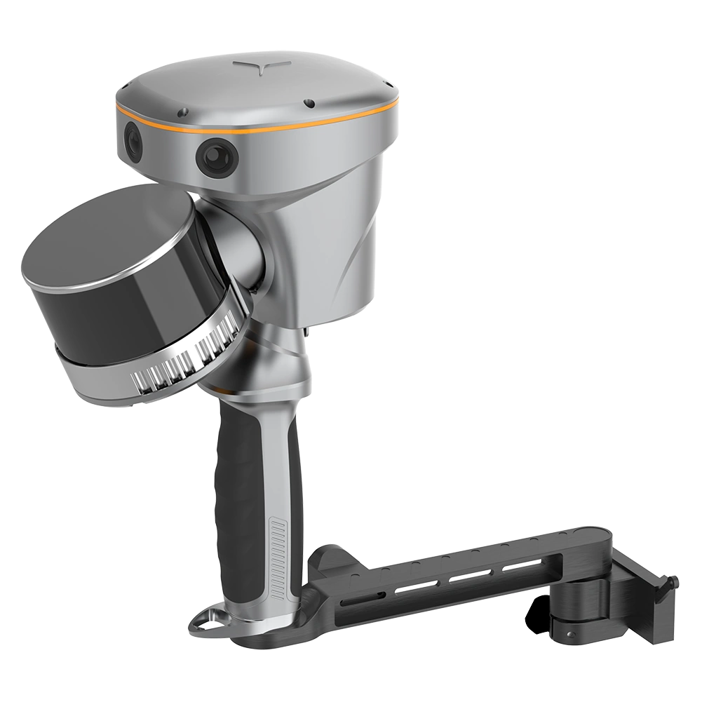
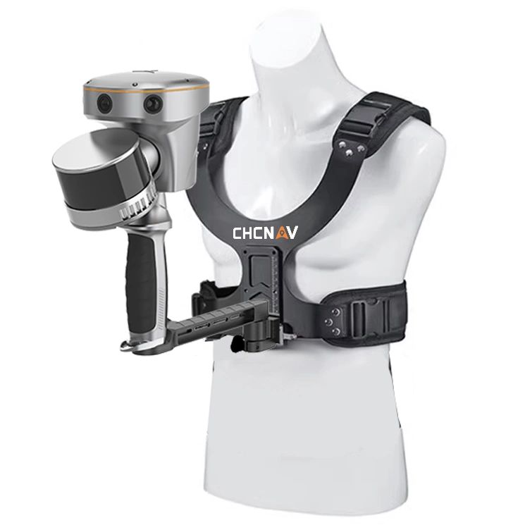
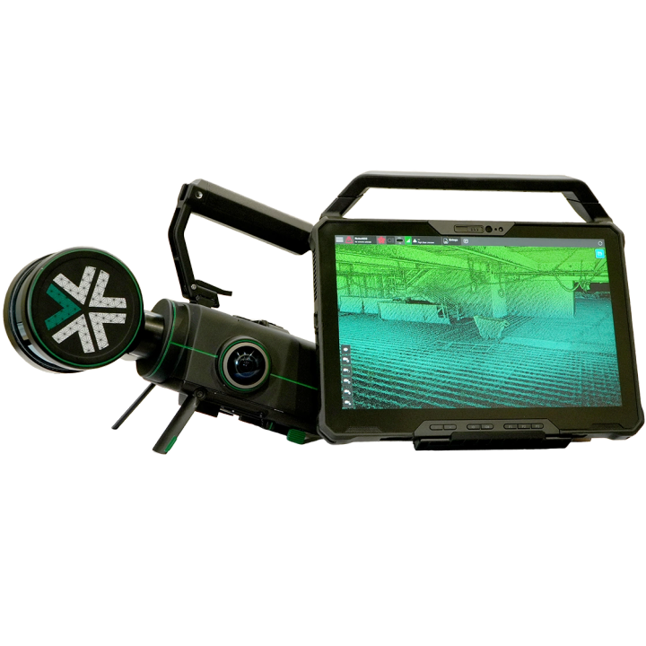
CHCNAV RS10 SLAM GNSS LiDAR Mobile Laser Scanner

- Integrates GNSS RTK, laser scanning, and visual SLAM technologies into a single platform.
- Improves efficiency of indoor & outdoor 3D scanning and surveying tasks.
- Available in 16 line and 32 line LiDAR versions
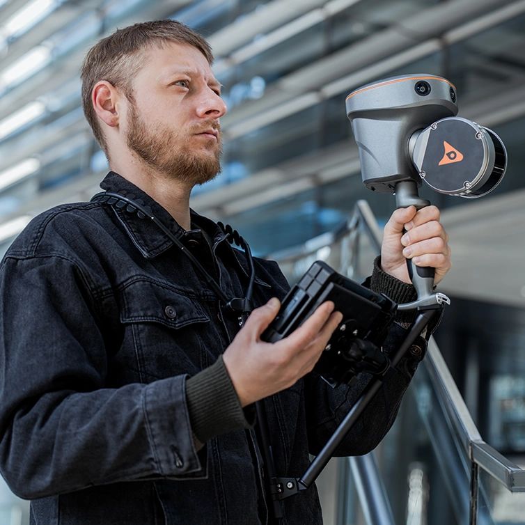
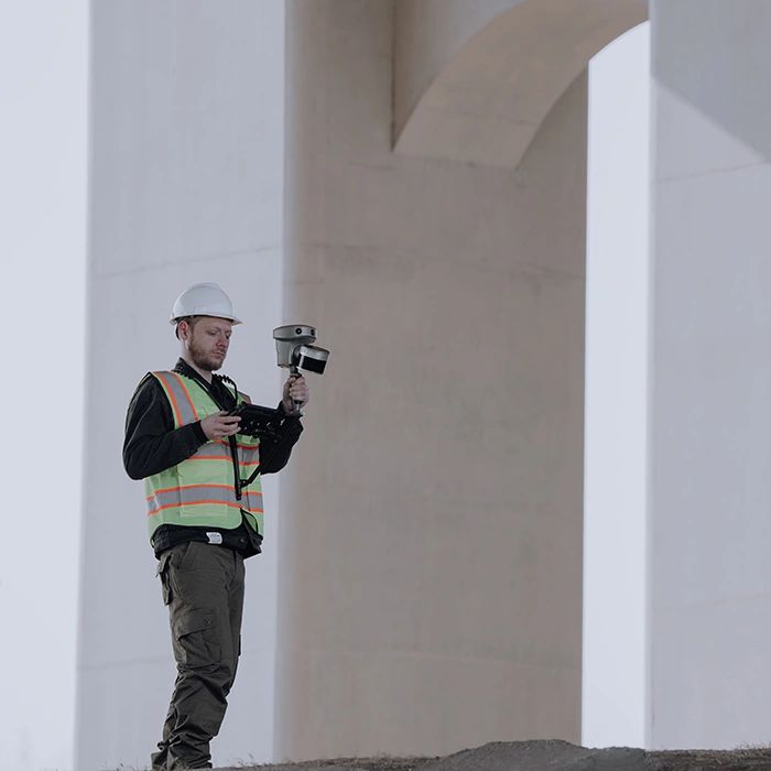
- Can be handheld, chest-mounted, pole mounted or vehicle mounted.
RTK AND SLAM FUSION FOR BETTER MAPPING ACCURACY
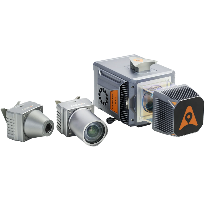
The RS10 is the result of CHCNAV's expertise in GNSS technology development. Featuring a 4th generation air dielectric GNSS antenna, it provides RTK positioning accuracy of better than 3 cm in a variety of challenging environments. Combined with the system's high-precision LiDAR and three HD cameras, it fuses RTK, laser, and visual SLAM to deliver 5 cm absolute measurement accuracy. From detailed architectural surveys to complex infrastructure projects, the RS10 gives professionals the tools they need to collect rich and accurate data efficiently.


REAL-TIME SLAM CAPABILITIES
Equipped with a powerful on-board processor, the RS10 provides real-time SLAM (Simultaneous Localization and Mapping) capabilities to create georeferenced point clouds directly in the field without the need for post-processing. With immediate feedback on the collected data, users can make adjustments on the fly to ensure complete and detailed scan coverage. The RS10 can map large areas up to 13,000 square meters in real-time, making it ideal for rapid or complex surveying projects where time and accuracy are critical.
EFFICIENT LOOP-FREE WORKFLOW
The integration of high-precision GNSS and SLAM technologies eliminates the need for traditional loop closure, which often complicates the data collection process for handheld scanners. By enabling loop-free path planning, the RS10 streamlines field data collection and significantly reduces the time and effort required to complete projects.


SEAMLESS OUTDOOR AND INDOOR MAPPING
The transition between outdoor and indoor environments is seamless with the RS10's ability to use the same coordinate system without the need for additional georeferencing. Users can select the desired CS (coordinate system) directly in the field using either the SmartGo or LandStar™ SWs, ensuring consistent, simplified and accurate data collection in both outdoor and indoor environments.
SFIX TECHNOLOGY - PRECISION WITHOUT SATELLITES
With innovative SFix technology working in RTK rover mode, when RS10 enters an area with weak or even no GNSS signal, where conventional RTK surveying doesn’t work, RS10 will calculate accurate RTK point coordinates from its LiDAR and Visual SLAM data. This technology ensures a precision of 5 cm within 1 minute without satellite signals, opening new possibilities for surveying indoor spaces and urban canyons.


VI-LIDAR TECHNOLOGY FOR CONTACTLESS MEASUREMENTS
The RS10's Vi-LiDAR technology offers a new mode of RTK surveying that combines GNSS rover capabilities with laser scanning for contactless offset measurements. By simply selecting the point to be measured in the CHCNAV LandStar software, its three-dimensional coordinates are calculated in real time from the intersection of the RTK origin segment and the LiDAR point cloud to an accuracy of 5cm within 15m.span>
| Brochures | |
|---|---|
| RS10SLAM16 - Brochure |


Brand: CHCNAV |
Code: RS10SLAM16
APN: 9319499276294 |
Supplier Code: 8005010111
Brand: CHCNAV |
Code: RS10SLAM16
APN: 9319499276294 |
Supplier Code: 8005010111
At a glance
- Integrates GNSS RTK, laser scanning, and visual SLAM technologies into a single platform.
- Improves efficiency of indoor & outdoor 3D scanning and surveying tasks.
- Available in 16 line and 32 line LiDAR versions
- Can be handheld, chest-mounted, pole mounted or vehicle mounted.
