

Pix4Dcloud

- Online cloud photogrammetry processing, analysing and sharing.
- Measure distances, areas, and volumes and add annotations.
- Perform virtual inspections.
- Easy share large datasets with stakeholders.
- Sample data can be viewed here.
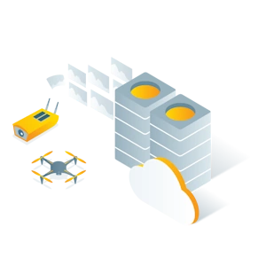
Capture
Capture aerial data with a drone or aircraft, ollect terrestrial data using PIX4Dcatch and viDoc RTK rover.
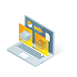
Process
Automatically process your images on the cloud using photogrammetry algorithms to transform them into measurable deliverables. Generate accurate and georeferenced orthomosaics, 3D meshes, point clouds, and elevation models.
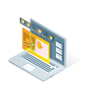
Analyse
Visualize, monitor and document site progress using an intuitive interface, a timeline, and built-in measurement tools, accessible online from any device or location, on a collaborative cloud-based platform.
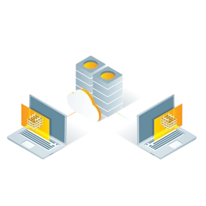
Share
With a simple URL, share the results with your team or clients to ensure seamless information flow and greater collaboration.
| Comparison Charts | |
|---|---|
| Pix4D products master comparison table - Comparison Chart | Datasheets |
| Pix4Dcloud - Datasheet |


Brand: Pix4D |
Code: PIX4DCLOUDN
Supplier Code: PIX4DCLOUD
Brand: Pix4D |
Code: PIX4DCLOUDN
Supplier Code: PIX4DCLOUD
At a glance
- Online cloud photogrammetry processing, analysing and sharing.
- Measure distances, areas, and volumes and add annotations.
- Perform virtual inspections.
- Easy share large datasets with stakeholders.
- Sample data can be viewed here.
CaptureCapture aerial data with a drone or aircraft, ollect terrestrial data using PIX4Dcatch and viDoc RTK rover.
|
|
|
|
ProcessAutomatically process your images on the cloud using photogrammetry algorithms to transform them into measurable deliverables. Generate accurate and georeferenced orthomosaics, 3D meshes, point clouds, and elevation models.
|
AnalyseVisualize, monitor and document site progress using an intuitive interface, a timeline, and built-in measurement tools, accessible online from any device or location, on a collaborative cloud-based platform.
|
|
|
|
ShareWith a simple URL, share the results with your team or clients to ensure seamless information flow and greater collaboration.
|
