


IKE Office Pro
- AI-powered pole imagery analysis
- PolePilot's sophisticated image recognition techniques detect wires, equipment, and heights of attachment.
- Save time and deliver consistent results
- Automated annotation and measurement
- Improve Data Quality and reduce field Data Recollection
- Measure and manage poles and create customized dashboards
- Understand field team performance and create customized reporting dashboards
- Easy, customized collection forms
- Import existing pole data
- Integrated with IKE Products and Services
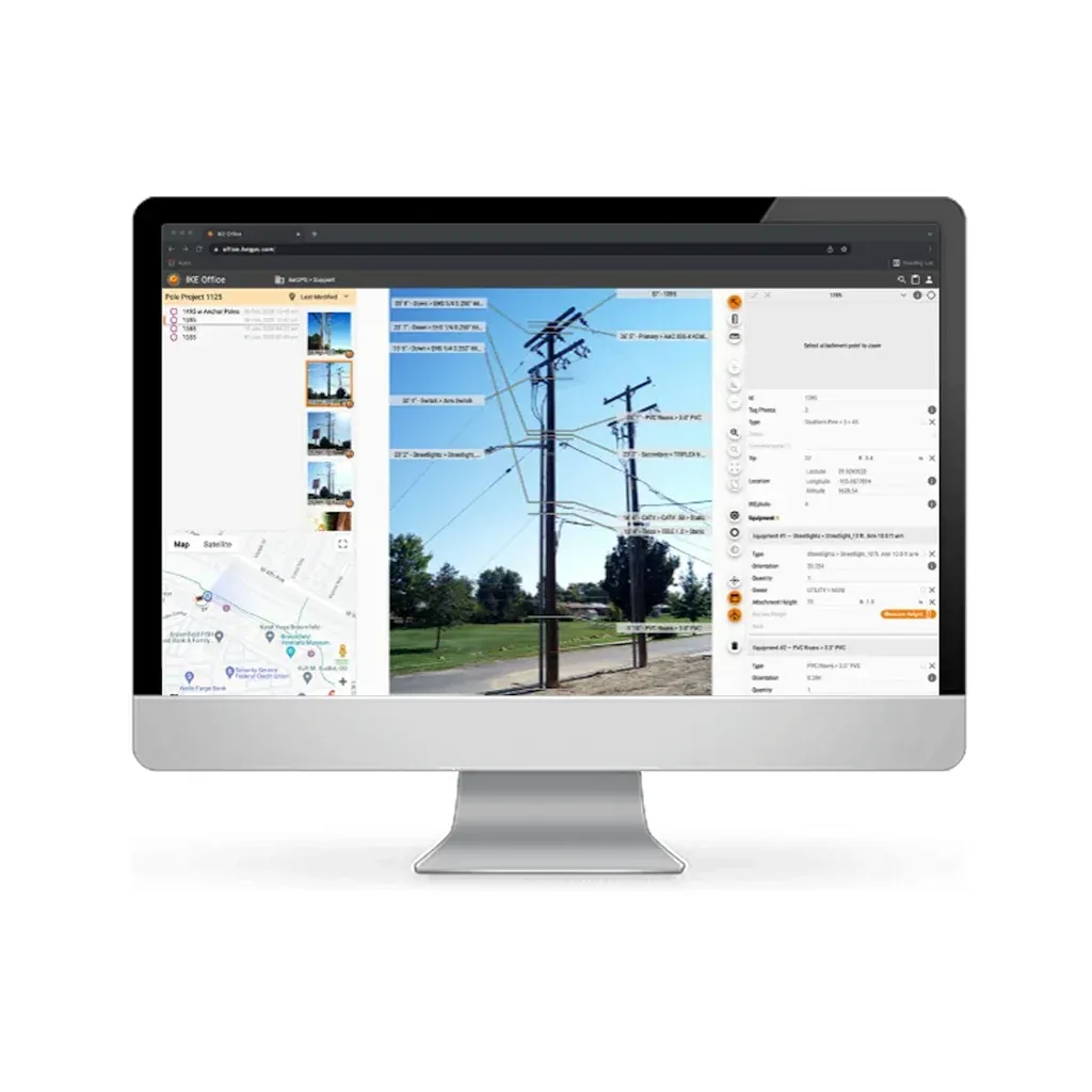
- Measure and annotate Poles, Spans, Equipment : Create a clear picture of your network using data from the IKE Device to annotate heights of attachment, identify equipment, and measure spans and anchors.
- Map your Poles : Get an overview of your projects and collections with a detailed interactive map.
- Manage your Data via Cloud Connected Software : Build, manage, and share your projects with your team online and in one location.
- Export Data in dozens of ways : Robust exports allow your data can go where you need it -- IKE Report, KML, EXCEL, JSON, raw and annotated images, and more.
| Datasheets | |
|---|---|
| IKE Office Pro - Datasheet |
Brand: ike GPS |
Code: NEW-IKEPRO
Supplier Code: NEW IKEPRO

Brand: ike GPS |
Code: NEW-IKEPRO
Supplier Code: NEW IKEPRO
At a glance
- AI-powered pole imagery analysis
- PolePilot's sophisticated image recognition techniques detect wires, equipment, and heights of attachment.
- Save time and deliver consistent results
- Automated annotation and measurement
Safely speed up field data collection
Capture field data fast while keeping fielders safe with the most advanced pole survey technology on the market.
Get to revenue faster with digitized data
Get permits and construct faster with high-quality data standardized and automated for your workflows.
Increase data quality and reduce revisits
Custom forms and multiple validation points means you get high quality data in one trip to the pole.
Get real time metrics with project-specific dashboards
See the metrics of a collection and the efficiency of the collector with data uploaded from the field.
Simplify your pole load analysis
Direct integration with PoleForeman (an IKE Structural product), O-Calc Pro, SpidaCalc, and PLS CADD makes pole loading as simple as point and click.
Integration with IKE software and services
Records from IKE Office Pro can be used for PLA in PoleForeman, AI in IKE Insight, or we can do the work for you with IKE Analyze.

Drive down collection cost per pole
by measuring in IKE Office Pro

Standardize your data
with all of your departments and partners

Works with all leading pole load analysis solutions
including PoleForeman
