


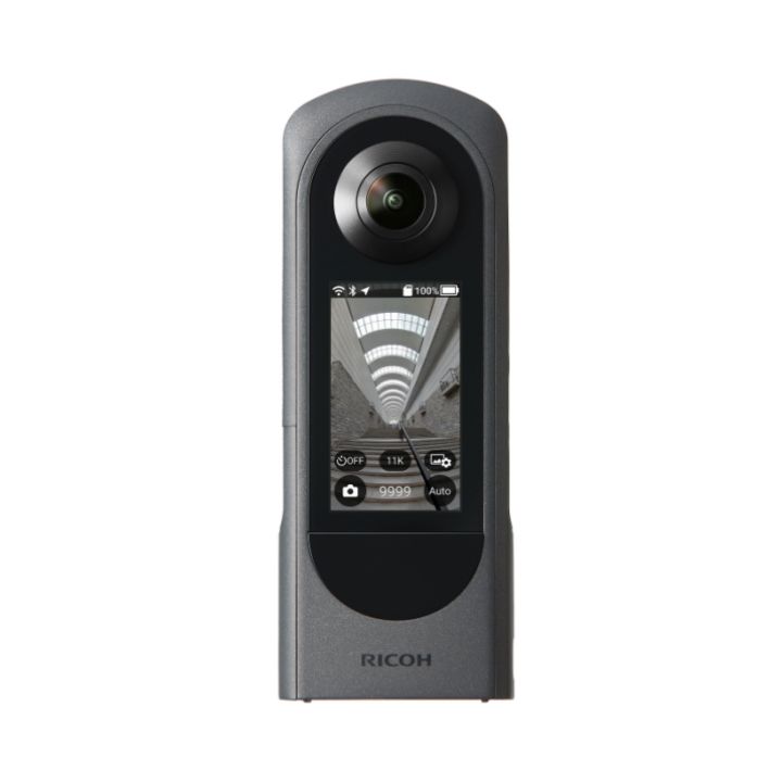
Mosaic 51 360 Degree Camera Asset Management & Mapping
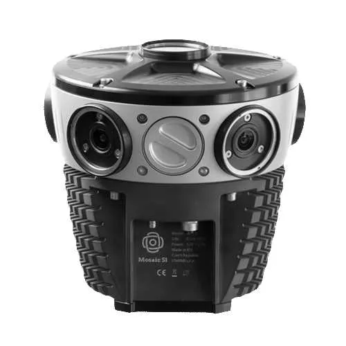

- The most durable, precise and practical 360º camera for mobile mapping & surveying.
- 12K resolution for the clearest image available.
- All-in-one-solution, on-board GPU, no computer necessary.
- Robust industrial grade construction, IP64, use it anywhere no matter the environment.
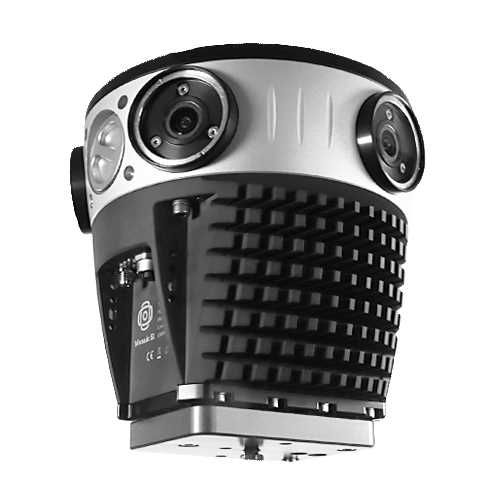
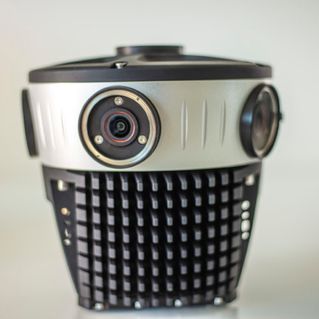
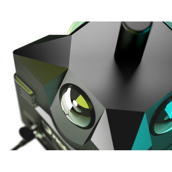
Top of the Line, Protected Optics
Six easy to service 12-Megapixel noise-free image sensors with proper thermal management and microsecond-level sync.

Advanced, Ultra-Precise GPS
Connects up to 4 GNSS networks for high precision. Works in canyons, tunnels and even indoors!
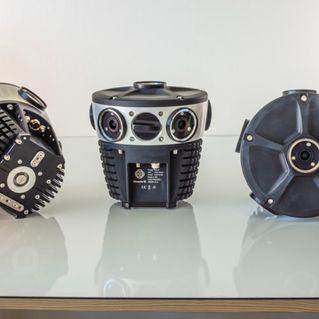
Industrial-Grade Construction and Durability
Industrial-grade water resistant connectors, IP64, fully sealed, passively cooled. Flawless operation even in the hottest environments!

AES 256-bit Encryption
Data acquisition with 256-bit encryption is available out of the box, for full confidentiality and GDPR compliance.
Amazing 12-bit Compressed RAW Images or h.264
Up to 8:1 compressed RAW for game-changing efficiency.

| Sensors | 6 x 12MP |
| Resolution | 12K |
| IP rating | IP64 |
| Frame rate | 10fps |
| Disk capacity | 2 Terabytes hot swappable |
| Brochures | |
|---|---|
| Mosaic 51 360 Degree Camera Asset Management & Mapping - Brochure |
Brand: Mosaic |
Code: MOSAIC51

Brand: Mosaic |
Code: MOSAIC51
At a glance
- The most durable, precise and practical 360º camera for mobile mapping & surveying.
- 12K resolution for the clearest image available.
- All-in-one-solution, on-board GPU, no computer necessary.
- Robust industrial grade construction, IP64, use it anywhere no matter the environment.
Top of the Line, Protected OpticsSix easy to service 12-Megapixel noise-free image sensors with proper thermal management and microsecond-level sync.
|
|
|
|
Advanced, Ultra-Precise GPSConnects up to 4 GNSS networks for high precision. Works in canyons, tunnels and even indoors!
|
Industrial-Grade Construction and DurabilityIndustrial-grade water resistant connectors, IP64, fully sealed, passively cooled. Flawless operation even in the hottest environments!
|
|
|
|
AES 256-bit EncryptionData acquisition with 256-bit encryption is available out of the box, for full confidentiality and GDPR compliance.
|
Amazing 12-bit Compressed RAW Images or h.264Up to 8:1 compressed RAW for game-changing efficiency.
|
|
Mosaic 51: Built To Get Dirty
Mosaic 51 is a purpose-built, AI-compatible, rugged 12K-resolution 360º camera for HD mobile surveying, GIS, railway and infrastructure inspection.
The robust, all-in-one-solution can handle the cold, the heat, rain, snow and mud. With a built-in computer it’s meant for the road, no matter the terrain or climate.
The industrial frame, IP64 rating, and removable lenses means it’s waterproof, dust proof and guarantees that it will come home in the same condition it left in, but this time full of HD images collected with the 6 x 12MP image sensors.
How Can You Benefit From The Rugged Mosaic 51?
Gain greater insight of your environments
With the highest resolution, standalone unit, you can quickly capture the necessary street-level images of your sites, streets, and towns to make better informed decisions.
Decrease operational costs & increase efficiency
The Mosaic 51 was built to be easy to use, requiring only one person who is both driver and operator. No need for lengthy training, a computer on board, or repeat site visits. Capture one time and utilize ten fold.
Increase your project capacity & sales
With a robust device you can count on and which collects data faster, win more proposals, fulfill deadlines on time and build more trust with clients.
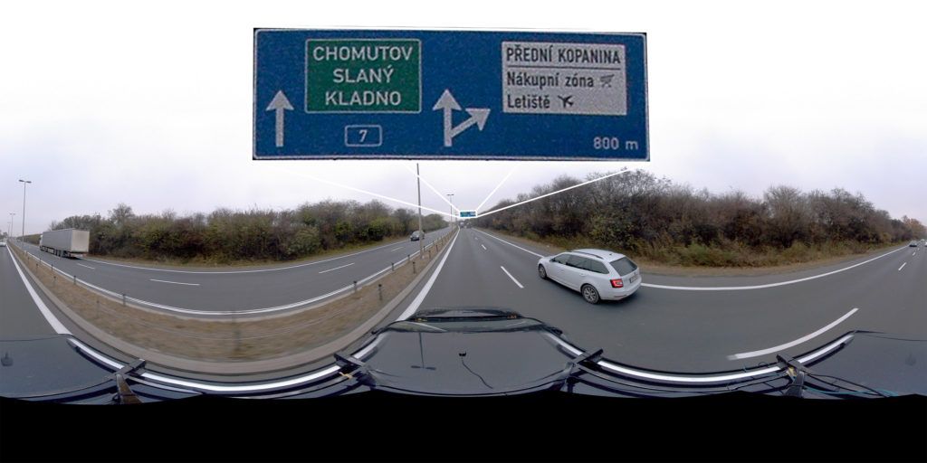
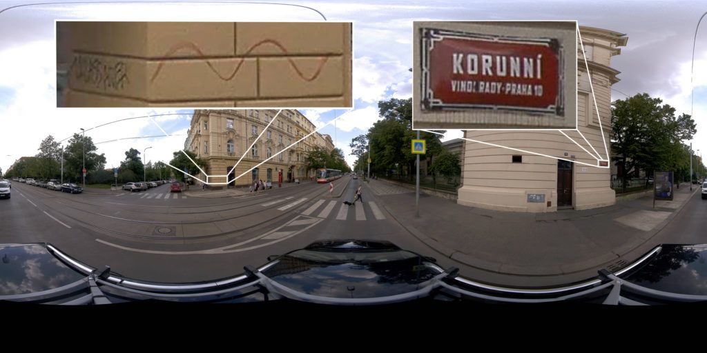
See What You Can Do With The Mosaic 51 360° Camera
Generate 12K Resolution Panorama Images To Read Road Signs On The Highway
Capture 12K Resolution Panorama Images To Read Building Signs, Identify Objects And Infrastructure
In Need Of Repair And Beautification.
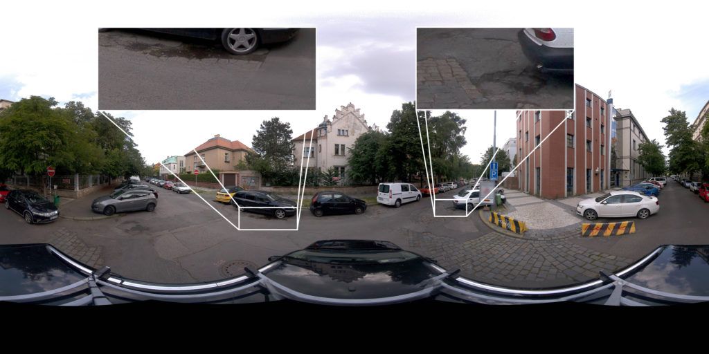
Capture 12K Resolution Panorama Images To Identify Dangerous Road Conditions
Such As Potholes, Cracks, Surface Deterioration, And Rutting.
Capture 360º Street-Level Images To Provide The Solutions For Your Projects
The purposely-built Mosaic 51 will provide great benefits for projects such as:
-
Land Surveying & Mapping Companies - Travel more places, collect data faster than before, and ensure that you are mapping all of the streets, roads and trails within your scope, with a street-level view in 360º.
-
Telecommunication & Utility Companies - Gain a better view of your powerlines, right of way, telephone poles and more. Capture the highest quality images with the least amount of work.
-
Local Governments & Municipalities - Know what services are or aren't already in your community. Keep an inventory of street furniture and their conditions. Create a better environment for your citizens.
-
Road & Infrastructure Maintenance Crews - Ensure greater safety and prolong the life of current infrastructure with more consistent maintenance checks. Have the data to react faster to potential risks.
