ExynAero: Autonomous Flight
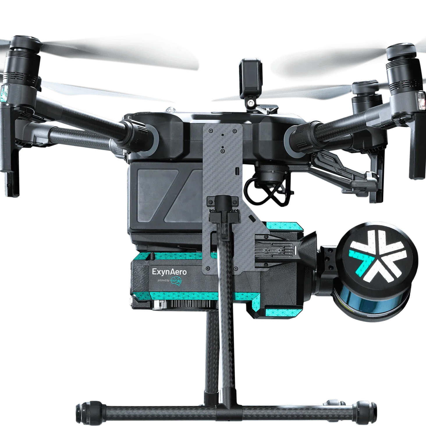
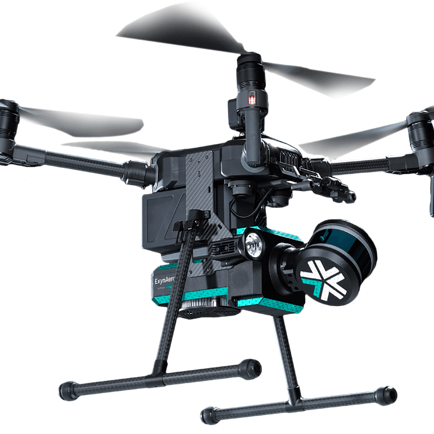
Autonomous Flight for Mission-Critical Industries. Engineered for flexibility, ExynAero uses advanced artificial intelligence and machine learning to adapt to virtually any industrial application.
Access Difficult-to-Reach Data, Maximize Safety
ExynAero maximizes human safety by optimizing efficient data collection. Our autonomous, industrial-grade robots easily navigate complex environments, using onboard sensors and AI to accomplish the mission.
4K CAMERA AND BUILT-IN LIGHTINGEquipped for high-quality 3D mapping, our drones also deliver high-resolution video and active lighting providing a never-before-seen view of dangerous environments.
|
 |
 |
GIMBALLED VELODYNE LIDARDesigned for autonomy, the LiDAR Sensors guiding our drones deliver near-field perception for safe navigation in extremely difficult conditions.
|
1.6KM RANGECapture beyond-line-of-sight data without worrying about physical obstacles, dangerous infrastructure, or other unsafe environmental factors.
|
 |
 |
18 MINUTE FLIGHT TIMEExynAI's efficient planning algorithms mean our robots can fly farther, faster, than the competition. Meaning our customers can capture more data, more coverage, with much less downtime.
|
ADVANCED COLLISION AVOIDANCEWith an onboard SLAM engine, Exyn drones adapt to dynamic environments, detect & avoid obstacles, adjust to sensor failures, and navigate obstructions like thin wires or people, all in real-time.
|
 |
 |
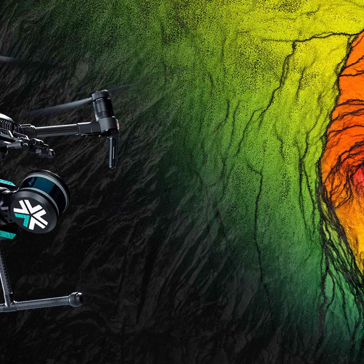
PRECISE DATA VISUALIZATIONExynAero captures a robust map of any environment, with the ability to overlay any sensor data on a real-time 3D map creating comprehensive, engaging, and actionable 3D visuals.
|
Mapping
● LiDAR based SLAM
● Demonstrated < 10cm georeferenced accuracy in post process
● 3D map georeferenced to mine coordinate system
● Output data available in .las, .csv, or .ply format
User Interface
● Ruggedized tablet with proprietary exynView software to set and launch mission
● Easy mission setup and one button launch
● Live mission view on tablet when comms are available
Data Management
● ~500GB storage for flight data (1 min = 3GB)
● Easy data transfer off tablet via USB or network
Key Sensors
● Velodyne LiDAR Puck LITE™, class 1 laser
● 16 channel, 100 meter range
● 300,000 points per second, dual return
● Gimballed system with 360-degree field of view
● HD Visual Camera
Flight Time & Range
● Max Flight Time: ~15 minutes per battery
● Approximate range: 1.6km Size & Weight
● Fully Assembled with Propellers: 883x886x520 mm
● Without Propellers/Landing Gear Folded: 722x282x380 mm
● Box: 850x560x330 mm
● Weight (including batteries): 6.7kg
● Shipping Weight: 24kg
| Specifications | |
|---|---|
| ExynAero: Autonomous Flight - Specifications |
Brand: Exyn |
Code: EXYNAERO
Supplier Code: EXYNAERO
Brand: Exyn |
Code: EXYNAERO
Supplier Code: EXYNAERO
At a glance
Autonomous Flight for Mission-Critical Industries. Engineered for flexibility, ExynAero uses advanced artificial intelligence and machine learning to adapt to virtually any industrial application.
4K CAMERA AND BUILT-IN LIGHTINGEquipped for high-quality 3D mapping, our drones also deliver high-resolution video and active lighting providing a never-before-seen view of dangerous environments.
|
 |
 |
GIMBALLED VELODYNE LIDARDesigned for autonomy, the LiDAR Sensors guiding our drones deliver near-field perception for safe navigation in extremely difficult conditions.
|
1.6KM RANGECapture beyond-line-of-sight data without worrying about physical obstacles, dangerous infrastructure, or other unsafe environmental factors.
|
 |
 |
18 MINUTE FLIGHT TIMEExynAI's efficient planning algorithms mean our robots can fly farther, faster, than the competition. Meaning our customers can capture more data, more coverage, with much less downtime.
|
ADVANCED COLLISION AVOIDANCEWith an onboard SLAM engine, Exyn drones adapt to dynamic environments, detect & avoid obstacles, adjust to sensor failures, and navigate obstructions like thin wires or people, all in real-time.
|
 |
 |
PRECISE DATA VISUALIZATIONExynAero captures a robust map of any environment, with the ability to overlay any sensor data on a real-time 3D map creating comprehensive, engaging, and actionable 3D visuals.
|
Mapping
● LiDAR based SLAM
● Demonstrated < 10cm georeferenced accuracy in post process
● 3D map georeferenced to mine coordinate system
● Output data available in .las, .csv, or .ply format
User Interface
● Ruggedized tablet with proprietary exynView software to set and launch mission
● Easy mission setup and one button launch
● Live mission view on tablet when comms are available
Data Management
● ~500GB storage for flight data (1 min = 3GB)
● Easy data transfer off tablet via USB or network
Key Sensors
● Velodyne LiDAR Puck LITE™, class 1 laser
● 16 channel, 100 meter range
● 300,000 points per second, dual return
● Gimballed system with 360-degree field of view
● HD Visual Camera
Flight Time & Range
● Max Flight Time: ~15 minutes per battery
● Approximate range: 1.6km Size & Weight
● Fully Assembled with Propellers: 883x886x520 mm
● Without Propellers/Landing Gear Folded: 722x282x380 mm
● Box: 850x560x330 mm
● Weight (including batteries): 6.7kg
● Shipping Weight: 24kg
| Specifications | |
|---|---|
| ExynAero: Autonomous Flight - Specifications |
News | Jun 14, 2023


