



CEE HydroMagic Software
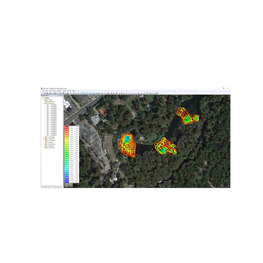
Hydromagic is a professional hydrographic survey software package for the acquisition and editing of single beam echo sounder surveys. The software is affordable and has been designed to be intuitive, allowing new users with relatively little experience in hydrographic surveying to quickly become proficient and start conducting bathymetry projects. Most menus and settings are accessible from a simple right-click, and the entire package operates from a single menu view making navigation around the user interface easy. The geodetic framework of Hydromagic is rigorous, with over 5000 pre defined local and global map datums and grids available. Surveying with an RTK GNSS receiver providing tide (elevation) data in real time is possible using appropriate geoid models.
Simple and Clear Navigation Display
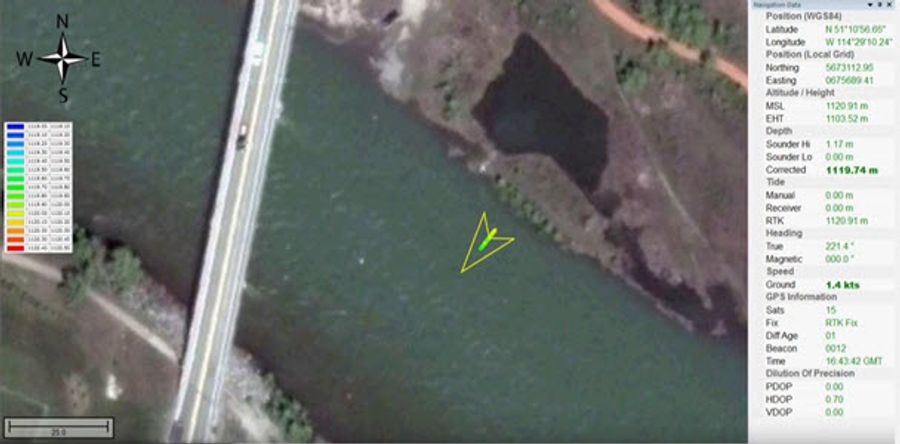
Hydromagic presents the bathymetry and position information in a simple, single window view that shows the GNSS and sounding data, vessel track and georeferenced colorized soundings. If survey lines have been loaded, a cross track error indicator is available to help steering down the survey line.
Single Beam Data Editing
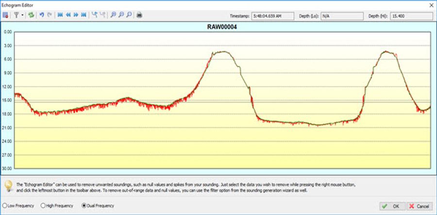
Hydromagic has a range of data editing functions to convert raw data files into edited soundings. Tide and sound velocity corrections may be applied, and data may be edited and filtered based on position and depth data.
XYZ and Final Product Data Export
Edited data may be exported as an XYZ point cloud for processing in third party software. TIN modelling in Hydromagic may be used to generate matrices of equidistant point data that may then be used for contour plots and volume / cross section calculations. Several output formats are available for common industry software packages, including export to Google Earth.
Volume Calculation Tools
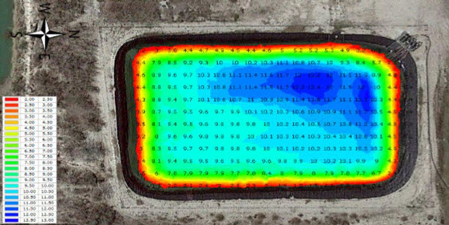
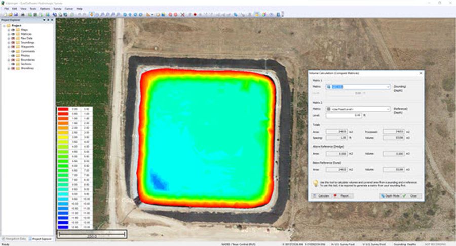
For industrial water management applications, Hydromagic has an automated strapping chart feature that allows a bathymetry map to form the basis of a water level versus volume relationship for a storage pond. Changes in measured water level may be easily converted to available water volume, and report templates are available for export.
Brand: CEE HydroSystems |
Code: CEE-HIMAGIC
MPN:
APN: 9319499064273 |
Supplier Code:

Brand: CEE HydroSystems |
Code: CEE-HIMAGIC
MPN:
APN: 9319499064273 |
Supplier Code:
At a glance
Hydromagic is a professional hydrographic survey software package for the acquisition and editing of single beam echo sounder surveys. The software is affordable and has been designed to be intuitive, allowing new users with relatively little experience in hydrographic surveying to quickly become proficient and start conducting bathymetry projects. Most menus and settings are accessible from a simple right-click, and the entire package operates from a single menu view making navigation around the user interface easy. The geodetic framework of Hydromagic is rigorous, with over 5000 pre defined local and global map datums and grids available. Surveying with an RTK GNSS receiver providing tide (elevation) data in real time is possible using appropriate geoid models.
Simple and Clear Navigation DisplayHydromagic presents the bathymetry and position information in a simple, single window view that shows the GNSS and sounding data, vessel track and georeferenced colorized soundings. If survey lines have been loaded, a cross track error indicator is available to help steering down the survey line. |
|
|
|
Single Beam Data EditingHydromagic has a range of data editing functions to convert raw data files into edited soundings. Tide and sound velocity corrections may be applied, and data may be edited and filtered based on position and depth data. |
XYZ and Final Product Data ExportEdited data may be exported as an XYZ point cloud for processing in third party software. TIN modelling in Hydromagic may be used to generate matrices of equidistant point data that may then be used for contour plots and volume / cross section calculations. Several output formats are available for common industry software packages, including export to Google Earth. |
|
|
|
Volume Calculation ToolsFor industrial water management applications, Hydromagic has an automated strapping chart feature that allows a bathymetry map to form the basis of a water level versus volume relationship for a storage pond. Changes in measured water level may be easily converted to available water volume, and report templates are available for export. |
