


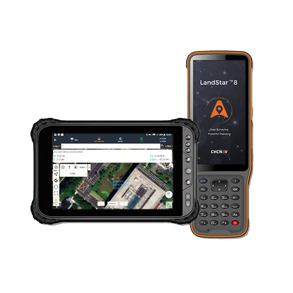
CHCNAV Landstar 8 Data Collection Software (Android)
With LandStar8, we want to provide our users with unprecedented field experience like never before. LandStar8’s modular design allows users to customize the interface according to their usage habits, making it easier and more efficient for field crews to work,” said Rachel Wang, Product Manager of CHC Navigation’s Surveying and Engineering Division. "We also provide more cloud connectivity options for the software users. Whether it is backup, data storage, or remote technical support, users can connect to their data anytime, anywhere.
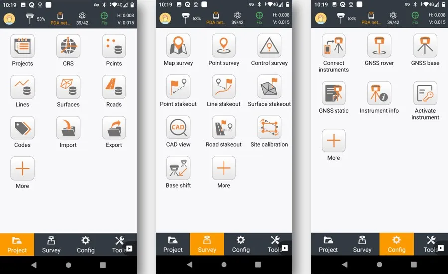
Simplified interface layout to make surveyor’s life easier
LandStar 8 has a simple and intuitive layout with large map windows and sharp graphics. Users can hide features they rarely use and display only those they use on a daily basis, making the interface more straightforward and easier to use. LandStar8 is a flexible and user-friendly field software for surveying and mapping tasks.
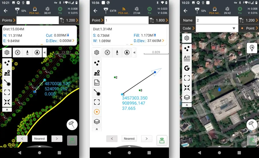
Enhance operator productivity in the field
LandStar8's proprietary MetaCAD graphics engine opens DWG and DXF base maps faster and with smoother rendering. DXF files up to 200 MB can be opened in less than 10 seconds. LandStar8 supports opening external reference files, automatically recognizes CAD length units, and allows editing of CAD base maps directly in the field.
Brand: CHCNAV |
Code: 1906210639
Supplier Code: 1906210639
Brand: CHCNAV |
Code: 1906210639
Supplier Code: 1906210639
At a glance
With LandStar8, we want to provide our users with unprecedented field experience like never before. LandStar8’s modular design allows users to customize the interface according to their usage habits, making it easier and more efficient for field crews to work,” said Rachel Wang, Product Manager of CHC Navigation’s Surveying and Engineering Division. "We also provide more cloud connectivity options for the software users. Whether it is backup, data storage, or remote technical support, users can connect to their data anytime, anywhere.
Simplified interface layout to make surveyor’s life easierLandStar 8 has a simple and intuitive layout with large map windows and sharp graphics. Users can hide features they rarely use and display only those they use on a daily basis, making the interface more straightforward and easier to use. LandStar8 is a flexible and user-friendly field software for surveying and mapping tasks. |
|
|
|
Enhance operator productivity in the fieldLandStar8's proprietary MetaCAD graphics engine opens DWG and DXF base maps faster and with smoother rendering. DXF files up to 200 MB can be opened in less than 10 seconds. LandStar8 supports opening external reference files, automatically recognizes CAD length units, and allows editing of CAD base maps directly in the field. |
