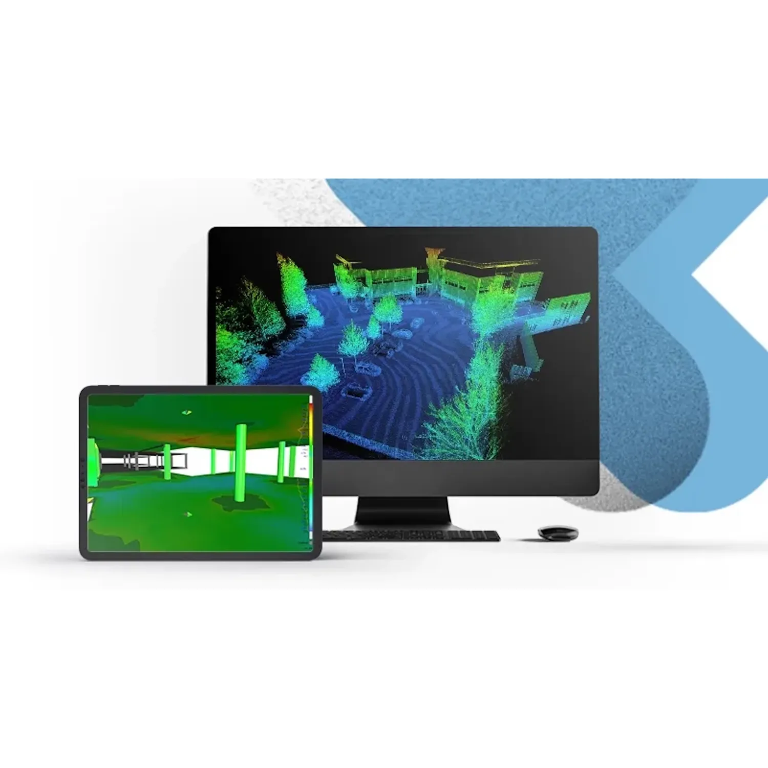
Leica Cyclone 3DR TimeLimited 1 Week
Product options:
- Cyclone 3DR Timelimted license - 1 Week Subscription
- Available in Standard, Survey, Plant, AEC and Pro versions.
- Access to the features listed under the license you choose in the Specifications.
- TimeLimited to 7 days from activation.
- You will receive your invoice containing your EID for your software purchase within 1-2 business days.
- Please download the latest version of Cyclone 3DR from https://cyclone3dr.com/downloads.php
TimeLimited Weekly Licenses
Experience the versatility of Leica Cyclone 3DR with the TimeLimited Weekly License. Pay only for the features you need with this one-week access, perfect for testing the software or complementing a Leica Laser Scanner rental.
Cyclone 3DR
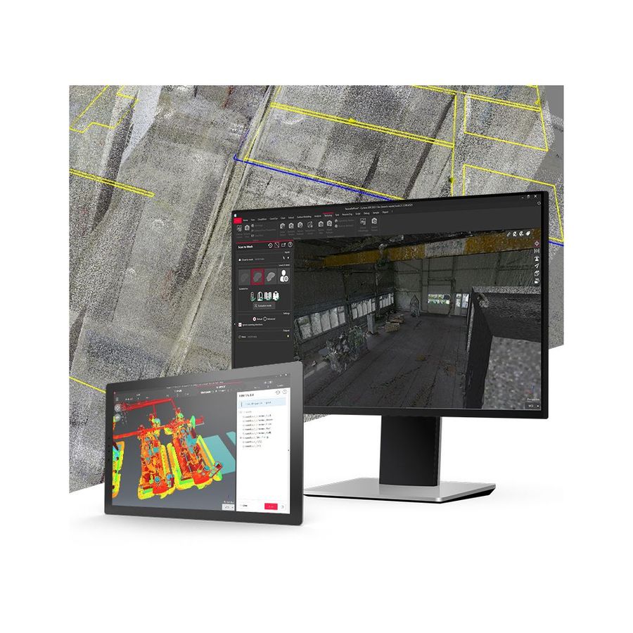
Cyclone 3DR is the Swiss army knife of point cloud solutions. Sensor-agnostic, it seamlessly supports data from a wide range of sources, including Leica, Trimble, Z+F, Riegl, mobile laser scanning (MLS) systems, and UAVs. This tool is essential for professionals tackling diverse 3D workflows.
Streamline your 3D data workflows with Cyclone 3DR, part of the innovative next-gen Cyclone family. This software bridges the gap from point cloud import to advanced analysis and publishing, empowering both newcomers and seasoned professionals.
Automate repetitive tasks to reduce project delays and deliver actionable insights to clients quickly. Cyclone 3DR transforms your point cloud into meaningful data for applications across construction, engineering, and beyond.
Curious about the different Cyclone 3DR Editions? Explore the Specifications section or keep reading below for more details on specific modules.
Base Edition
Start your point cloud journey with the Base Edition, the cornerstone of Cyclone 3DR. This edition empowers users to manage, view, and edit large-scale datasets effortlessly.
With features like noise detection, segmentation, and target extraction, the Base Edition ensures efficient workflows for foundational tasks while setting the stage for specialised applications in surveying, construction, and infrastructure projects.
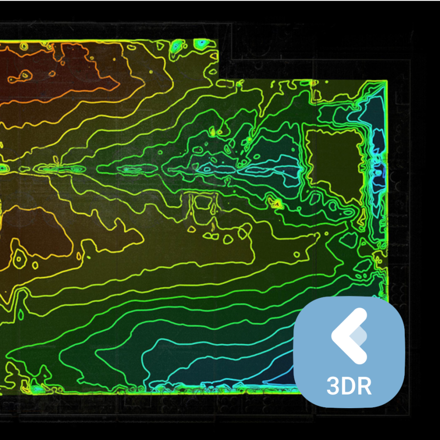
Survey Edition
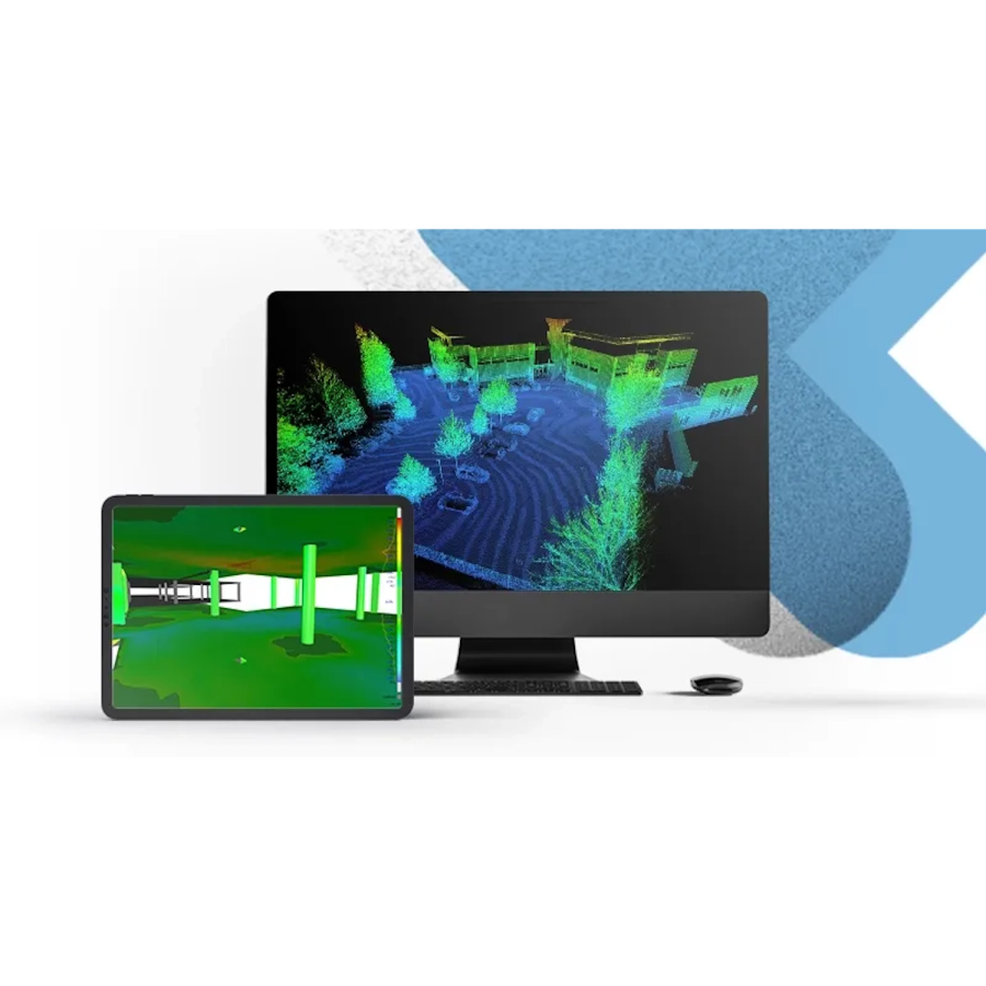
Elevate your workflows with the Survey Edition, tailored for surveying and geospatial professionals. It supports DTM/DSM creation, stockpile measurements with detailed reporting, and surface analysis for enhanced data insights.
Key features include profile extraction for tunnels, over/under shotcrete reporting, advanced point selection tools, and contour export capabilities. Perfectly suited to Australia’s diverse terrains, the Survey Edition ensures accurate and efficient data processing.
AEC Edition
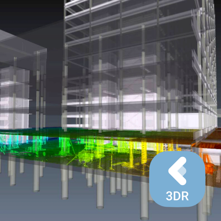
Designed for the Architecture, Engineering, and Construction (AEC) sectors, this edition offers tools for 3D modelling, BIM (Building Information Modelling) integration, and clash detection. Generate volume calculations and CAD-ready surfaces with ease.
Ideal for Australian infrastructure and construction projects, the AEC Edition enhances team collaboration and improves project outcomes with advanced reverse engineering workflows and export options like IGES/STEP.
Plant Edition
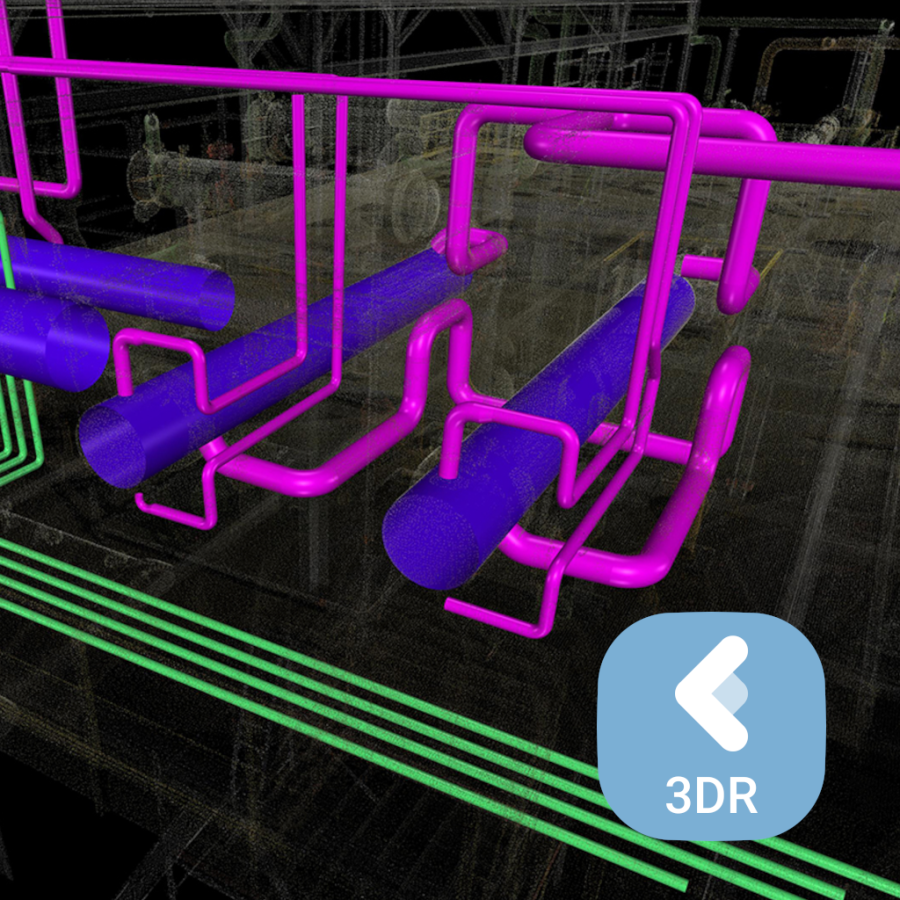
The Plant Edition is your go-to solution for industrial applications, offering robust tools for pipeline modelling, machinery layouts, and complex system designs.
Features include clash detection, 3D inspection, roundness checks, and settlement analysis, ensuring compliance with safety and operational standards across Australia’s mining, oil, gas, and industrial sectors.
Pro Edition
Achieve unparalleled precision with the Pro Edition, the most advanced version of Cyclone 3DR. Access every feature and tool for high-level point cloud processing, from automated workflows to in-depth analysis.
Optimised for industries requiring top-tier performance, this edition supports advanced scripting, mesh refinement, and compatibility with a wide range of data formats, empowering professionals across Australia to deliver exceptional results.

| Feature | Standard (Base) | Survey (Option) | AEC (Option) | Plant (Option) | Pro (Edition) |
| POINT CLOUD PROCESSING | |||||
| Noise detection | SUPPORTED | SUPPORTED | |||
| Clean/Separate clouds by fence | SUPPORTED | SUPPORTED | |||
| Separate with object | SUPPORTED | SUPPORTED | |||
| Reduce | SUPPORTED | SUPPORTED | |||
| Density homogenisation | SUPPORTED | SUPPORTED | |||
| Segmentation (by distance, scan station, colour or by extradata) | SUPPORTED | SUPPORTED | |||
| Target extraction | SUPPORTED | SUPPORTED | SUPPORTED | ||
| Detect moving objects | SUPPORTED | SUPPORTED | |||
| Ground extractor filter | SUPPORTED | SUPPORTED | |||
| Walls and floors filter | SUPPORTED | SUPPORTED | SUPPORTED | SUPPORTED | |
| Tunnel filter | SUPPORTED | SUPPORTED | SUPPORTED | SUPPORTED | |
| Automatic Classification / Manual Classification | SUPPORTED | SUPPORTED | SUPPORTED | SUPPORTED | |
| Explode by class / Class representation / Support of classification with LAS-LAZ, LGSx and e57 | SUPPORTED | SUPPORTED | |||
| Points on grid (ground, lowest, highest) | SUPPORTED | SUPPORTED | |||
| CloudWorx | Standard (Base) | Survey (Option) | AEC (Option) | Plant (Option) | Pro (Edition) |
| Connect to Cyclone IMP, LGSx and Cyclone ENTERPRISE server | SUPPORTED | SUPPORTED | |||
| Create UCS and align views | SUPPORTED | SUPPORTED | |||
| Create and manage limit boxes, limit slices and limit planes | SUPPORTED | SUPPORTED | |||
| Clone LGSx | SUPPORTED | SUPPORTED | |||
| Reality Cloud Studio, powered by HxDR | Standard (Base) | Survey (Option) | AEC (Option) | Plant (Option) | Pro (Edition) |
| Connect to Reality Cloud Studio | SUPPORTED | SUPPORTED | |||
| COORDINATE SYSTEMS | Standard (Base) | Survey (Option) | AEC (Option) | Plant (Option) | Pro (Edition) |
| Local coordinate systems | SUPPORTED | SUPPORTED | |||
| Translation, rotation, free move | SUPPORTED | SUPPORTED | |||
| Best align N points | SUPPORTED | SUPPORTED | |||
| Best fit | SUPPORTED | SUPPORTED | |||
| BIM Alignment | SUPPORTED | SUPPORTED | SUPPORTED | ||
| SURFACE MODELLING | Standard (Base) | Survey (Option) | AEC (Option) | Plant (Option) | Pro (Edition) |
| Scan to Mesh | SUPPORTED | SUPPORTED | |||
| 3D meshing | SUPPORTED | SUPPORTED | |||
| Spherical meshing | SUPPORTED | SUPPORTED | |||
| 2D meshing | SUPPORTED | SUPPORTED | |||
| Mesh refining: smoothing (including locally with brush), decimation, hole filling sharp, edges and borders reconstruction, junctions, cut mesh, inspection steps, subdivide | SUPPORTED | SUPPORTED | |||
| Mesh extrusion | SUPPORTED | SUPPORTED | |||
| Mesh convex hull | SUPPORTED | SUPPORTED | |||
| Meshing under constraints (with polylines) | SUPPORTED | SUPPORTED | |||
| Mesh segmentation | SUPPORTED | SUPPORTED | |||
| Spikes detection | SUPPORTED | SUPPORTED | |||
| Write on mesh | SUPPORTED | SUPPORTED | |||
| DSM and DTM creation | SUPPORTED | SUPPORTED | |||
| Building extraction | SUPPORTED | SUPPORTED | SUPPORTED | ||
| Clean / Separate Mesh (selection zone, size…) | SUPPORTED | SUPPORTED | |||
| Mesh Extraction from BIM models | SUPPORTED | SUPPORTED | |||
| Subdivide Mesh | SUPPORTED | SUPPORTED | |||
| CONTROL/INSPECTION/ANALYSIS | Standard (Base) | Survey (Option) | AEC (Option) | Plant (Option) | Pro (Edition) |
| Angle, distance, geometry | SUPPORTED | SUPPORTED | |||
| Cubature/volume | SUPPORTED | SUPPORTED | |||
| Geometric shape extraction | SUPPORTED | SUPPORTED | |||
| 3D inspection | SUPPORTED | SUPPORTED | |||
| 2D inspection | SUPPORTED | SUPPORTED | |||
| BIM inspection | SUPPORTED | SUPPORTED | SUPPORTED | ||
| Reporting (CSV, PDF and 3DPDF) | SUPPORTED | SUPPORTED | |||
| Stastistics | SUPPORTED | SUPPORTED | |||
| Stockpile Measurement | SUPPORTED | SUPPORTED | |||
| Progress Monitoring / Export BCF | SUPPORTED | SUPPORTED | |||
| Profile Extraction and Analysis for tunnels and roads (creation, inspection, volumes, unroll) | SUPPORTED | SUPPORTED | SUPPORTED | ||
| Surface Analysis (levelness, flatness, slope) / Gridded Inspection | SUPPORTED | SUPPORTED | SUPPORTED | ||
| ASTM E1155 Floor Flatness / Floor Levelness | SUPPORTED | SUPPORTED | |||
| Clash Analysis / Export BCF clashes | SUPPORTED | SUPPORTED | SUPPORTED | ||
| Inspection Notes and Visual Notes/ Export BCF | SUPPORTED | SUPPORTED | SUPPORTED | ||
| POLYLINES/SECTION/EXTRACT | Standard (Base) | Survey (Option) | AEC (Option) | Plant (Option) | Pro (Edition) |
| Sections (planar, radial, etc.) | SUPPORTED | SUPPORTED | |||
| Smoothing | SUPPORTED | SUPPORTED | |||
| Decimation | SUPPORTED | SUPPORTED | |||
| Chaining | SUPPORTED | SUPPORTED | |||
| Neutral axis extraction | SUPPORTED | SUPPORTED | |||
| Breakline extraction (single) | SUPPORTED | SUPPORTED | |||
| Planar contour extraction | SUPPORTED | SUPPORTED | |||
| Contour lines | SUPPORTED | SUPPORTED | |||
| Virtual Surveyor | SUPPORTED | SUPPORTED | |||
| Breakline extraction (multiple) | SUPPORTED | SUPPORTED | |||
| Polyline edition (stretch, edit, resample, replace...) | SUPPORTED | SUPPORTED | |||
| Scan-to-Plan | SUPPORTED | SUPPORTED | |||
| Scan-to-Pipe (Straight segments, elbows, reducers, branches) | SUPPORTED | SUPPORTED | |||
| IMAGE/TEXTURE MANAGEMENT | Standard (Base) | Survey (Option) | AEC (Option) | Plant (Option) | Pro (Edition) |
| Conversion between inspected or coloured mesh to textured mesh | SUPPORTED | SUPPORTED | |||
| Automatic and manual mapping of pin hole, cube faces and spherical images | SUPPORTED | SUPPORTED | |||
| Automatic and manual mapping of orthoimages | SUPPORTED | SUPPORTED | |||
| Texture from clouds | SUPPORTED | SUPPORTED | |||
| Camera calibration | SUPPORTED | SUPPORTED | |||
| Creation of texture atlas | SUPPORTED | SUPPORTED | |||
| Texture edition (adjust, explode, remove) | SUPPORTED | SUPPORTED | |||
| Texture from material | SUPPORTED | SUPPORTED | |||
| Smart Texture | SUPPORTED | SUPPORTED | |||
| Orthoimage (including georeferencing information as word file) | SUPPORTED | SUPPORTED | |||
| Edition of image masks | SUPPORTED | SUPPORTED | |||
| REVERSE ENGINEERING | Standard (Base) | Survey (Option) | AEC (Option) | Plant (Option) | Pro (Edition) |
| IGES, STEP and DXF import | SUPPORTED | SUPPORTED | |||
| REVIT, IFC, and DWG import | SUPPORTED | SUPPORTED | SUPPORTED | ||
| CAD Surface creation | SUPPORTED | SUPPORTED | |||
| Local or overall surface improvements | SUPPORTED | SUPPORTED | |||
| Support of measuring arm with RDS | SUPPORTED | SUPPORTED | |||
| IFC Export (meshes) | SUPPORTED | SUPPORTED | SUPPORTED | ||
| Reverse engineering workflow (creation and edition of networks, CAD surface generation based on networks, manage overlapped surface, export in IGES/ STEP) | SUPPORTED | SUPPORTED | |||
| IGES/STEP export (geometrical shapes and existing CAD model) | SUPPORTED | SUPPORTED | |||
| USER INTERFACE | Standard (Base) | Survey (Option) | AEC (Option) | Plant (Option) | Pro (Edition) |
| Orthographic and perspective view | SUPPORTED | SUPPORTED | |||
| Multiview with synchronisation | SUPPORTED | SUPPORTED | |||
| Tree explorer | SUPPORTED | SUPPORTED | |||
| AutoSaves | SUPPORTED | SUPPORTED | |||
| Clipping box and plane | SUPPORTED | SUPPORTED | |||
| Grid | SUPPORTED | SUPPORTED | |||
| Shortcuts | SUPPORTED | SUPPORTED | |||
| Send to/Send from AutoCAD | SUPPORTED | SUPPORTED | |||
| Send to/Send from Hexagon MinePlan | SUPPORTED | SUPPORTED | |||
| Send to/Send from Hexagon BricsCAD | SUPPORTED | SUPPORTED | |||
| Import from Cyclone FIELD 360 | SUPPORTED | SUPPORTED | |||
| Localisation | SUPPORTED | SUPPORTED | |||
| English | SUPPORTED | ||||
| French | SUPPORTED | ||||
| Protuguese | SUPPORTED | ||||
| Japanese | SUPPORTED | ||||
| German | SUPPORTED | ||||
| Italian | SUPPORTED | ||||
| Chinese (simplified) | SUPPORTED | ||||
| Spanish | SUPPORTED | ||||
| Korean | SUPPORTED | ||||
| Russian | SUPPORTED | ||||
| Cyclone camera | SUPPORTED | SUPPORTED | |||
| Navigation through TLS and MMS scanner setups | SUPPORTED | SUPPORTED | |||
| Scan trajectory import / export in LGSx (Dynamic scanners) | SUPPORTED | SUPPORTED | |||
| Basic Point selection tools (selection, vertex, nearest, middle, intersection, XYZ) | SUPPORTED | SUPPORTED | |||
| Advanced Point selection tools (target, highest, low- est) | SUPPORTED | SUPPORTED | SUPPORTED | ||
| Survey Point selection tools (ground, white line) | SUPPORTED | ||||
| Objects display management | SUPPORTED | SUPPORTED | |||
| Capture view | SUPPORTED | SUPPORTED | |||
| Stereo Rendering | SUPPORTED | SUPPORTED | |||
| TOUCH MODE WORKFLOWS | Standard (Base) | Survey (Option) | AEC (Option) | Plant (Option) | Pro (Edition) |
| BIM Inspection including connection to Cyclone FIELD 360 | SUPPORTED | SUPPORTED | |||
| AUTOMATION | Standard (Base) | Survey (Option) | AEC (Option) | Plant (Option) | Pro (Edition) |
| Scripting | SUPPORTED | SUPPORTED | |||
| ANIMATION | Standard (Base) | Survey (Option) | AEC (Option) | Plant (Option) | Pro (Edition) |
| Animation - Video | SUPPORTED | SUPPORTED | |||
| RDS CONNECTION | Standard (Base) | Survey (Option) | AEC (Option) | Plant (Option) | Pro (Edition) |
| Online data capture and visualisation | SUPPORTED | SUPPORTED | |||
| TANK MONITORING MODULE | Standard (Base) | Survey (Option) | AEC (Option) | Plant (Option) | Pro (Edition) |
| 3D inspection | SUPPORTED | SUPPORTED | |||
| Roundness and verticality | SUPPORTED | SUPPORTED | |||
| Settlements | SUPPORTED | SUPPORTED | |||
| Export and reporting | SUPPORTED | SUPPORTED | |||
| POINT CLOUD IMPORT FORMATS | Standard (Base) | Survey (Option) | AEC (Option) | Plant (Option) | Pro (Edition) |
| Leica Geosystems (*.pts, *.ptx) and LGSx (*.lgsx) | SUPPORTED | SUPPORTED | |||
| Leica Nova MS50/60 (*.sdb, *.xml) | SUPPORTED | SUPPORTED | |||
| ShapeGrabber (*.3pi) | SUPPORTED | SUPPORTED | |||
| 3DReshaper binary file (*.nsd) | SUPPORTED | SUPPORTED | |||
| AutoDesk DXF (*.dxf) | SUPPORTED | SUPPORTED | |||
| STL (*.stl) | SUPPORTED | SUPPORTED | |||
| Polyworks (*.psl) | SUPPORTED | SUPPORTED | |||
| Leica T-Scan + Steinbichler (*.ac) | SUPPORTED | SUPPORTED | |||
| LiDAR data (*.las; *.laz) | SUPPORTED | SUPPORTED | |||
| Other ASCII (*.*) | SUPPORTED | SUPPORTED | |||
| Zoller and Fröhlich (*.zfs - *.zfc) | SUPPORTED | SUPPORTED | |||
| PLY points without triangles (*.ply) | SUPPORTED | SUPPORTED | |||
| ESRI ASCII (raster format *.asc) | SUPPORTED | SUPPORTED | |||
| FARO (*.fls - *.fws) | SUPPORTED | SUPPORTED | |||
| POLYWORKS (*.psl) | SUPPORTED | SUPPORTED | |||
| E57 (*.E57) | SUPPORTED | SUPPORTED | |||
| LandXML files (*.xml) | SUPPORTED | SUPPORTED | |||
| RDBX | SUPPORTED | SUPPORTED | |||
| MESH IMPORT FORMATS | Standard (Base) | Survey (Option) | AEC (Option) | Plant (Option) | Pro (Edition) |
| STL format (*.stl) | SUPPORTED | SUPPORTED | |||
| Binary PBI format (*.pbi) | SUPPORTED | SUPPORTED | |||
| DXF 3Dface format (*.dxf) | SUPPORTED | SUPPORTED | |||
| ASCII POLY format (*.poly) | SUPPORTED | SUPPORTED | |||
| OBJ format (*.obj) | SUPPORTED | SUPPORTED | |||
| ASCII Leica format (*.msh) | SUPPORTED | SUPPORTED | |||
| OFF files (*.off) | SUPPORTED | SUPPORTED | |||
| PLY (*.ply) | SUPPORTED | SUPPORTED | |||
| GLB files (*.glb, *.glft) | SUPPORTED | SUPPORTED | |||
| CONTOUR/SECTION IMPORT FORMATS | Standard (Base) | Survey (Option) | AEC (Option) | Plant (Option) | Pro (Edition) |
| IGES format | SUPPORTED | SUPPORTED | |||
| DXF polyline format | SUPPORTED | SUPPORTED | |||
| Binary MLI format (*.mli) | SUPPORTED | SUPPORTED | |||
| CAD MODEL IMPORT FORMATS | Standard (Base) | Survey (Option) | AEC (Option) | Plant (Option) | Pro (Edition) |
| IGES | SUPPORTED | SUPPORTED | |||
| STEP | SUPPORTED | SUPPORTED | |||
| DWG | SUPPORTED | SUPPORTED | SUPPORTED | ||
| BIM MODEL IMPORT FORMATS | Standard (Base) | Survey (Option) | AEC (Option) | Plant (Option) | Pro (Edition) |
| IFC | SUPPORTED | SUPPORTED | SUPPORTED | ||
| RVT | SUPPORTED | SUPPORTED | SUPPORTED | ||
| POINT CLOUD EXPORT FORMATS | Standard (Base) | Survey (Option) | AEC (Option) | Plant (Option) | Pro (Edition) |
| ASCII FILES (*.asc, *.csv) | SUPPORTED | SUPPORTED | |||
| Binary files (*.nsd) | SUPPORTED | SUPPORTED | |||
| Leica Geosystems (*.pts, *.ptx) and LGSx (*.lgsx) | SUPPORTED | SUPPORTED | |||
| E57 (*.e57) including images | SUPPORTED | SUPPORTED | |||
| IGES (*.igs) | SUPPORTED | SUPPORTED | |||
| LAS (*.las) | SUPPORTED | SUPPORTED | |||
| LAZ (*.laz) | SUPPORTED | SUPPORTED | |||
| AutoDesk DXF (*.dxf) | SUPPORTED | SUPPORTED | |||
| LGSx (point cloud, UCS, limit box, trajectory) | SUPPORTED | SUPPORTED | |||
| MESH EXPORT FORMATS | Standard (Base) | Survey (Option) | AEC (Option) | Plant (Option) | Pro (Edition) |
| ASCII and binary STL format (*.stl) | SUPPORTED | SUPPORTED | |||
| Binary PBI format (*.pbi) | SUPPORTED | SUPPORTED | |||
| DXf 3Dface format (*.dxf) | SUPPORTED | SUPPORTED | |||
| ASCII POLY format (*.poly) | SUPPORTED | SUPPORTED | |||
| Vertices only (*.asc) | SUPPORTED | SUPPORTED | |||
| DXF polyline (*.dxf) | SUPPORTED | SUPPORTED | |||
| STEP file (*.stp) | SUPPORTED | SUPPORTED | |||
| ASCII Leica format (*.msh) | SUPPORTED | SUPPORTED | |||
| PLY (*.ply) | SUPPORTED | SUPPORTED | |||
| LandXML (*.xml) | SUPPORTED | SUPPORTED | |||
| OBJ format (*.obj) | SUPPORTED | SUPPORTED | |||
| GLB files (*.glb) | SUPPORTED | SUPPORTED | |||
| FBX files (*.fbx) | SUPPORTED | SUPPORTED | |||
| CONTOUR/SECTION EXPORT FORMATS | Standard (Base) | Survey (Option) | AEC (Option) | Plant (Option) | Pro (Edition) |
| IGES format | SUPPORTED | SUPPORTED | |||
| DXF polyline format | SUPPORTED | SUPPORTED | |||
| Binary MLI format (*.mli) | SUPPORTED | SUPPORTED | |||
| ASCII formats | SUPPORTED | SUPPORTED | |||
| CAD/BIM MODEL EXPORT FORMATS | Standard (Base) | Survey (Option) | AEC (Option) | Plant (Option) | Pro (Edition) |
| IGES (geometrical shapes and existing CAD model) | SUPPORTED | SUPPORTED | |||
| STEP (geometrical shapes and existing CAD model) | SUPPORTED | SUPPORTED | |||
| Image export format | SUPPORTED | SUPPORTED | |||
| Orthoimage including georeferencing information as World file | SUPPORTED | SUPPORTED | |||
| IFC Piping models | SUPPORTED | SUPPORTED | |||
| PROJECT FILES - EXPORT | Standard (Base) | Survey (Option) | AEC (Option) | Plant (Option) | Pro (Edition) |
| RESHAPER (*.rsh) | SUPPORTED | SUPPORTED | |||
| DXF | SUPPORTED | SUPPORTED | |||
| PDF 3D | SUPPORTED | SUPPORTED | |||
| SKETCHFAB | SUPPORTED | SUPPORTED | |||
| PUBLISHING FEATURES | Standard (Base) | Survey (Option) | AEC (Option) | Plant (Option) | Pro (Edition) |
| Publish Point Cloud to LGS | SUPPORTED | SUPPORTED | |||
Recommended Specifications Processor: 2 GHz Dual Quad Core i7 processor or better
RAM: Minimum 16 GB or more for 64 bit OS
Hard Disk: 3 GB free disk space
Graphic Card: Nvidia – Quadro or GeForce 1 GB (with OpenGL support, versions 4.3 or higher)
Operating System: Microsoft Windows® 10 (Build 1809) – 11 (64 bits supported)
Tablet Device for Touch Mode Microsoft Surface PRO Core i7 1.5 GHz – 16GB RAM
Minimum requirements for Automatic Classification
Graphic card: Nvidia with GPU capabilities
Minimum GPU Memory: 4 GB
Compute capability: 5.0 or higher
RAM: 32 GB
Hard disk: 10 GB free disk space
CUDA® 11.8 Toolkit from Nvidia
| Datasheets | |
|---|---|
| Leica Cyclone 3DR TimeLimited 1 Week - Datasheet | Installation Guides |
| Leica Cyclone 3DR TimeLimited 1 Week - Installation Guide | Specifications |
| Leica Cyclone 3DR TimeLimited 1 Week - Specifications |
Brand: Leica Geosystems |
Code:
LG901511
Product options:
Brand: Leica Geosystems |
Code:
LG901511
At a glance
- Cyclone 3DR Timelimted license - 1 Week Subscription
- Available in Standard, Survey, Plant, AEC and Pro versions.
- Access to the features listed under the license you choose in the Specifications.
- TimeLimited to 7 days from activation.
- You will receive your invoice containing your EID for your software purchase within 1-2 business days.
- Please download the latest version of Cyclone 3DR from https://cyclone3dr.com/downloads.php


