Leica Cyclone REGISTER 360PLUS BLK Edition TimeLimited - 1 week
Register 360 Plus BLK Edition TimeLimited - 1 Week
Each License contains:
- 1 x Week subscription to Cyclone REGISTER 360 (BLK Edition) Software
- Each license of Cyclone REGISTER 360 (BLK Edition) provides access to Cyclone FIELD 360 for in-field data collection and scan pre-alignment.
- The ability to import from the Leica BLK range of Laser scanners including BLK360, All new BLK360, BLK2GO, BLK ARC, BLK2FLY.
- All of the functions from Register 360 BLK Edition, TimeLimited to 7 days from activation.
As your order includes Software, you will receive a separate email with download and licensing instructions for your software purchase within 1-2 business days.
TimeLimited Weekly Licenses
Opt for the Leica Cyclone REGISTER 360 PLUS BLK Edition TimeLimited - 1 week License and pay only for the features you need.
Whether you want to test Leica Cyclone REGISTER 360 before making a purchase or require software to complement your Leica Laser Scanner rental, this license grants you one week of access to Cyclone REGISTER 360 BLK Edition.


Register 360 Plus BLK Edition
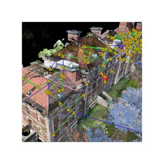
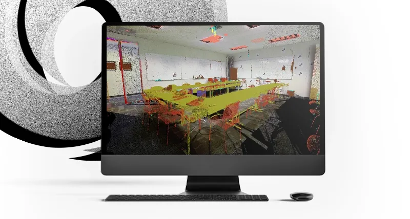
Speed: Project completion is significantly faster with features like multithreaded batch routines, one-step import and processing, guided workflows, built-in QA/QC tools, and automated reporting.
Scale: Handles challenging projects with ease, making complex workflows hassle-free. New users can manage large projects, scaling as needed, thanks to the user-friendly interface.
Simplicity: Cyclone REGISTER 360 (BLK Edition) simplifies the registration process with guided workflows, assisting new users and speeding up the process for experienced ones. Intuitive QA tools and reporting remove guesswork from registration quality, making information easily accessible. Batch export final products to various formats and programs, and even push live data to the cloud for global collaboration with a click.
Key
¹ : Requires Cyclone WORKFLOW licence| Registration, Visualisation, Modeling & Query Tools | Cyclone FIELD 360 | Cyclone REGISTER 360 PLUS (BLK Edition) | Cyclone REGISTER 360 PLUS |
|---|---|---|---|
| Large project support | SUPPORTED | SUPPORTED | |
| Optimised for Tablets | SUPPORTED | ||
| Touch navigation, Pan, Zoom | SUPPORTED | ||
| Project and Setup Explorer | SUPPORTED | ||
| Scan control | SUPPORTED | ||
| Complete loop closure registration | SUPPORTED | ||
| Optimised for smartphones | SUPPORTED | ||
| 3D navigation, Pan, Zoom, Rotate | SUPPORTED | SUPPORTED | SUPPORTED |
| Panoramic view mode (points) | SUPPORTED | SUPPORTED | SUPPORTED |
| Panoramic view mode (image) | SUPPORTED | SUPPORTED | SUPPORTED |
| Align to surface view mode | SUPPORTED | SUPPORTED | |
| Quick orthographic orientation | SUPPORTED | ||
| Cloud Level of Detail for fast visualisation | SUPPORTED | SUPPORTED | SUPPORTED |
| Quickly show/hide point clouds | SUPPORTED | SUPPORTED | SUPPORTED |
| HDR imagery viewing | SUPPORTED | SUPPORTED | SUPPORTED | Toggle Visibility |
| Setups | SUPPORTED | SUPPORTED | SUPPORTED |
| Setup labels | SUPPORTED | SUPPORTED | |
| Links | SUPPORTED | SUPPORTED | |
| GeoTags | SUPPORTED | SUPPORTED | |
| Control labels | SUPPORTED | SUPPORTED | Point Cloud Colour Map Viewing Options |
| Intensity mapping | SUPPORTED | SUPPORTED | SUPPORTED |
| Greyscale | SUPPORTED | SUPPORTED | SUPPORTED |
| Image colour mapping | SUPPORTED | SUPPORTED | SUPPORTED |
| Infrared | SUPPORTED | SUPPORTED | SUPPORTED |
| Colour clouds per setup | SUPPORTED | SUPPORTED | |
| Colour clouds per bundle | SUPPORTED | SUPPORTED | |
| Gradient Background | SUPPORTED | SUPPORTED | |
| Create Multi-image from cube-mapped images | SUPPORTED | SUPPORTED | |
| Multi-image blending | SUPPORTED | SUPPORTED | |
| Texture map colours onto point clouds | SUPPORTED | SUPPORTED | SUPPORTED |
| Limit Box for efficient viewing and interaction of selected regions | SUPPORTED | SUPPORTED | |
| TruSlicer | SUPPORTED | SUPPORTED | |
| Slice along X,Y and Z axis | SUPPORTED | SUPPORTED | |
| Colour clouds by setup | SUPPORTED | SUPPORTED | |
| Auto Bundle (grouping) of scans | SUPPORTED | SUPPORTED | |
| Visualise bundle's Link network | SUPPORTED | SUPPORTED | SUPPORTED |
| View multiple setups and bundles in the same view | SUPPORTED | SUPPORTED | |
| Global registration of multiple scans | SUPPORTED | SUPPORTED | Geo-Referencing/Control |
| Applied control | SUPPORTED | SUPPORTED | |
| Geometric matching of control to bundle | SUPPORTED | SUPPORTED | |
| Option to override Applied Control with DAC | SUPPORTED | ||
| Cloud-to-Cloud registration | SUPPORTED | SUPPORTED | SUPPORTED |
| Optional prioritisation of target-based registration over Cloud-to-Cloud registration | SUPPORTED | SUPPORTED | |
| Classification-enhanced Cloud-to-Cloud Registration | SUPPORTED | SUPPORTED | |
| Auto Align Scans | SUPPORTED | SUPPORTED | SUPPORTED |
| Smart Align for Auto Align | SUPPORTED | SUPPORTED | |
| Visual Alignment including tilted scans | SUPPORTED | SUPPORTED | SUPPORTED |
| Bundle/Group Visual Alignment | SUPPORTED | SUPPORTED | |
| Automatic orientation for Visual Alignment | SUPPORTED | ||
| Automated registration using Black & White targets | SUPPORTED | SUPPORTED | |
| Automated registration using sphere targets | SUPPORTED | SUPPORTED | |
| Automated registration across Sitemaps | SUPPORTED | SUPPORTED | |
| Automatic registration from VIS data | SUPPORTED | SUPPORTED | SUPPORTED |
| Loop closure of BLK2GO data | SUPPORTED | SUPPORTED | |
| Merge projects | SUPPORTED | SUPPORTED | |
| Editing target labels/names | SUPPORTED | SUPPORTED | |
| View scanner locations | SUPPORTED | SUPPORTED | SUPPORTED |
| Live Scanner location tracking | SUPPORTED | Region Growing | |
| Smooth surface to segment extraneous data | SUPPORTED | SUPPORTED | Scan Cleaning |
| Single scan cleaning | SUPPORTED | SUPPORTED | |
| Bundle cleaning | SUPPORTED | SUPPORTED | |
| Cross-SiteMap cleaning | SUPPORTED | SUPPORTED | |
| Support for double scan cleaning | SUPPORTED | SUPPORTED | |
| Detect Moved Objects filtering | SUPPORTED | SUPPORTED | |
| Smooth surface cleaning | SUPPORTED | SUPPORTED | Generate Cross-Sections through Point Clouds along an alignment |
| Ortho Image extraction | SUPPORTED | SUPPORTED | User-defined QA parameters mapped to link and bundle errors |
| Color-coded | SUPPORTED | SUPPORTED | |
| Optimised with graphics for colour-blind users | SUPPORTED | SUPPORTED | Measure & Dimension Point Clouds & Models |
| Simple/Advanced measurement options | SUPPORTED | SUPPORTED | |
| Slope distance | SUPPORTED | SUPPORTED | SUPPORTED |
| ∆X, ∆Y, ∆Z distances | SUPPORTED | SUPPORTED | |
| Area (rectangle) | SUPPORTED | SUPPORTED | |
| Area (polygon) | SUPPORTED | ||
| Angle measurement | SUPPORTED | SUPPORTED | |
| Visualise Cyclone FIELD 360 measurements | SUPPORTED | UCS Tools | |
| Multiple coordinate system support | SUPPORTED | SUPPORTED | |
| Create UCS from walls | SUPPORTED | SUPPORTED | |
| Create UCS from room corner | SUPPORTED | SUPPORTED | |
| Set XYZ coordinate from pick point | SUPPORTED | SUPPORTED | Geometry Types that can be created |
| HDS spherical targets | SUPPORTED | SUPPORTED | |
| Black/White targets | SUPPORTED | SUPPORTED | |
| Auto Black & White Target Extraction | SUPPORTED | SUPPORTED | |
| Estimate normals | SUPPORTED | SUPPORTED | Undo/Redo Operations within Review & Optimise |
| SiteMap creation | SUPPORTED | SUPPORTED | |
| Optimisation | SUPPORTED | SUPPORTED | |
| Create/edit targets | SUPPORTED | SUPPORTED | |
| Create/edit GeoTags | SUPPORTED | SUPPORTED | |
| Create/edit Assets | SUPPORTED | SUPPORTED | |
| Delete Setups | SUPPORTED | SUPPORTED | |
| Create/delete/modify links | SUPPORTED | SUPPORTED | TruSpace KeyPlan StieMap |
| In-field GeoTagging | SUPPORTED | ||
| Create GeoTags | SUPPORTED | SUPPORTED | SUPPORTED |
| Target Tagging | SUPPORTED | Registration Reporting | |
| Customisable Registration Report | SUPPORTED | SUPPORTED | |
| Basic Registration Report | SUPPORTED | ||
| Create SiteMap | SUPPORTED | SUPPORTED | |
| Create Map from OpenStreetMap’s Slippy map (satellite or streetmap view) | SUPPORTED | SUPPORTED | |
| GPS locate Setups on satellite map | SUPPORTED | SUPPORTED | |
| Create Hyperlinks in SiteMaps | SUPPORTED | SUPPORTED | |
| Edit Hyperlinks in SiteMaps | SUPPORTED | SUPPORTED | |
| Change Colour Mapping (RGB, Intensity, Greyscale, Infrared, shaded surface lighting) | SUPPORTED | SUPPORTED | |
| Temperature readout within infrared view | SUPPORTED | SUPPORTED | |
| Publish TruView from KeyPlan | SUPPORTED | SUPPORTED | |
| Produce Floor Plans and Models | SUPPORTED | Import | |
| Adaptive image resolution for RTC360 imports with Low and Medium resolution images | SUPPORTED | SUPPORTED | |
| ASCII PTX(feet and meters) | SUPPORTED | ||
| Batch Import and Auto-Align Images supports iSTAR/Nodal Ninja/ Spheron | SUPPORTED | SUPPORTED | |
| Batch import of B2G via command line interface | SUPPORTED | SUPPORTED | |
| Batch re-import of edited Panoramic images¹ | SUPPORTED | SUPPORTED | |
| BMP/TIFF/JPG/PNG | SUPPORTED | SUPPORTED | |
| Command Line Interface Importing of RTC360 and BLK360 data stored locally | SUPPORTED | ||
| Control file in CSV format | SUPPORTED | ||
| Control file in TXT format | SUPPORTED | SUPPORTED | |
| Cyclone REGISTER 360 PLUS archive file (RAF) | SUPPORTED | ||
| Direct WiFi import of project data collected on BLK360 | SUPPORTED | SUPPORTED | SUPPORTED |
| E57 | SUPPORTED | ||
| FARO: fls/fws/frp | SUPPORTED | ||
| Filter BLK2GO data upon import | SUPPORTED | SUPPORTED | |
| Filter points by range | SUPPORTED | SUPPORTED | |
| Import *.blk data from BLK360 Data Manager | SUPPORTED | SUPPORTED | |
| Import .cmi data from BLK3D | SUPPORTED | SUPPORTED | |
| Import Cyclone REGISTER 360 PLUS (BLK Edition) archive file (RAF) | SUPPORTED | SUPPORTED | |
| Import Cyclone REGISTER 360 PLUS registration versions | SUPPORTED | SUPPORTED | |
| Import preview data collected on RTC360 | SUPPORTED | ||
| Import project data collected on BLK2GO handheld imaging laser scanner | SUPPORTED | SUPPORTED | |
| Import project data collected on BLK360 imaging laser scanner including Cyclone FIELD 360 links/assets/GeoTags | SUPPORTED | SUPPORTED | |
| Import project data collected on RTC360 and P-series scanners including Cyclone FIELD 360 links/assets/GeoTags | SUPPORTED | ||
| Import project data collected on ScanStation C10 | SUPPORTED | ||
| Import project data collected on ScanStation P15/P16/P20/P30/P40/P50 | SUPPORTED | ||
| Import scans without images | SUPPORTED | SUPPORTED | |
| Import select setups from E57/PTX/PTG (when contained in file) | SUPPORTED | ||
| LGS (Leica Geosystems Universal Project File) | BLK LGS ONLY | SUPPORTED | |
| LGSx (Leica Geosystems Universal Project File post December 2023) | BLK LGSX ONLY | SUPPORTED | |
| PTZ, PTG, PTB | PTG ONLY | ||
| RCP | SUPPORTED | ||
| Save Import Settings | SUPPORTED | SUPPORTED | |
| ZFS/ZFC/ZFPRJ | SUPPORTED | Export | |
| Publish a sub-selection of setups | SUPPORTED | SUPPORTED | |
| Publish contents of a LimitBox | SUPPORTED | SUPPORTED | |
| ASCII PTS/PTX | SUPPORTED | SUPPORTED | |
| PTX as separate Setups (feet and metres) | SUPPORTED | SUPPORTED | |
| PTG | SUPPORTED | SUPPORTED | |
| RCP (unified and separate setups) | SUPPORTED | SUPPORTED | |
| LAS (feet and metres) ¹ | SUPPORTED | SUPPORTED | |
| Batch Export of Panoramic images (JPG) | SUPPORTED | SUPPORTED | |
| Batch Export of Panoramic images (EXR) ¹ | SUPPORTED | SUPPORTED | |
| E57 unified | SUPPORTED | SUPPORTED | |
| E57 separate Setups | SUPPORTED | SUPPORTED | |
| E57 with WayPoints and Images | BLK KINEMATIC DATA | BLK KINEMATIC DATA | |
| Setup sub-selection | SUPPORTED | SUPPORTED | |
| LimitBox contents | SUPPORTED | SUPPORTED | |
| Compatibility mode for third-party software | SUPPORTED | SUPPORTED | |
| HDR imagery | SUPPORTED | SUPPORTED | |
| Cyclone REGISTER 360 PLUS archive file (RAF) | SUPPORTED | ||
| Imagery Publishing Features | |||
| Publish with/without imagery | SUPPORTED | SUPPORTED | |
| Publish HDR imagery | SUPPORTED | SUPPORTED | |
| Publish LDR optionally | SUPPORTED | SUPPORTED | |
| Cyclone REGISTER 360 PLUS (BLK Edition) archive file (RAF) | SUPPORTED | ||
| LGS (Leica Geosystems Universal project file) including Password-protected | SUPPORTED | SUPPORTED | |
| LGSx (Leica Geosystems Universal project file post December 2023) including Password-protected | SUPPORTED | SUPPORTED | |
| Automatic file conversion to 2023.1 data architecture | SUPPORTED | SUPPORTED | |
| TruView Local dataset | SUPPORTED | SUPPORTED | |
| Publish to TruView Cloud | SUPPORTED | SUPPORTED | |
| Publish to JetStream Enterprise | SUPPORTED | SUPPORTED | |
| Batch export RAF archive file via command line interface | SUPPORTED | SUPPORTED | |
| Publish to Cyclone ENTERPRISE | SUPPORTED | SUPPORTED | |
| Decimate point clouds upon publish | SUPPORTED | SUPPORTED | |
| Save screen image as image file | SUPPORTED | SUPPORTED | |
| Auto-blur faces and licence plates¹ | SUPPORTED | SUPPORTED | |
| IFC | SUPPORTED | ||
| DXF | SUPPORTED |
| Brochures | |
|---|---|
| LG979920.tag.Brochure.pdf - Brochure |
Brand: Leica Geosystems |
Code: LG979920
Supplier Code: 979920
Brand: Leica Geosystems |
Code: LG979920
Supplier Code: 979920
At a glance
Register 360 Plus BLK Edition TimeLimited - 1 Week
Each License contains:
- 1 x Week subscription to Cyclone REGISTER 360 (BLK Edition) Software
- Each license of Cyclone REGISTER 360 (BLK Edition) provides access to Cyclone FIELD 360 for in-field data collection and scan pre-alignment.
- The ability to import from the Leica BLK range of Laser scanners including BLK360, All new BLK360, BLK2GO, BLK ARC, BLK2FLY.
- All of the functions from Register 360 BLK Edition, TimeLimited to 7 days from activation.
As your order includes Software, you will receive a separate email with download and licensing instructions for your software purchase within 1-2 business days.


