


vGIS Reality Capture Annual Subscription
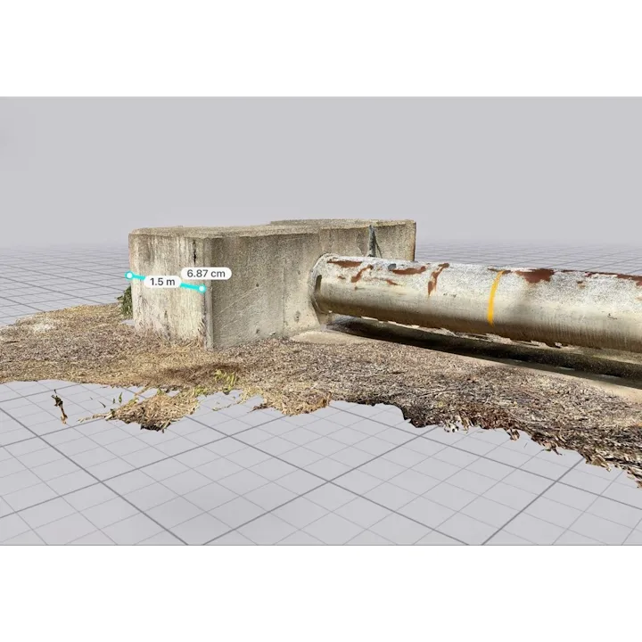
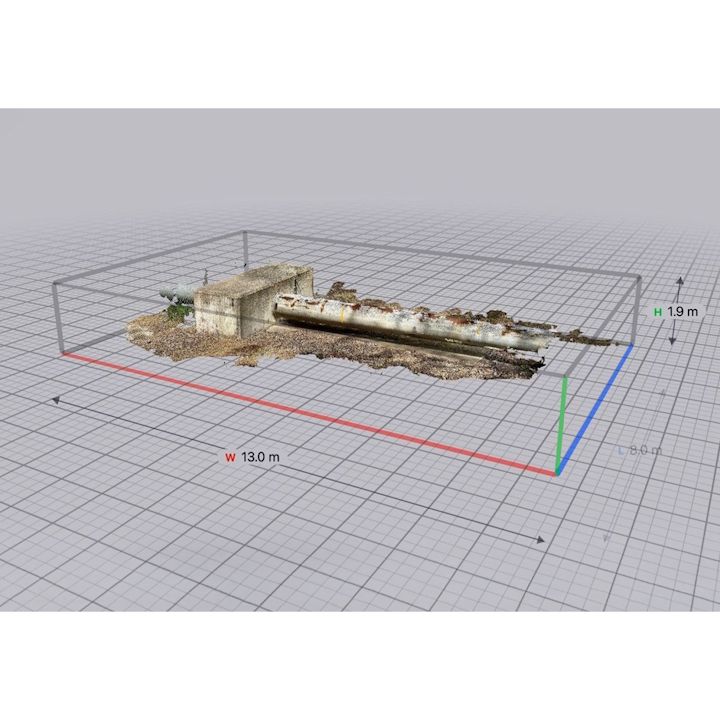
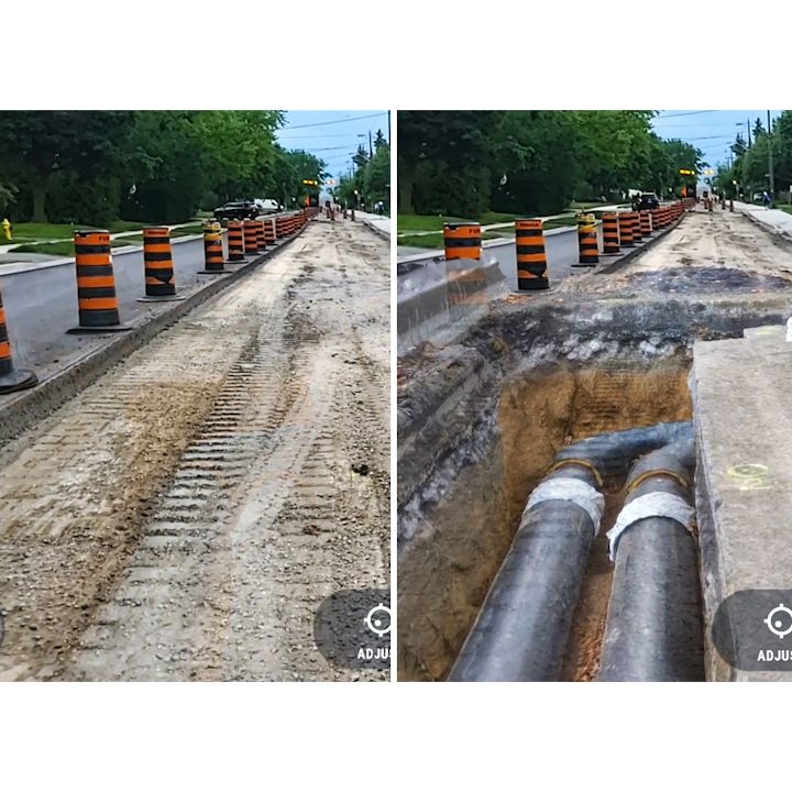
vGIS adds a new dimension to your 3D scans and point-cloud data by displaying it in augmented reality with centimeter-level accuracy.Review previously documented excavations or perform 3D scans using only your Apple iPhone, or tablet to make better decisions and avoid costly mistakes and delays.With a few lines of code, vGIS integrates with your current reality-capture providers, like Autodesk, Bentley, Esri, and Leica, so that you can publish your 3D scans in vGIS from your existing archives automatically
Related Categories
GIS Asset Mapping Software
Brand: vGIS |
Code: VGIS-RC-A
MPN:
Supplier Code:

Brand: vGIS |
Code: VGIS-RC-A
MPN:
Supplier Code:
At a glance
Related Categories
GIS Asset Mapping Software
