

WingtraOne Package with Micasense RedEdge-MX - Gen I **
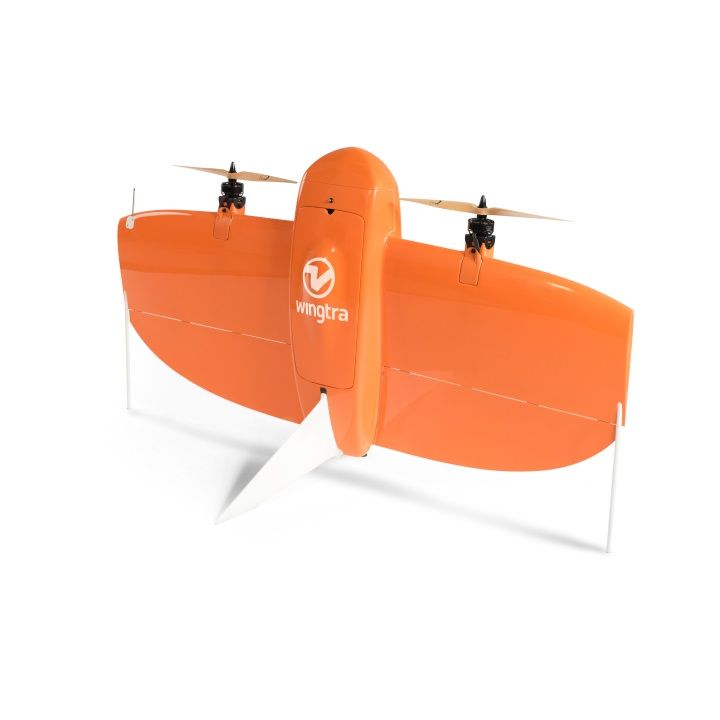
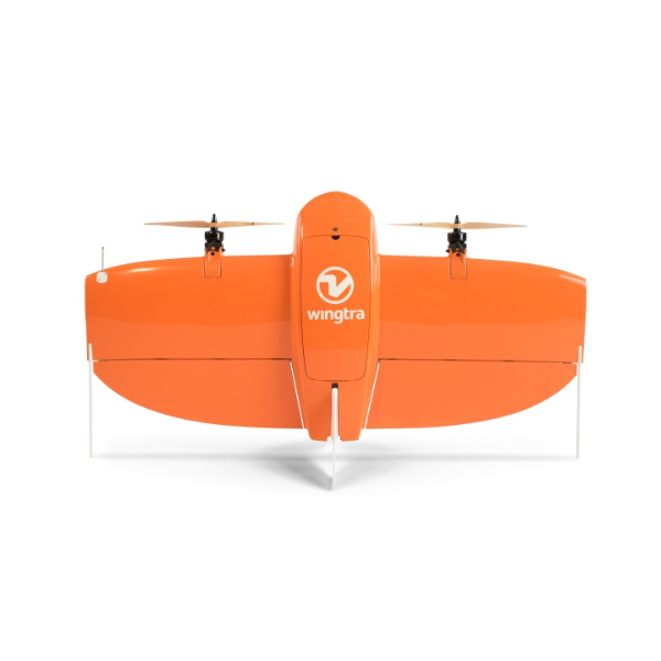
WingtraOne
- Best in class survey-grade accuracy without ground control points (GCPs)
- Proven RMS error of 1.2 cm in X/Y and 2.3 cm in Z direction
- Absolute orthomosaic & digital surface model accuracy down to 1 cm
- Agnostic workflow: Operate your existing reference station & GNSS knowledge
- Only pay for what you need: Your WingtraOne can be upgraded to PPK accuracy at any time
MAP UNREACHABLE SURVEY AREAS
WingtraOne’s unparalleled vertical landing technology enables touchdown in confined areas as small as 2 m x 2 m like boats or forest lanes. Combined with a flight range of up to 50 km, large coverage mapping missions become feasible that have been impossible up until today.
PRECISION & SUCCESS
Cover 100+ ha at 1 cm/px GSD in a single flight. The WingtraOne increases precision and survey mission success with an unprecedented combination of image resolution and flight coverage. By carrying a 42 MP photogrammetric-grade camera and an ultra low distortion lens, the WingtraOne covers 100 ha at 0.7 cm/px resolution in a single flight or 400 ha at 3 cm/px.
TRULY AUTONOMUS TAKE-OFF
The WingtraOne advances operators’ safety to the next level as it works truly autonomously during its entire mission, including take-off and landing. Instead of risky catapult or hand launches that can cause dangerous injuries, the WingtraOne takes off vertically without any human interaction.
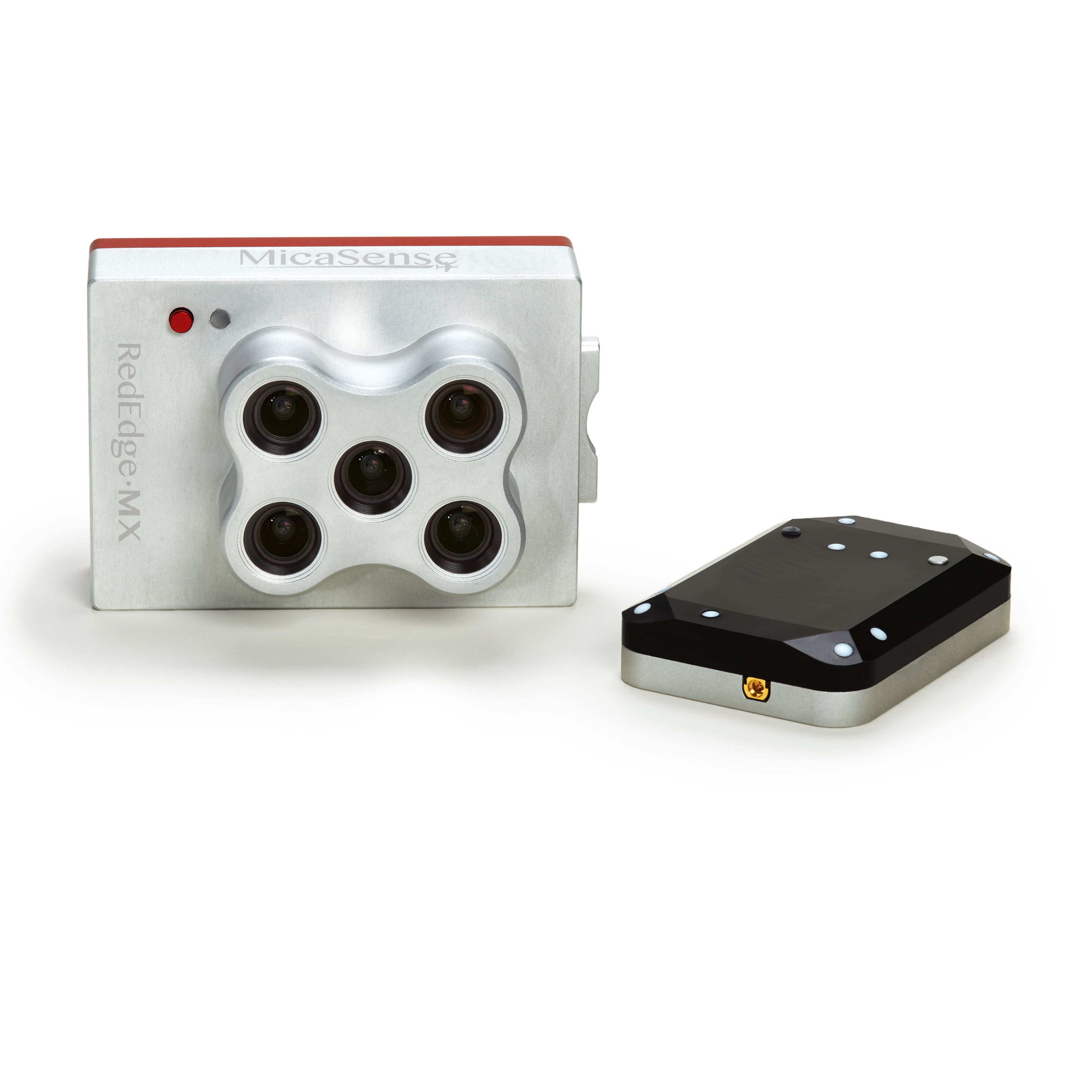
MICASENSE REDEDGE CAMERA
Chlorophyll Map
The red edge spectral band is the star here, working in conjunction with the other bands to provide a more accurate measure of not just plant vigor but plant health.
NDVI Layer
This commonly known index compares the reflectance of the red band with that of the near-infrared band. However, this index alone provides limited information.
Digital Surface Model
A DSM is an astonishingly advantageous tool in any agronomist’s arsenal, primarily because of its use in evaluating surface properties and water flow.
RGB Image
RedEdge-M features global shutters for distortion-free images, including narrowband red, green, and blue bands for RGB color images that when processed are aligned to all visible and non-visible bands and vegetation indices.
RedEdge-M is a reliable, accurate, high-precision sensor.
Fly a 100-acre field (at 400 ft AGL, 70% overlap) with RedEdge-M in 27 minutes
RedEdge-M is action-ready, integrating seamlessly no matter the platform.
It has a compact design and is lightweight to work with as many drone models as possible.
| Specifications | |
|---|---|
| WingtraOne Package with Micasense RedEdge-MX - Gen I ** - Specifications |
Brand: Wingtra |
Code: WOP-RE
MPN:
Supplier Code:


The Vertical Take-Off and Landing (VTOL) capability allows the WingtraOne to ascend and move like a helicopter. For the mapping mission it transitions into forward cruise flight and matches the endurance and speed of fixed-wing airplanes. In order to land, the WingtraOne switches back to hover flight and descends vertically.
The WingtraOne is designed from ground up to safeguard its valuable sensors and eliminate wear and tear of the equipment. Instead of broken wings or damaged cameras from belly landings & parachute touchdowns, the WingtraOne lands gently. During the vertical descent, laser sensor data enables the WingtraOne to sense the ground and land safely even on the most rocky grounds like open pit mines and on hilly terrain.
In case of a changing landing environment like a drifting boat or recently parked cars, the landing spot can be adjusted as easily as with any multirotor.
